|
|
Post by rajacobs on Mar 24, 2010 22:55:42 GMT -8
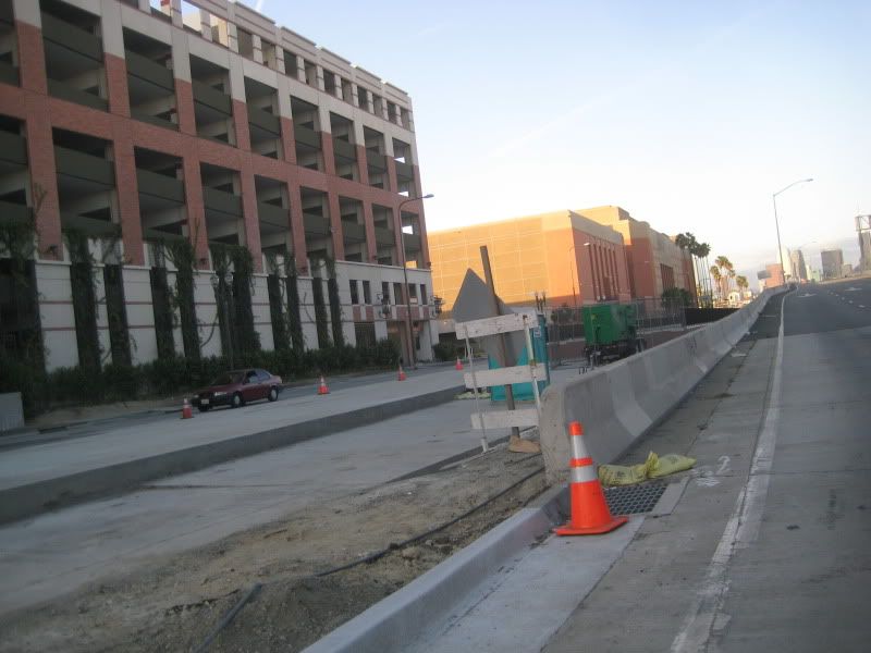
In the Phase II ROW, between Venice and Bagley, this afternoon a couple of dozers worked on clearing out ALL the leftover fill dirt and leveling the tract.
|
|
|
|
Post by Gokhan on Mar 25, 2010 11:58:53 GMT -8
I checked the Bagley area. Hundreds of truck loads of large piles are still remaining west of Bagley. I'm guessing most or all of this is useless as Expo declared it unsuitable as backfill material at one point. East of Bagley is being cleared as rajacobs said. Perhaps, hopefully, they will start Phase 2 utility relocation in this area soon.
At Washington and National, they were putting forms around another cage. There are still five more without forms.
They are preparing for track installation on and around La Brea bridge. Unfortunately they can't install tracks near Farmdale until CPUC approves it, probably a few more months from now.
Major underground utility relocation is taking place at Hauser. I'm not sure why this hasn't been done earlier.
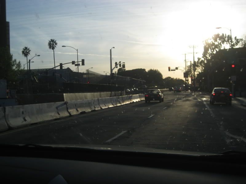
La Brea and La Cienega falsework is slowly being lowered and it's scheduled to be fully lowered by April 5 and 9, respectively. At that point the supports in the median should be gone.
Work on stations continues and they are doing some work on tracks as well. Overhead poles are being installed. They are working on finishing the right-of-way by USC, including preparing the landscaping area.
|
|
|
|
Post by rajacobs on Mar 27, 2010 23:25:19 GMT -8
I'm troubled that next year, though the Venice station will complete, no safe means of crossing Venice Boulevard will be in place.
I anticipate that numerous commuters will be standing at crosswalks enduring long wait times to move south across Venice Boulevard to board the Expo Line. It seems that a significant safety concern exists here. Has the Expo Line board or project time addressed this issue?
...And when the Venice Expo Line bridge completes, does it include a pedestrian walkway for commuters from the "northside?"
|
|
|
|
Post by Gokhan on Mar 28, 2010 1:23:11 GMT -8
Culver City has asked for a pedestrian bridge and that should be put in once Phase 2 is completed, when they extend the aerial structure over Venice and Robertson. Crosswalks seem clearly marked there; so, hopefully, they will be safe. Of course, even with a pedestrian bridge, many people will still use the crosswalks.
|
|
|
|
Post by rajacobs on Mar 28, 2010 4:19:17 GMT -8
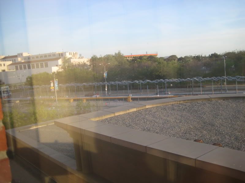
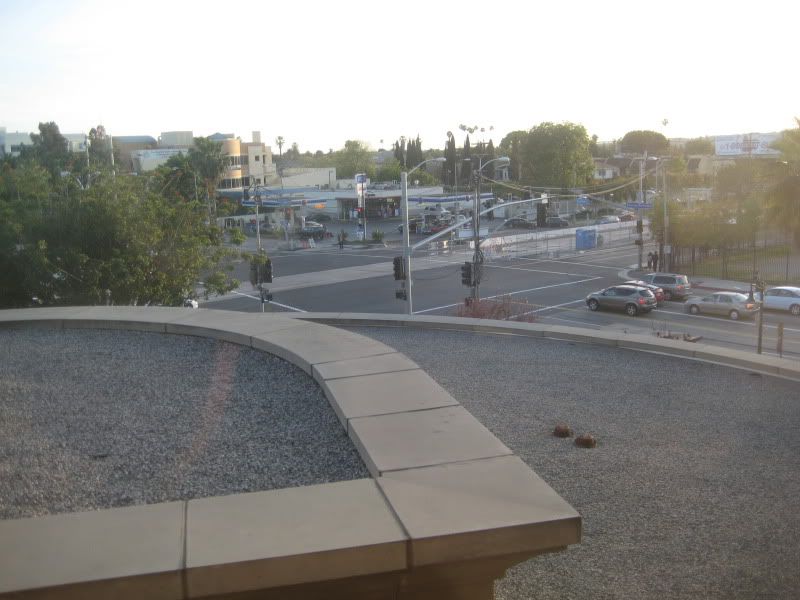
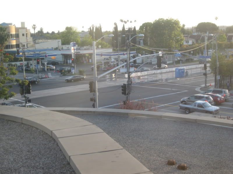
I agree that crosswalks are clearly marked at Venice and Robertson. However, having waited to cross on many occasions, I find the wait times very long as traffic control arbits among the competing traffic flows. Commuters fearful of missing their train may not have the patience to wait out the light. Further, the traffic congestion and, at-times, traffic crawl, offers "justification" to negotiate a very large intersection without the benefit of a walk light--if one believes a train is about to leave. Solution? I can't think of one--increasing frequency of walk signals across Venice reduces the traffic flow on Venice. I'll be interested to see how this scenario plays out. -- Regarding the pedestrian bridge to be completed as the Venice Aerial Station completes, I believe a need exists to connect the station to the neighborhood west-northwest of the OfficeMax/Alberson shopping center as much as connecting the station to the north side of Venice. 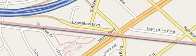 A pedestrian bridge or walkway that follows the right of way across Venice is good. Assuming that it will be built on the northside of the tracks, it will be most useful if, when it reaches the north side of Venice, it is extended underneath the tracks (to the south of the tracks). This would take it to Exposition Drive / South Durango to enable station access for residents of this area without requiring them to cross the shopping center to reach the pedestrian bridge. |
|
|
|
Post by metrocenter on Mar 28, 2010 11:37:23 GMT -8
One idea is to extend the center platform across Venice to the north side of the street. This extended platform would not be for boarding trains: it's purpose would simply be the "bridge" connecting riders from north of Venice Blvd to the station. It would be separated by a fence from the tracks, and separated from the "paid" boarding area by ticket reader machines. This area could even have ticket vending machines and transit information there. At the north end of this north entrance, you would just need stairs and an elevator.
This could be supplemented, if necessary, by a separate ped bridge east of Robertson, but only if that bridge connects directly to the platform level of the station.
I do not like the idea of any separate ped bridge that forces pedestrians to go up, then over Venice, then back down to street level, and then back up to the platform.
|
|
|
|
Post by Gokhan on Mar 28, 2010 11:45:50 GMT -8
One idea is to extend the center platform across Venice to the north side of the street. This would prevent a future spur on Venice. The station was built to the south of Venice so that a future spur would be possible. |
|
|
|
Post by Gokhan on Mar 28, 2010 11:49:15 GMT -8
|
|
|
|
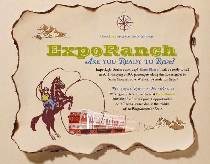
Post by rajacobs on Mar 28, 2010 12:30:10 GMT -8
...OK, "Expo Ranch." That's interesting, ...behind See's Candy Factory or thereabouts and east of Ballona Creek. But "Ranch"  Come on... Community master planning rather than development would sit better with me. Expo line offers much access; with planning that incorporates mixed use development (entertainment, commercial, office, and food) much can be accomplished. |
|
|
|
Post by Gokhan on Mar 28, 2010 12:40:19 GMT -8
Well, it is a ranch: 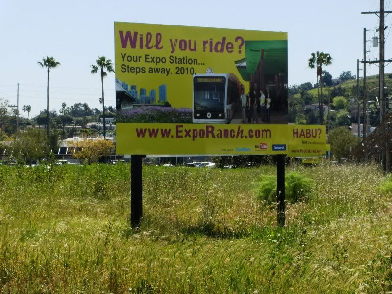 |
|
|
|
Post by rajacobs on Mar 28, 2010 13:22:07 GMT -8
I'll believe it when I see the steers a'roaming across La Cienega and findin' their way to the old Ballona waterin' hole...
|
|
|
|
Post by metrocenter on Mar 28, 2010 14:57:21 GMT -8
This landowner is hoping to cash in on Expo as a development opportunity. That's great. And as a private entity they can call it most anything they want. But I'm glad to see "Expo" prominently included in the name.
|
|
|
|
Post by metrocenter on Mar 30, 2010 9:31:47 GMT -8
FYI, I have created 10 new wikipedia pages, one for each new Expo Phase 1 station (including Farmdale as a "proposed" station). I've also added several wiki links to these station pages, from existing wikipedia pages. The 12 Phase 1 pages are: My focus was to provide lots of useful information about the stations, in a uniform style. (I am very OCD: these pages are actually cleaner and more complete than some wiki pages for stations that are in operation.) However, FYI I was not able to find good images for all of the stations. |
|
|
|
Post by Gokhan on Mar 30, 2010 15:36:12 GMT -8
Thanks a lot, metrocenter, they are looking great! Could you also create the Phase 2 station pages when you get a chance?
|
|
|
|
Post by bobdavis on Mar 30, 2010 16:41:48 GMT -8
Back when the Blue Line was the only electric railway operation in LA, I was riding the train near Dominguez Junction and spotted a horseman riding along an adjacent trail. I thought, "that's really old time passenger transportation! A fine demonstration of how Southern Californians got around before railroads came to the Southland." Not sure if it's still there, but there used to be a rather low-budget "horsekeeping" facility near the Blue Line yard north of Long Beach.
|
|
|
|
Post by Gokhan on Mar 30, 2010 18:53:06 GMT -8
Back when the Blue Line was the only electric railway operation in LA, I was riding the train near Dominguez Junction and spotted a horseman riding along an adjacent trail. I thought, "that's really old time passenger transportation! A fine demonstration of how Southern Californians got around before railroads came to the Southland." Not sure if it's still there, but there used to be a rather low-budget "horsekeeping" facility near the Blue Line yard north of Long Beach. That's not public transit but personal transit. I bet you've never witnessed horse-powered trolleys or horse-pulled jitneys.  |
|
|
|
Post by bluelineshawn on Mar 30, 2010 20:00:25 GMT -8
Thanks metrocenter.
You have some of the stations listed as having split platforms. That sounds right, but the wiki definition of a split platform is having platforms on multiple levels (ie Wilshire/Verrmont). I don't know if these are split or just side platforms that are offset.
|
|
|
|
Post by metrocenter on Mar 30, 2010 20:30:00 GMT -8
Thanks metrocenter. You have some of the stations listed as having split platforms. That sounds right, but the wiki definition of a split platform is having platforms on multiple levels (ie Wilshire/Verrmont). I don't know if these are split or just side platforms that are offset. Thankfully someone here knows what he's talking about.  You are right, I got the wrong term stuck in my head. I will fix ASAP. Edit: actually, I got the term "split-platform" from the recent CPUC ruling, where the term is used incorrectly several times. |
|
|
|
Post by Gokhan on Mar 30, 2010 20:51:03 GMT -8
Phase 2 FEIR uses the split platform, side platform, and center platform terms for the various types of Expo stations ( link). They refer to it as side platform when the platforms are at the same milepost and split platform when they are at the opposite side of the crossings. Since these are official terms, it might be a good idea to update the Wikipedia page that defines split platform to make it clear that the platforms are not necessarily at different levels but at different positions, the latter being suitable for light-rail and the former for subways. |
|
|
|
Post by wad on Mar 31, 2010 3:54:33 GMT -8
Back when the Blue Line was the only electric railway operation in LA, I was riding the train near Dominguez Junction and spotted a horseman riding along an adjacent trail. I thought, "that's really old time passenger transportation! A fine demonstration of how Southern Californians got around before railroads came to the Southland." Not sure if it's still there, but there used to be a rather low-budget "horsekeeping" facility near the Blue Line yard north of Long Beach. I've seen the horseman on multiple occasions, too, riding alongside the Blue Line right of way. I mainly saw him around the Artesia station. |
|
|
|
Post by bobdavis on Mar 31, 2010 21:24:15 GMT -8
Actually, I have seen and ridden horse-powered trams (can't really call them "trolleys" because they're not powered by overhead wire), and not just at Disneyland. Douglas, the capital city of the Isle of Man has a horse tramway that's been in service since the days of Queen Victoria. It runs between the ferry terminal and the electric railway terminal along the waterfront. And the electric railway opened in 1895 and still has its first interurban car. I was also at Seashore Trolley Museum some years ago for a special-event day that featured a horse car powered by borrowed draft horses. Closer to home, Arden Farms, an historic "open air museum" in Newark, CA (south of Oakland) has a narrow gauge railway with four-footed motive power hauling a flatcar with benches. I even have a family connection to draft animals, although not in passenger service. My dad had an uncle who drove construction teams, a "muleskinner". Enough horsing around--let's get those newfangled eelectrical cars a-runnin'!
|
|
|
|
Post by darrell on Apr 1, 2010 23:49:31 GMT -8
Another milestone tonight: the La Cienega bridge falsework is coming down tonight! 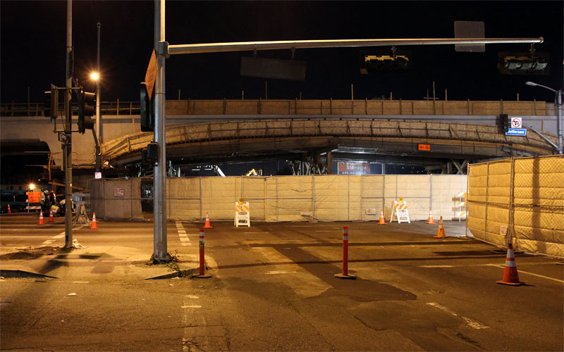 La Cienega was closed and fenced off. 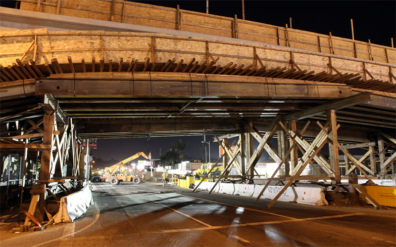 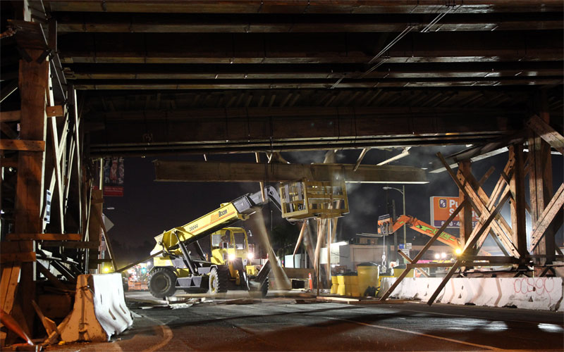 Steel beams were being taken down one at a time, with a shower of wood beams (detail below). Tomorrow we should finally see what the bridge looks like! 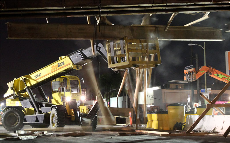 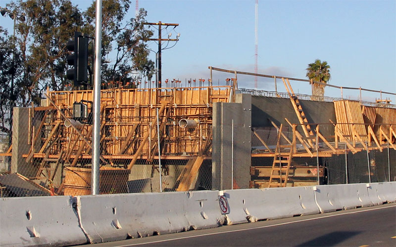 And this evening forms are already coming off of the Ballona Creek bridge's western section. |
|
|
|
Post by darrell on Apr 2, 2010 0:44:27 GMT -8
No, I wasn't under the bridge ... the middle three photos are from the same place, at the temporary fence in the first photo.
For the photo techies, the third/fourth photo was taken at ISO 1600, F/5.6, 1/4 second, zoomed to 28 mm (45 mm in full-frame 35mm equivalent). The second photo was at 1/2 second and a wide 15 mm (24 mm equivalent).
|
|
|
|
Post by rajacobs on Apr 2, 2010 1:25:25 GMT -8
I couldn't squeeze high-quality out of my digital at 1600 even with the steadiest mount. The 3rd & 4th pics are downright artistic! ...Nice job.
Tonight I also noted that new fill dirt has been moved into temporary storage in the ROW between Venice and Bagley ...lots of it, perhaps 40 dump trucks full.
|
|
|
|
Post by Gokhan on Apr 2, 2010 9:50:06 GMT -8
Did anyone listen to the board meeting yesterday? (This is not a rhetorical question. Usually the staff members present crucial information to the board members at these meetings. It would be nice to know what they said about the Phase 2 lawsuit, Phase 1 and 2 design and construction, and Farmdale.) |
|
|
|
Post by Gokhan on Apr 2, 2010 11:49:26 GMT -8
Another milestone tonight: the La Cienega bridge falsework is coming down tonight! Nope. It's a long process. It's not scheduled to be finished until the second week of April. Tonight I also noted that new fill dirt has been moved into temporary storage in the ROW between Venice and Bagley ...lots of it, perhaps 40 dump trucks full. This is actually not dirt. It's the granular backfill material they purchased for several million dollars and it will be used for the west-of-Ballona-Creek and east-of-Washington-Blvd LRT ramps. Construction seems to be moving somewhat slowly. Now, they have put forms on three of the Washington columns and there are only four left. Incidentally someone was taking a picture of one of the columns there today. I wonder if he was someone on this board. Side forms on the Ballona bridge have come off. They are starting catenary installation on the already erected poles near Normandie. They will start pulling the wires soon. USC area is starting to look better. And, finally, here is a picture of the Western Station. Protective canopies, artwork, and ticket machines are still missing:  |
|
|
|
Post by darrell on Apr 2, 2010 12:08:28 GMT -8
Yes, the falsework is down over La Cienega as of this morning (except the higher station platform)! 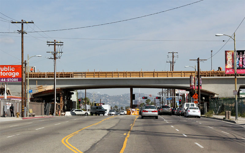 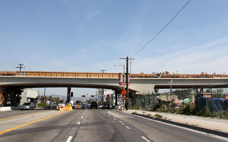 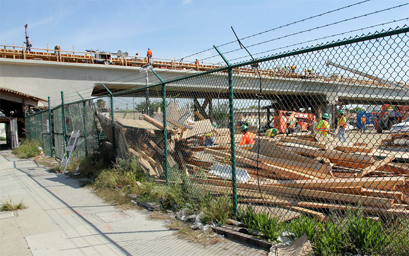 Form lumber was being sorted from last night. 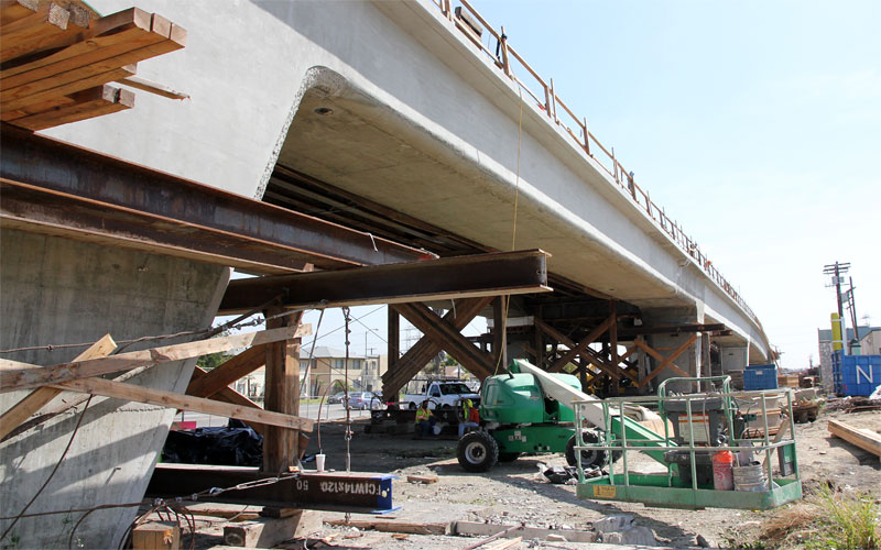 Note the jack-hammered surface on the way to finishing the rounded detail on the right of the column. 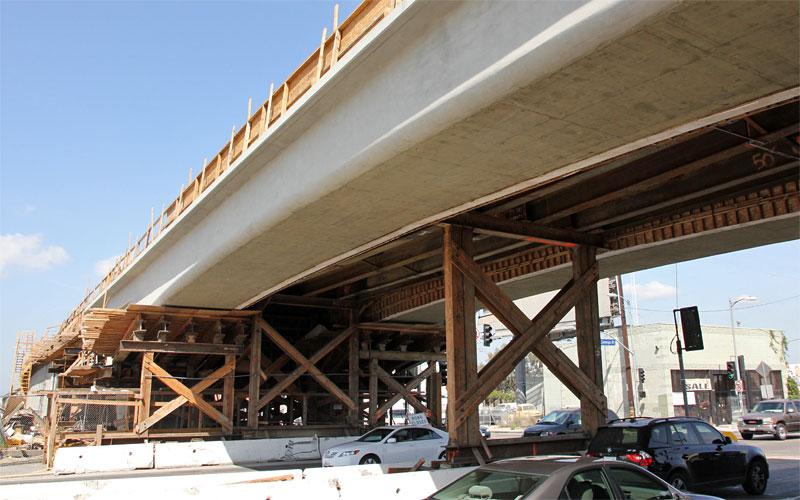 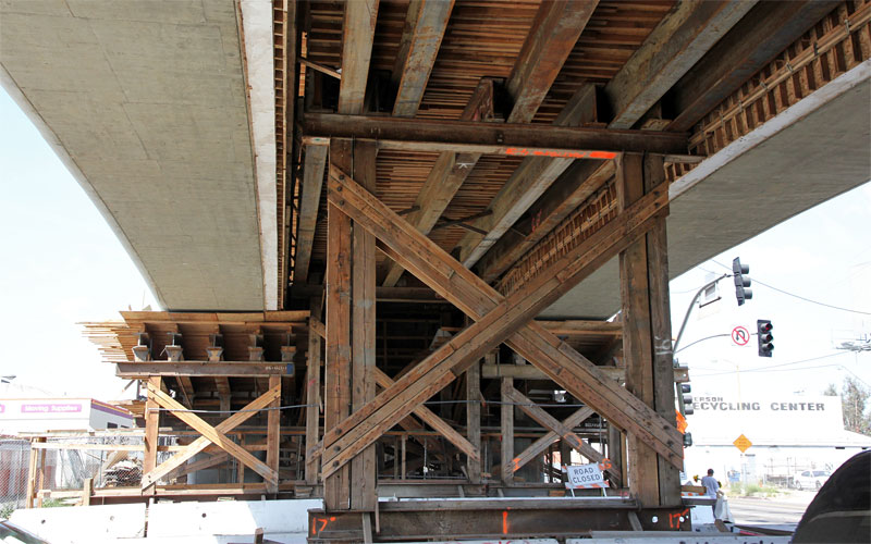 Note the daylight on the right side of the left concrete span. 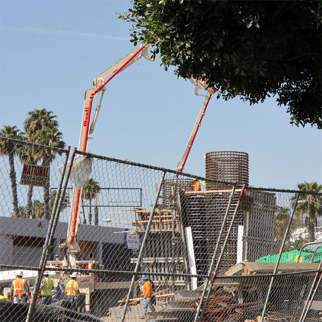 And a photo of the forms on the two columns just east of Washington Blvd. in Culver City (from my car, so I'm presumably not the person Gokhan saw). |
|
|
|
Post by jamesinclair on Apr 2, 2010 12:52:04 GMT -8
|
|
|
|
Post by Gokhan on Apr 2, 2010 13:31:38 GMT -8
Well, the falsework in the median is still there as well as some other falsework at the sides. When I drove by, I didn't think it looked much different than in the pictures taken in the recent weeks but the bridge is appearing more and more everyday. We won't see its final form until late this year when they finish the station and all the accessories.
The person taking pictures at Washington and National was someone I didn't know.
|
|
|
|
Post by metrocenter on Apr 2, 2010 17:11:18 GMT -8
I saw the bridge on the way home tonight. Looks to me like all of the falsework above the street was removed. There are still a number of steel and wood structures along either side of the street and on the approaches to the station.
|
|


 Come on... Community master planning rather than development would sit better with me. Expo line offers much access; with planning that incorporates mixed use development (entertainment, commercial, office, and food) much can be accomplished.