regen
Junior Member

Posts: 63
|
Post by regen on Mar 28, 2011 23:42:25 GMT -8
Last time we covered the south Valley, now it's time to head north!
For the northern San Fernando Valley portion of the 405 Rail Line from Roscoe Blvd., there are several alignment choices to the Sylmar Metrolink/San Fernando HSR Station: Van Nuys Blvd., Sepulveda Blvd, and the Pacific Electric right-of-way (a mix of the first two). The 405 Fwy alignment has very low density around it, so it may not be a very desirable choice.
Note that either of the south Valley alignments that reach Van Nuys Blvd. could qualify for either continuing on Van Nuys or the Pacific Electric ROW.
Here are some advantages to each choice:
Van Nuys Blvd.
1. High residential density
2. Highest bus ridership of any Valley corridor
3. Shorter tunnel to Wilshire/Westwood
Sepulveda Blvd.
1. Moderate-high residential density
2. Wide alignment available along the full length of the route
Pacific Electric ROW (Van Nuys-Parthenia-Sepulveda-Brand)
1. High residential density
2. Wide alignment available along the full length of the route
Disadvantages of Pacific Electric ROW
1. Longest route = higher cost
2. Most S-curves = slower speeds, longer trip times
Or the project could just have a northern terminus at Roscoe Blvd. and not serve the north Valley or connect to the Antelope Valley Metrolink and California High-Speed Rail at all.
Note: for close access to freeway if park-and-ride is a priority, Van Nuys goes by I-5, Sepulveda along I-405, both by CA-118.
What do you think?
|
|
|
|
Post by wad on Mar 29, 2011 4:15:45 GMT -8
Or the project could just have a northern terminus at Roscoe Blvd. and not serve the north Valley or connect to the Antelope Valley Metrolink and California High-Speed Rail at all. It would also miss a poor, predominantly Latino portion of the Valley that would deserve the project on account of existing patronage of buses. |
|
|
|
Post by bzcat on Mar 29, 2011 10:42:14 GMT -8
Shortest route + highest residential density makes Van Nuys are clear favor.
|
|
|
|
Post by jdrcrasher on Mar 29, 2011 18:26:47 GMT -8
Shortest route + highest residential density makes Van Nuys are clear favor. Yeah, starting at Van Nuys makes the most sense. Though i'm not too sure it has the highest residential density compared to the PE ROW (mix of Van Nuys and Sepulveda). In fact, I wouldn't be surprised if, north of Woodman, the density along Van Nuys falls behind the PE ROW. The radial curves on the PE ROW seem to be flexible enought that I don't think speed will be much of an issue at all; unlike the Union Station Gold Line viaduct. |
|
|
|
Post by carter on Mar 29, 2011 22:23:08 GMT -8
I voted for Van Nuys all the way. Couple of concerns about Parenthia. Firstly, it looks like the median in the street has something of a park like atmosphere in the middle of the street and I doubt the locals would want to see it ripped out. (Kind of like the Expo ROW, but the latter had "do not trespass" signs.) Also, it looks like a storm drain runs in the middle of it for some time. That sounds like a total engineering headache. maps.google.com/maps?q=parenthia+street&oe=utf-8&client=firefox-a&ie=UTF8&hl=en&hq=&hnear=Parthenia+St,+Los+Angeles,+California&ll=34.228161,-118.460598&spn=0.018486,0.038581&t=h&z=15&layer=c&cbll=34.228152,-118.460982&panoid=ePhRXUiOFviviWwnPjH6pQ&cbp=12,62.43,,0,-1.84 |
|
|
|
Post by tonyw79sfv on Mar 29, 2011 22:30:46 GMT -8
While it makes sense to align the potential LRT on the PE ROW, only part of that path has maintained its width to support LRT, particularly in small sections in the district of Van Nuys, Panorama City, most of North Hills, Mission Hills, and San Fernando. Most of Van Nuys Boulevard in the PE ROW segment really doesn't have the width of Sepulveda between Parthenia and Brand and is about as wide as any Valley boulevard (the widest parts of Van Nuys Boulevard is from Chandler to Oxnard, then substantially narrows and widens again just north of Vanowen to just south of Sherman Way; it was widened from Arminta to Lorne when The Plant shopping center was built a decade ago). With that in mind, there will be displacement of traffic lanes on Van Nuys Boulevard; and if that's the case, there should be no issue continuing that all the way to San Fernando Road on Van Nuys. I have no issue with the PE ROW alignment up to Nordoff/Sepulveda as that area is just as transit-dependent as Nordoff/Van Nuys, however, continuing on Sepulveda and Brand will miss out on another area of transit usage - Pacoima. Mission Hills doesn't justify rapid transit as evidenced by Metro Rapid 734's lack of stops between Sepulveda/Devonshire and Brand/Laurel Canyon (about 2 miles). Metro published a study of north-south SFV corridors 9 years ago that I posted here before the board crashed the second time. I'll post that document again. Of particular interest is page 37.  |
|
|
|
Post by jeisenbe on Mar 30, 2011 16:12:38 GMT -8
Re: curve radius. The Pacific Electric right-of-way (Van Nuys to Parthenia to Sepulveda to Brand) has a curve of 1400 feet radius, another of about 1200 feet, and two larger curves of around 1800 or 2000 feet radius. According to this page, European high-speed-rail trains are allowed to go 53 mph around curves of 1000 feet radius with only 4 inches of superelevation (in the outer rail is just 4 inches higher than the inner rail). 6 inches of superelevation is allowed, I believe, at least if there is no traffic crossing the curve! So a 1200 foot curve should allow 60 mph speeds, which is about the max speed allowed on the Blue Line. Even Amtrak's 2-level, heavy diesel trains can go 43 mph thru a 1000 foot curve, more than the 35 mph speed limit for street-running trains. The ridership graph is compelling for doing the Van Nuys Only options, but I think the PE right-of-way should be considered if it allows more gated crossings and more 55 or 65 mph max speed sections to be used. Map of curves and route: maps.google.com/maps/ms?ie=UTF8&hl=en&msa=0&ll=34.24998,-118.447981&spn=0.05548,0.077162&z=14&msid=209582850025375035802.00049fbbe3b2293788678 |
|
|
|
Post by carter on Mar 31, 2011 10:34:09 GMT -8
Re: curve radius. The Pacific Electric right-of-way (Van Nuys to Parthenia to Sepulveda to Brand) has a curve of 1400 feet radius, another of about 1200 feet, and two larger curves of around 1800 or 2000 feet radius. According to this page, European high-speed-rail trains are allowed to go 53 mph around curves of 1000 feet radius with only 4 inches of superelevation (in the outer rail is just 4 inches higher than the inner rail). 6 inches of superelevation is allowed, I believe, at least if there is no traffic crossing the curve! So a 1200 foot curve should allow 60 mph speeds, which is about the max speed allowed on the Blue Line. Even Amtrak's 2-level, heavy diesel trains can go 43 mph thru a 1000 foot curve, more than the 35 mph speed limit for street-running trains. The ridership graph is compelling for doing the Van Nuys Only options, but I think the PE right-of-way should be considered if it allows more gated crossings and more 55 or 65 mph max speed sections to be used. Map of curves and route: maps.google.com/maps/ms?ie=UTF8&hl=en&msa=0&ll=34.24998,-118.447981&spn=0.05548,0.077162&z=14&msid=209582850025375035802.00049fbbe3b2293788678 The case for high running speeds on the Parthenia-Sepulveda-Brand segment is compelling, but I still worry and wonder about the viability of the Parthenia segment. The ROW is quite narrow and there's a day-lit storm drain in the ROW for a about a quarter mile near Noble Ave. I'm not an engineer, but that seems like an expensive and potentially time consuming thing to work around. Here's a photo: 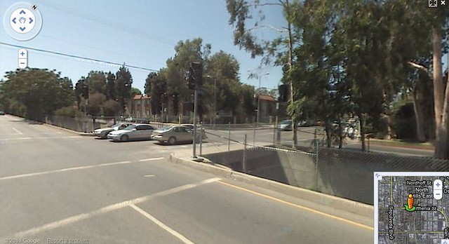 And a link to the google map: maps.google.com/maps/ms?ie=UTF8&hl=en&msa=0&msid=209582850025375035802.00049fbbe3b2293788678&ll=34.22815,-118.460862&spn=0.001565,0.002411&t=h&z=19&layer=c&cbll=34.22815,-118.460862&panoid=XEJ-V9YZs6I2l6Xnk2WYzg&cbp=12,302.11,,0,7.01 |
|
|
|
Post by jdrcrasher on Apr 1, 2011 5:17:23 GMT -8
We really need a Ventura Blvd subway.  I voted for Van Nuys all the way. Couple of concerns about Parenthia. Firstly, it looks like the median in the street has something of a park like atmosphere in the middle of the street and I doubt the locals would want to see it ripped out. (Kind of like the Expo ROW, but the latter had "do not trespass" signs.) I don't think it's a park, actually. I believe it's something similar to San Vincente in Beverly Hills. Just a plain green median. While it makes sense to align the potential LRT on the PE ROW, only part of that path has maintained its width to support LRT, particularly in small sections in the district of Van Nuys, Panorama City, most of North Hills, Mission Hills, and San Fernando. Most of Van Nuys Boulevard in the PE ROW segment really doesn't have the width of Sepulveda between Parthenia and Brand and is about as wide as any Valley boulevard (the widest parts of Van Nuys Boulevard is from Chandler to Oxnard, then substantially narrows and widens again just north of Vanowen to just south of Sherman Way; it was widened from Arminta to Lorne when The Plant shopping center was built a decade ago). Van Nuys, from the shopping center/Roscoe and Ventura Blvd, makes much more sense than Sepulveda, though. The greatest majority of the transit ridership is on this portion of Van Nuys, rather than north of the shopping center. The ROW is quite narrow and there's a day-lit storm drain in the ROW for a about a quarter mile near Noble Ave. I'm not an engineer, but that seems like an expensive and potentially time consuming thing to work around. Yeah, I think I might have seen or been by that area before. It takes up a roughly 800 ft section of Parthenia. Fortunately, due to it's very short length, it seems like if the route was grade-separated, it might be traversable. Thought that would mean that this portion might have to be elevated as some sort of viaduct. By the way, can a storm drain be covered over such a short distance, possibly with at-grade rail above it? I ask this because on the northern section between Plummer st and Arleta st, it's covered by a dirt path, as well as an apartment complex (near Woodman interstection). |
|
|
|
Post by bobdavis on Apr 1, 2011 12:53:26 GMT -8
This is an interesting discussion, even though I "don't have a dog in this fight". Any time Pacific Electric is mentioned, I "come to attention", even though this is one relic of the PE system I have never explored. Pasenger service north of Van Nuys was discontinued in 1938, but an isolated section of the track in and near the City of San Fernando was retained for local freight service. It was still in service in 1957, connected to the SP at San Fernando (according to Interurbans Special 60), but was finally abandoned in the 1960's or early 70's.
Regarding the storm drain--covering this structure to provide a railway right-of-way should be "no big deal"; a similar waterway in Monrovia was covered many years ago to allow a shopping center to be built.
|
|


