|
|
Post by John Ryan on Feb 7, 2010 19:50:03 GMT -8
Did anyone else notice the report in the LA Times that Expo would likely open to Crenshaw before the end of this year and that the extension to Culver City wouldn't be completed for an additional year after that? Recently, Expo officials have said both that both a phased opening and a delayed full opening are possible. Just last week, Rick Thorpe said a short Crenshaw opening might be the way to go. Yet, other Expo officials seem to have always preferred a delayed full opening. We should know more once the CPUC decision is handed down... Any idea when that will be? |
|
|
|
Post by Gokhan on Feb 7, 2010 21:35:00 GMT -8
CPUC decision might take a few more months. There is a lot of red tape and I'm sure Fix Expo and NFSR are doing their best to delay it as much as possible. If that happens in a few months, there will be no reason not to open the line to La Cienega, as the line will have been completed past there by the time first test trains can run in December.
We shall know more about the Venice/Robertson construction schedule when the contract for the superstructure is awarded next month.
|
|
|
|
Post by Justin Walker on Feb 7, 2010 23:22:25 GMT -8
Some pics from along the line: Installation of a crossover alongside LATTC continues. You can see part of the crossover is built into one of the grade crossings: 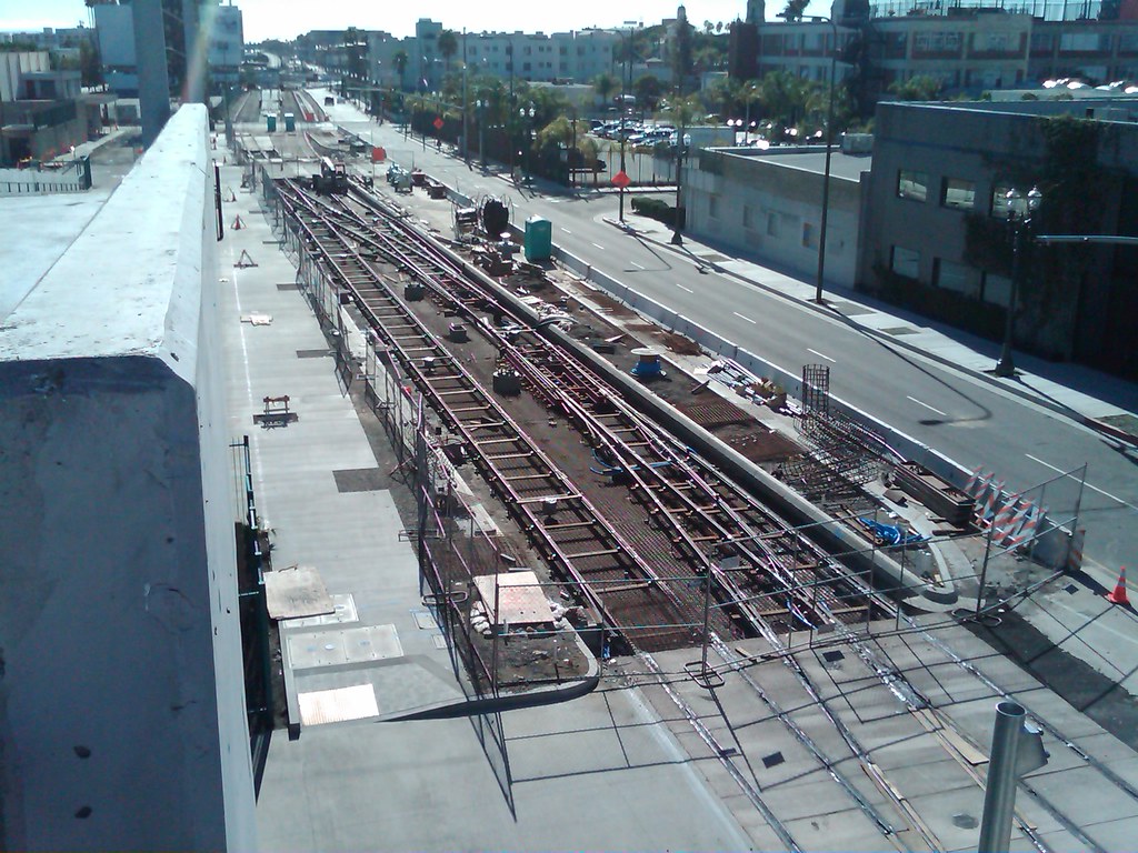 Progress at the 23rd St. station is starting to catch up with that of the Western station: 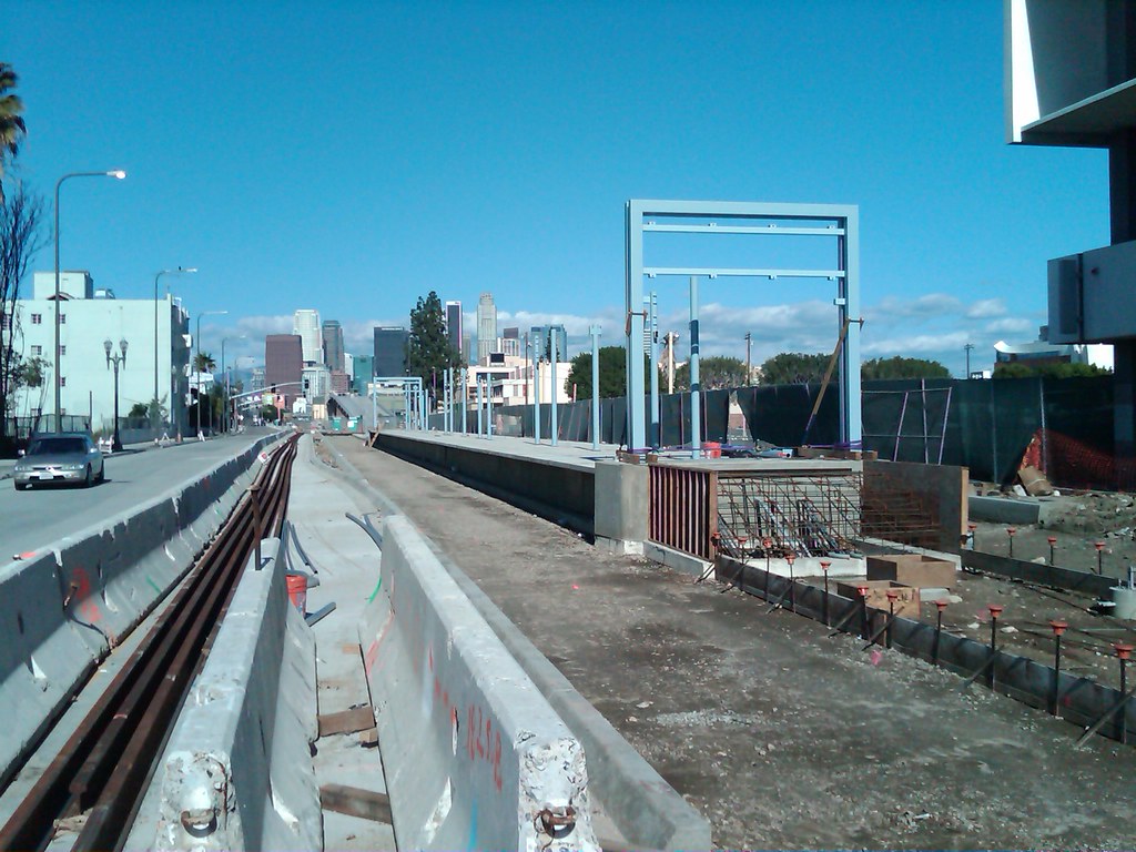 An overview picture of track leading north out the trench: 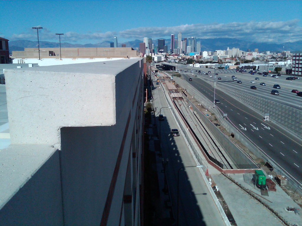 A curb is now being constructed on top of the Flower portal to provide left-turn lanes for southbound Flower St.: 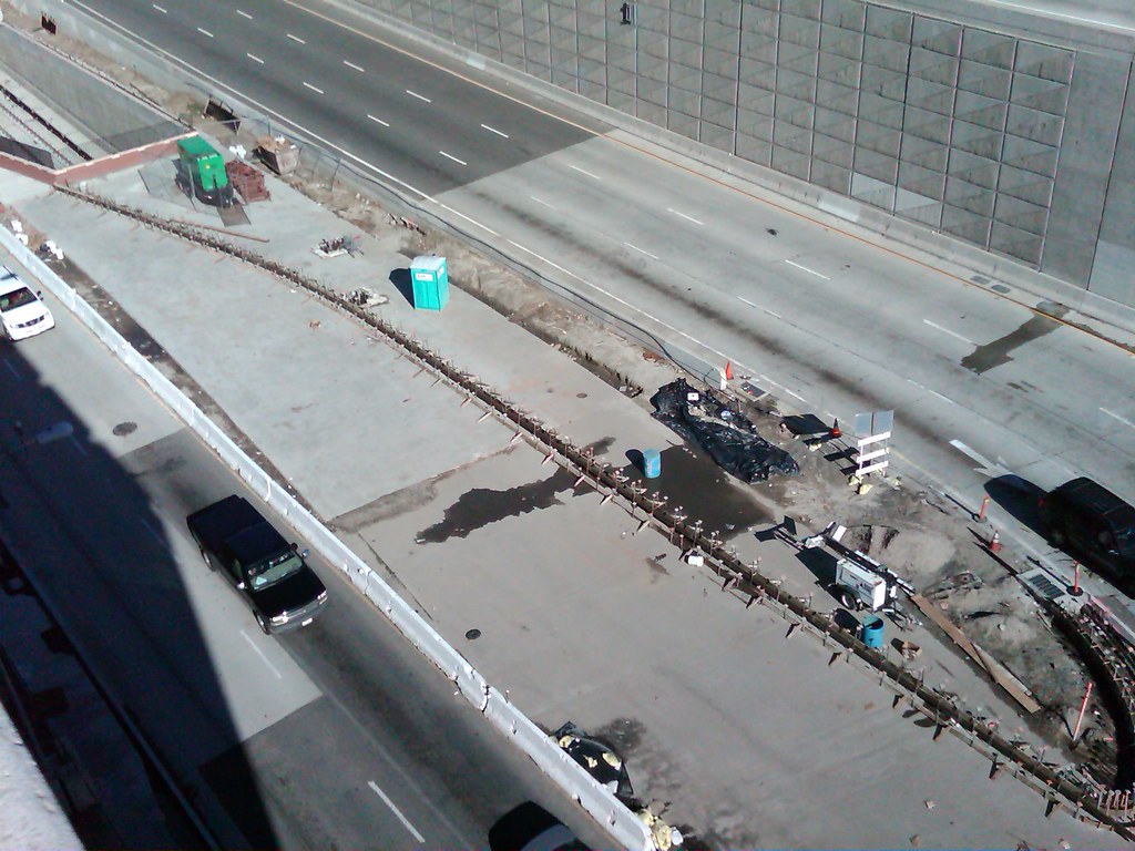 Current condition of the Vermont Ave. crossing. Note both the one Expo Line track and one remaining rail from the old freight tracks: 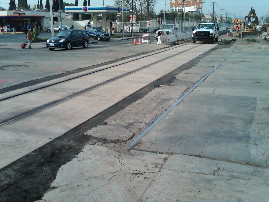 |
|
|
|
Post by Gokhan on Feb 8, 2010 11:11:16 GMT -8
Great pics, Justin, thanks. These are angles I don't catch.
It looks like heavy rain prevented the Vermont crossing from being completed. The old tracks, centered on the original right-of-way, are indicating that they realigned the right-of-way slightly.
|
|
|
|
Post by rajacobs on Feb 8, 2010 15:06:55 GMT -8
Administration of Kaiser Permanente West LA just north of the La Cienega station is interested in exploring a shuttle to run every 15 minutes or so, to and from the hospital as soon as the Expoline is running.
|
|
|
|
Post by darrell on Feb 8, 2010 18:05:13 GMT -8
An overview picture of track leading north out the trench: Beautiful day for photos, Justin, thanks! |
|
|
|
Post by bluelineshawn on Feb 8, 2010 20:33:09 GMT -8
Nice photo update Justin. Thanks.
|
|
|
|
Post by darrell on Feb 11, 2010 17:23:29 GMT -8
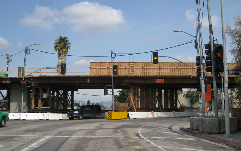 Side forms are going up across Jefferson (above, just east of Ballona Creek), just as they have largely come off of the La Brea bridge (below). 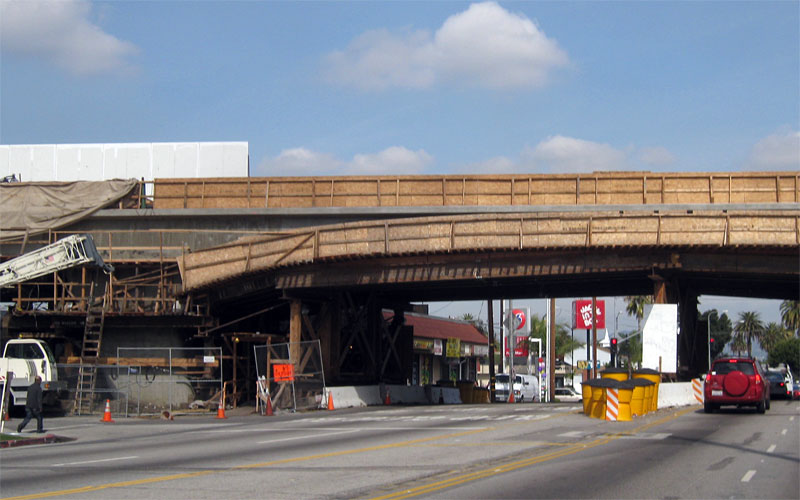 Compare to: 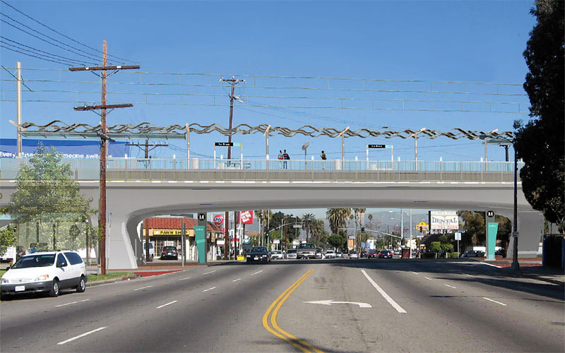 |
|
|
|
Post by Gokhan on Feb 11, 2010 20:07:53 GMT -8
The approval of Farmdale on April 22 and the ATP equipment not being installed until December ruling out the Crenshaw opening, it looks like the Segment A work is progressing slowly now. They have plenty of time to finish it in December as scheduled. There is still structural work going on the I-110 bridge with rebars at the south end being made.
They have also put the iron fences on the north-portal walls for the USC trench. The black iron fences are looking really good on the brick-patterned walls.
I might report next week on Segment B and C. I'm curious how many of the 16 Culver City supports are left. They all need to be finished by the end of this month so that work on the superstructure can start next month.
|
|
|
|
Post by darrell on Feb 12, 2010 18:36:16 GMT -8
This new Expo Authority construction notice about night work at La Brea makes me wonder if the bridge falsework will be coming down during the full closure next Monday-Wednesday nights. Please see attached construction notice regarding upcoming temporary overnight lane closures on La Brea Avenue and Jefferson Boulevard scheduled for February 15 through March 3.
What: Temporary Overnight Lane Closures on La Brea Avenue and Jefferson Boulevard
When: February 15, 2010 through March 3, 2010
Nighttime work hours: Monday through Friday; 9:00 p.m. to 5:30 a.m.
Where: Construction crews will be working in the northbound lanes of La Brea Avenue and the westbound and eastbound lanes of Jefferson Boulevard.
Traffic Impacts:
· Northbound traffic on La Brea Avenue will be limited to one through lane at all times. Southbound traffic on La Brea Avenue will not be impacted.
· Westbound Jefferson Boulevard will be limited to one through lane at all times. No left turns will be allowed during this construction activity.
· Eastbound Jefferson Boulevard will be limited to two through lane at all times. No left turns will be allowed during this construction activity.
· Directional signage, electronic message boards and flaggers will be used to safely direct drivers through the construction zones in order to minimize the disruption to traffic.
· Local access will be maintained for all residents.
· Due to additional construction activities in the area, La Brea Avenue will be closed overnight to all vehicular traffic, between Jefferson Boulevard and Rodeo Road, on February 15 through February 17, 2010, from 9:00 p.m. to 5:30 a.m. |
|
|
|
Post by Gokhan on Feb 16, 2010 13:43:27 GMT -8
Today, on a very nice day, I took a look at the Expo construction. We are approximately ten or eleven months away from completion now. Tracks are installed across Gramercy Pl now but the right-of-way will still be closed to traffic there until July. Here is the current list of the rail crossings already installed, shown in Green:  Washington Washington
21st
22nd
23rd
Adams
28th
30th
Jefferson
Trousdale
Watt
Menlo
Vermont
Raymond
Normandie
Halldale
Denker
Western
Gramercy
Arlington
7th
11th
Crenshaw
Buckingham
Farmdale
HauserSo, 19 have been installed and six are left among Expo Phase 1's 25 grade crossings (not counting the existing Blue Line shared track). Trousdale still remains. Washington will remain until late this year. Adams should be installed once the bridge work is complete. Buckingham and beyond will be installed after the grand approval of Farmdale on April 22. There is track work and statin work going on. Work on the bridges continue. Embedded track by USC is coming along. The Expo tracks are embedded at the Vermont Station and to the east of it (Segment 1A) and are ballasted to the west of the Vermont Station (Segment 1B [Vermont - Harcourt] and 1C [Harcourt - Venice/Robertson]). Here is a rare bird's-eye view of the Venice/Robertson Station: 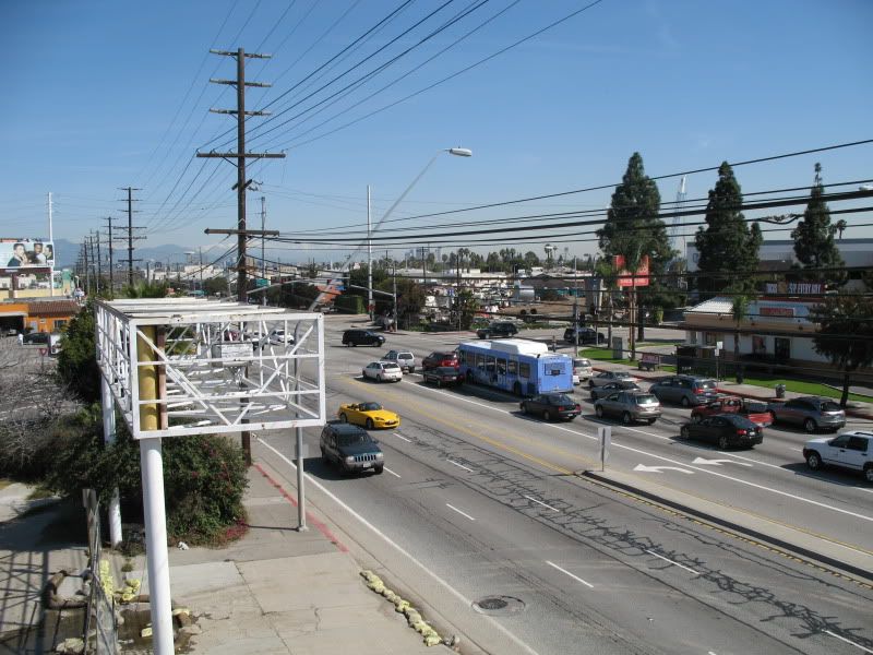 The overhead utilities along Venice are extensive, far beyond those at La Brea and La Cienega in Phase 1. They'd better start relocating these overhead wires now for Phase 2 to be completed on schedule, unlike Phase 1. Here is another view. Note the right-of-way northwest of Venice, where the line will continue in Phase 2: 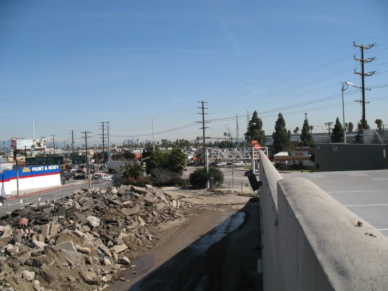 What I also noticed was how underused the parking lot at the terrace of the Culver Junction center, where the photos were taken, was. It could be a good parking opportunity for the Venice/Robertson Station. And this is bird's-eye view of the once-forbidden, beautiful Phase 2 right-of-way that extends the line into Palms and Cheviot Hills. It's fully approved and certified now and waiting for the end of the preliminary engineering for the Phase 2 light-rail line and bicycle and pedestrian path to go in: 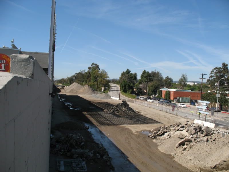 Now ground views of the Venice/Robertson Station. All 2x4 + 1 = 9 supports in the station area are erect now. There are 3 supports east of National, 1 on National, and there will be 3 in between National and Washington. Of these three two are still missing but they should be put in by the end of this month: 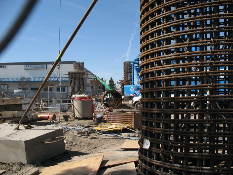 Another view of the station area: 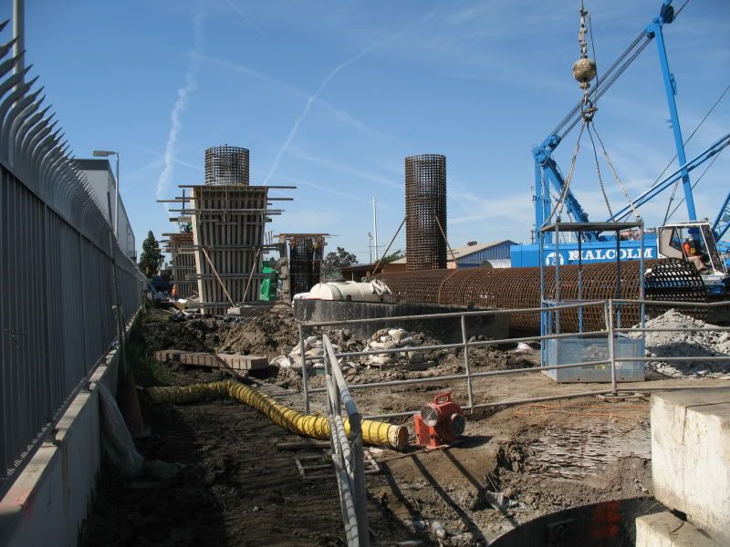 Finally the view of the La Cienega bridge and its northwest retaining wall. 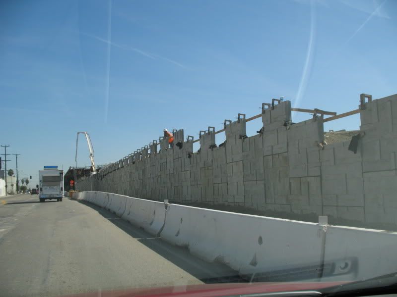 We are looking forward to the commencement of Phase 2 around September and completion of Phase 1 in December. |
|
|
|
Post by darrell on Feb 18, 2010 18:25:42 GMT -8
Good update, Gokhan! On La Brea, turns out this week's night closures did not remove the falsework yet. They have ground the concrete surface smooth (photos this morning): 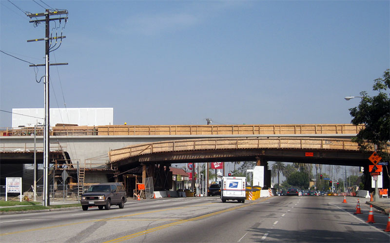 It's looking closer to the rendering: This was an interesting view east on Jefferson toward the La Brea ramp: 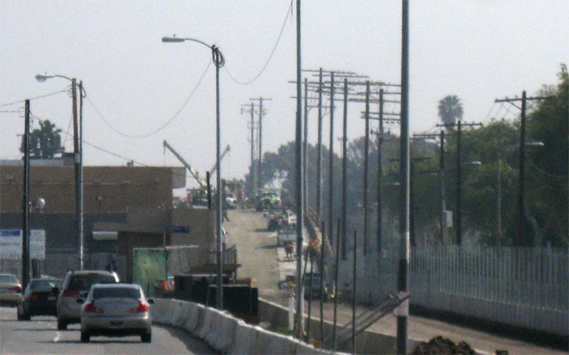 And here's how the finished parapet wall looks on the La Cienega MSE wall. It has a plain smooth surface: 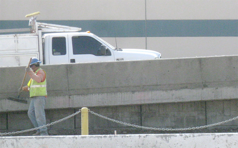 |
|
|
|
Post by bluelineshawn on Feb 18, 2010 21:16:50 GMT -8
Thanks for the photo updates guys. Looking forward to seeing some phase 2 construction photo updates by the end of the year!  |
|
|
|
Post by Gokhan on Feb 19, 2010 14:11:11 GMT -8
Everyday I keep forgetting that Manning is being repaved. As a result, I take a detour on Northvale. Here is what I ran into, across Palms Park in Cheviot Hills: 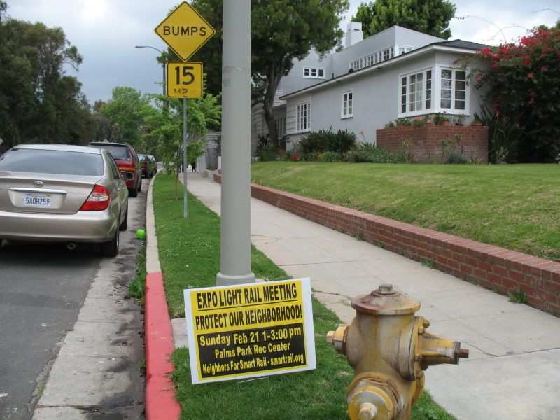 Protect our neighborhood from ... ! Protect our neighborhood from ... !Now that you ask for Phase 2 construction pictures, here are some preconstruction pics I took on this hazy day. The original right-of-way will be missed once the retaining walls go in and some of the trees and landscaping is removed. So, it's important not to miss these last opportunities to photograph the beautiful original right-of-way. Here is the gateway to Palms Park from Cheviot Hills -- Palms Park pedestrian bridge that is. It will be preserved during light-rail construction: 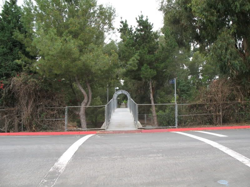 Here is a shot from the bridge looking northwest. Note that even though the right-of-way is in a trench, it's perfectly level. What is not level is Northvale. Northvale and surrounding Cheviot Hills area is very hill. Here the street is 25 ft above the level right-of-way and near Overland it's 10 ft below the right-of-way, while the right-of-way stays at a constant elevation: 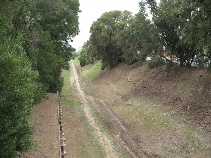 Feral cats are the natural inhabitants of the Expo right-of-way around Palms Park. Once there were about six dozen of them but nowadays they are scarcely numbered. A NIMBY complained and had them trapped a few years ago. NIMBYs are not only NIMBYs against trains but they are NIMBYs against everything -- cats, people, you name it! These cats are mostly black or dark-colored. This particular one was looking at me warily and curiously: 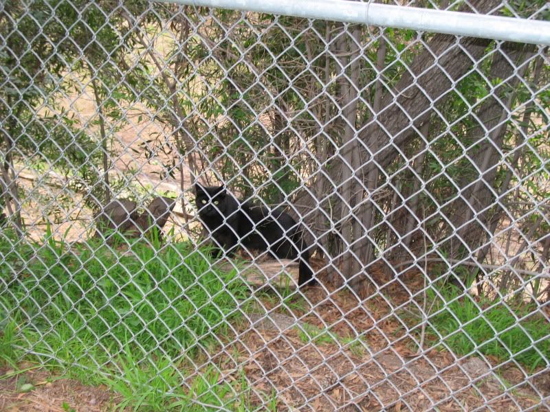 Not everyone is a NIMBY in Cheviot Hills, and some good-hearted residents pamper these kitties: 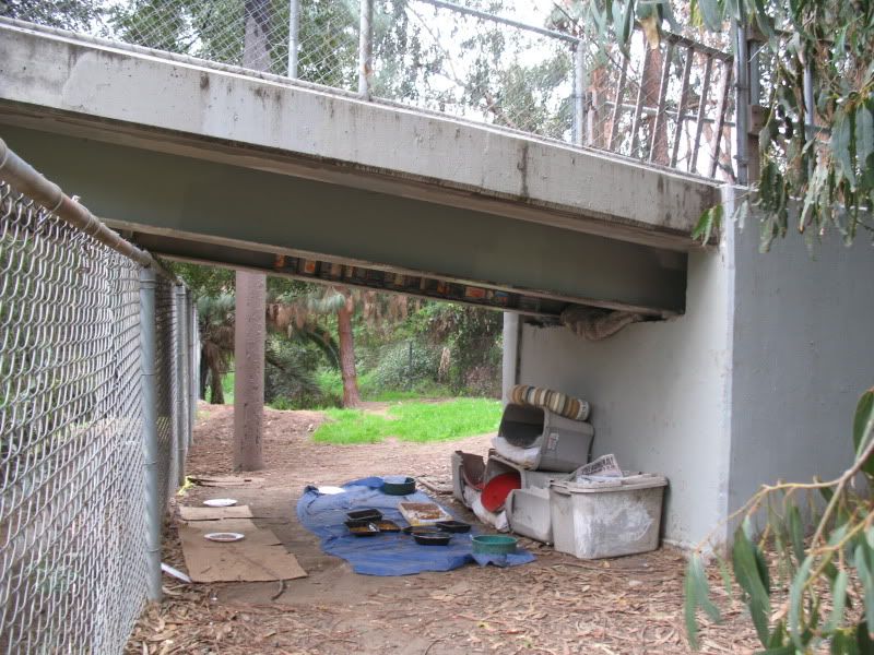 Another shot looking northwest: 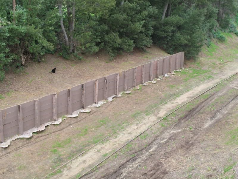 Looking northwest further away: 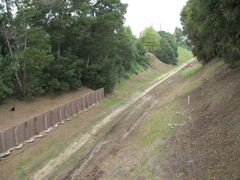 And looking southeast: 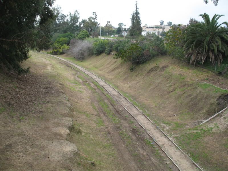 And let me tell the NIMBYs what really destroyed the neighborhood -- their very own homes. Before them it was ranch land, all green space, creeks, no cars, ... Now they are against light-rail, which will take some cars off the road and provide people with a crucial alternative way of transportation. Selfish, self-centered, world goes around me are synonymous with NIMBY. |
|
|
|
Post by John Ryan on Feb 19, 2010 16:06:08 GMT -8
I live on Dunleer right where you took these photos. I hope as many trees as possible can be saved--I would assume all the trees directly alongside Northvale will remain.
I have to disagree with you about the cats. They aren't 'natural' in any sense as they are only there because some misguided old lady didn't listen to Bob Barker and others continue to feed them. They were multiplying like rabbits and remain a nuisance and disease vector.
Can't wait for 2015.
|
|
|
|
Post by Gokhan on Feb 19, 2010 21:15:22 GMT -8
They ... remain a nuisance and disease vector. This is highly subjective, as some people don't like cats or other pets or animals. I myself enjoy the stray cats happily strolling around the right-of-way. They also hardly carry any disease. |
|
|
|
Post by spokker on Feb 19, 2010 21:20:42 GMT -8
Domesticated animals do not belong in the wild, Gokhan. If humans domesticated a species, they should take care of them properly. I certainly hope that the people feeding these strays are also supporting catch and release spay and neuter programs.
There is untold death and injury suffered by domesticated animals who live in a world they cannot easily survive in. I am sick and tired of seeing mangled dogs and cats in the road and I am sick and tired of irresponsible pet owners.
|
|
|
|
Post by Gokhan on Feb 19, 2010 21:23:35 GMT -8
Domesticated animals do not belong in the wild, Gokhan. If humans domesticated a species, they should take care of them properly. I certainly hope that the people feeding these strays are also supporting catch and release spay and neuter programs. There is untold death and injury suffered by domesticated animals who live in a world they cannot easily survive in. I am sick and tired of seeing mangled dogs and cats in the road and I am sick and tired of irresponsible pet owners. Well, it's a different habitat there. No cars, no humans, just an abandoned right-of-way unreachable by anything, and cats getting a second chance in the world. |
|
|
|
Post by metrocenter on Feb 20, 2010 8:02:03 GMT -8
Beautiful pics of the ROW, Gokhan. It really is a tranquil and beautiful area that provides a look back into L.A.'s past. At one time, much of L.A., from Boyle Heights to North Hollywood to Torrance, looked like this.
Understandably, some fear the Expo Line will ruin the character, the natural and rustic feel, of the canyon. Hopefully Expo can be designed to retain as much of the canyon's character and natural traits as possible, while still providing a first-class transit line for the rest of us.
|
|
|
|
Post by metrocenter on Feb 20, 2010 8:03:46 GMT -8
As for this one: Protect our neighborhood from ... ! Now that I work nearby (Sepulveda and Santa Monica), I take my morning walk in Rancho Park. And I can report, these signs are sprinkled around Rancho Park too, esp. near Exposition between Sepulveda and Westwood. |
|
|
|
Post by Gokhan on Feb 20, 2010 12:28:49 GMT -8
Now that I work nearby (Sepulveda and Santa Monica), I take my morning walk in Rancho Park. Wow, this is great. Expo Phase 2 will be very useful for you. You can walk to the Sepulveda Station in 20 minutes or take the bus there. |
|
|
|
Post by Gokhan on Feb 20, 2010 13:32:33 GMT -8
Phase 2 utilities are far more extensive than those in Phase 1. There is no way the project will completed in 2015 unless they start relocating these utilities this year. Utility relocation is the most difficult and time-consuming part of light-rail construction. You can see some of these utilities in my pictures. Crude-oil pipelines going to nearby oil fields: 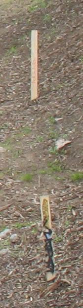 Some water or sewer line: 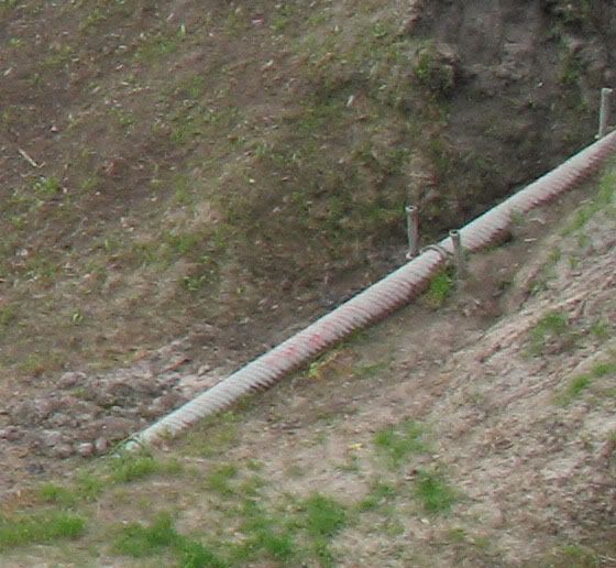 Maze of overhead utilities at Venice and Robertson Boulevards: 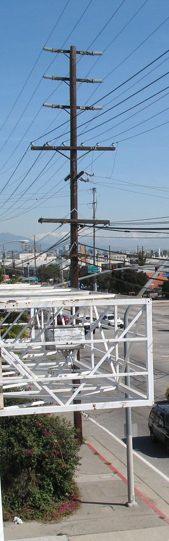 |
|
|
|
Post by LAofAnaheim on Feb 21, 2010 10:34:09 GMT -8
With the opening of the Phase I coming soon (hopefully the latest summer 2011)...I wonder what type of big changes do y'all forsee with bus service in the westside.
I hope to see the following:
- Pico-Rimpau terminal no longer being a transit center...and it being replaced by Venice/Robertson for Expo Line interface
- Big Blue Bus can stop running buses west of Robertson on Pico (Line 7) and Olympic (Line 5), so that they can cut down operating cost and potentially beef up more service on existing lines.
- Line 30/31 will make up the loss of the BBB Line 7 and go all the way to Pico/Robertson
- High frequency DASH service (5 - 10 minute frequencies) between the Venice/Robertson station to Century City. When Phase II opens...DASH will operate from Palms station and no longer Venice/Robertson
- Termination of the DASH F route between the Financial District in DTLA to USC. It's very popular, but the Expo Line is a replication of the service. Maybe a new route can be explored better connecting South Park, Financial District, and the Old Bank District (nighttime service, possibly?)
The opening of the Expo Line can create some efficiencies for the transit system. Any other recommendations?
|
|
|
|
Post by rajacobs on Feb 21, 2010 10:57:01 GMT -8
Kaiser Permanente is talking about a shuttle between the La Cienega station and the West LA hospital at La Cienega & Cadllac.
I'm wondering if reason might exist for a DASH route to take passengers up to the Grove and Fairfax District.
|
|
|
|
Post by JerardWright on Feb 21, 2010 11:04:55 GMT -8
Kaiser Permanente is talking about a shuttle between the La Cienega station and the West LA hospital at La Cienega & Cadllac. I'm wondering if reason might exist for a DASH route to take passengers up to the Grove and Fairfax District. To the last suggestion, I doubt that since the distance is fairly far for a DASH service to meet with Expo also the Rapid Bus Line 780 maybe a better match to serve along Fairfax. With the opening of the Phase I coming soon (hopefully the latest summer 2011)...I wonder what type of big changes do y'all forsee with bus service in the westside. I hope to see the following: - Pico-Rimpau terminal no longer being a transit center...and it being replaced by Venice/Robertson for Expo Line interface
- Big Blue Bus can stop running buses west of Robertson on Pico (Line 7) and Olympic (Line 5), so that they can cut down operating cost and potentially beef up more service on existing lines.
- Line 30/31 will make up the loss of the BBB Line 7 and go all the way to Pico/Robertson- High frequency DASH service (5 - 10 minute frequencies) between the Venice/Robertson station to Century City. When Phase II opens...DASH will operate from Palms station and no longer Venice/Robertson - Termination of the DASH F route between the Financial District in DTLA to USC. It's very popular, but the Expo Line is a replication of the service. Maybe a new route can be explored better connecting South Park, Financial District, and the Old Bank District (nighttime service, possibly?) The opening of the Expo Line can create some efficiencies for the transit system. Any other recommendations? To let you know right off the bat, the Bolded Blue suggestions you made will have nothing to do with Expo Line and it wouldn't make any improvements in service levels since it will take riders farther away to the neccessary destination along Pico Blvd. However this BBB and Metro route coordination may be reviewed in detail over the next few service changes, independent of Expo Line opening. The Century City DASH suggestion could work if its made as a Commuter Express service rather than a local DASH. The other suggestions maybe worked in detail. One thought I've had was turning over Metro Line 102 that runs on Exposition and parallel to Expo Line to LADOT DASH and integrate route segments as part of their Southeast, Leimert/Slauson and Crenshaw circulator shuttle services. |
|
|
|
Post by redwings105th on Feb 21, 2010 17:21:06 GMT -8
The other suggestions maybe worked in detail. One thought I've had was turning over Metro Line 102 that runs on Exposition and parallel to Expo Line to LADOT DASH and integrate route segments as part of their Southeast, Leimert/Slauson and Crenshaw circulator shuttle services. If that happens what would happen to the South Gate portion and the portion east of Figueroa on Jefferson? |
|
|
|
Post by transitfan on Feb 22, 2010 8:21:49 GMT -8
The other suggestions maybe worked in detail. One thought I've had was turning over Metro Line 102 that runs on Exposition and parallel to Expo Line to LADOT DASH and integrate route segments as part of their Southeast, Leimert/Slauson and Crenshaw circulator shuttle services. If that happens what would happen to the South Gate portion and the portion east of Figueroa on Jefferson? Maybe keep the East Jefferson Blvd portion, it could loop around the USC campus (S on Figueroa from Jefferson, W on Exposition, N on Vermont and E on Jefferson). Not sure where it would layover, though. Would probably have to be at one of the 102 stops on Exposition, as on Vermont, it would block the 204 and on Jefferson, the 38. |
|
|
|
Post by darrell on Feb 23, 2010 14:21:50 GMT -8
Here are a few new construction photos from this afternoon. 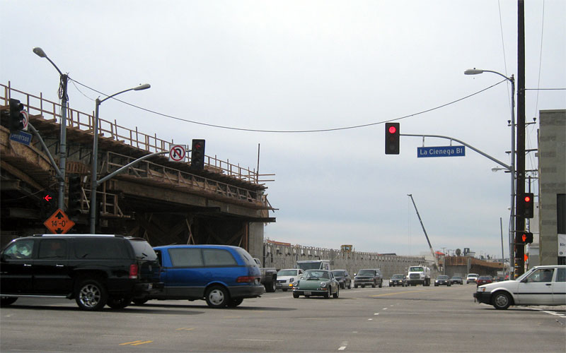 This view on Jefferson west from La Cienega gives a sense of visually how long the retained fill section will be, between the La Cienega bridge on the left and the Jefferson-Ballona Creek bridge in the distance. 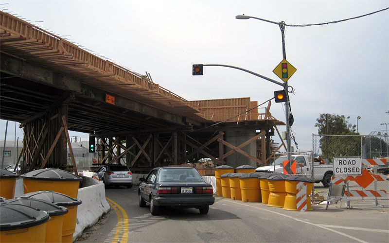 You can see the forms for the straddle bent (big concrete beam) that will connect the two columns on the east side of Ballona Creek. The soil here (old riverbed) wasn't solid enough to support the bridge with single columns. 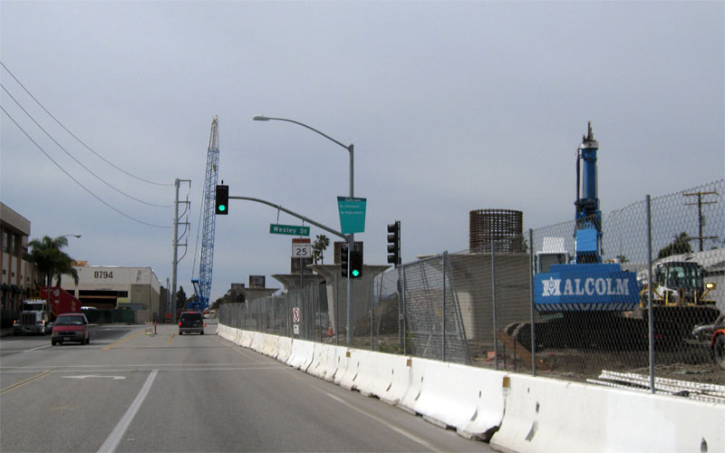 Excavation is beginning on the far right for the bridge abutment. It was added to the existing contract by the Expo Board recently. 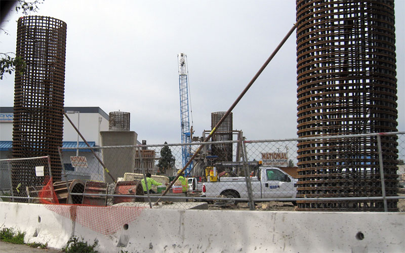 And a view out my car window of the columns west of Washington. |
|
|
|
Post by rajacobs on Feb 23, 2010 15:16:16 GMT -8
Catenary Poles are stacked on the Phase II ROW north of Venice and east of Bagley. 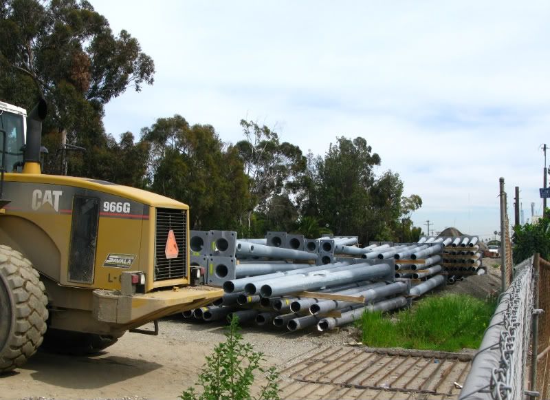 |
|
|
|
Post by Justin Walker on Feb 23, 2010 15:51:51 GMT -8
Darrell and rajacobs: great pictures! I can't wait for some upright catenary poles! Back at the east end, there was significant progress at the Trousdale station site today. Installation of overhead canopies: 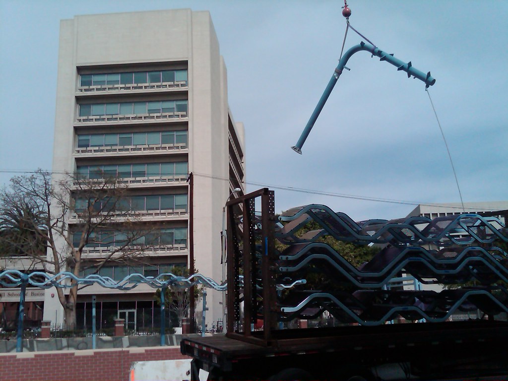 Completed canopy section at the end of the day: 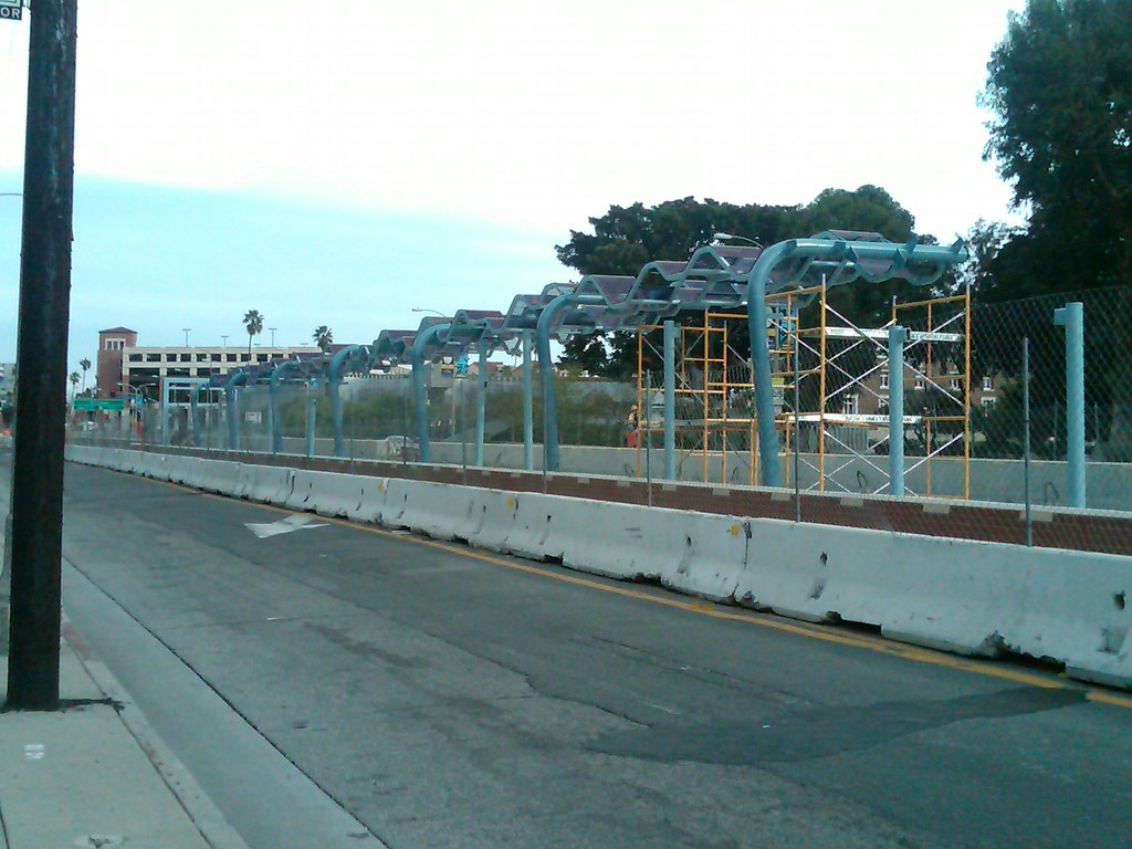 |
|


