|
|
Post by Gokhan on Sept 25, 2011 20:33:02 GMT -8
The reason why the National Boulevard curves is topography. There is a natural hill on the north side of National Boulevard that starts at the Palms/National intersection, on top of which the rail right-of-way goes. This is typical of the Palms / Cheviot Hills topography. National Boulevard avoids this hill by curving around it. This way the bicyclists on the new bike path will nicely get to avoid the hill as well. Palms Depot (Palms Station) for the Santa Monica Air Line was on the rail right-of-way behind the northwest corner of the Price Self-Storage, which was Depot Grounds back then and a used-furniture store until it was torn down in 2005 to build the storage place. There was an orphan Southern Pacific box car there on the siding behind the Depot Grounds (used-furniture store, now replaced by Price Self-Storage) until they tore it down in 2005: 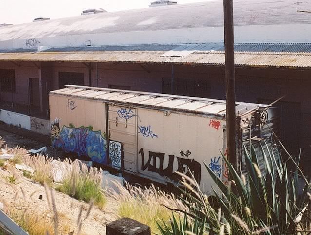 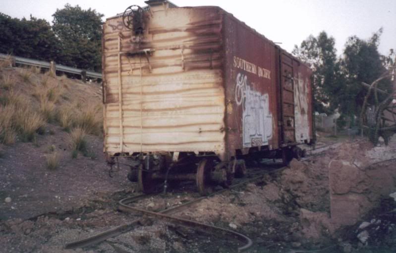 Here is where the Palms Depot was: 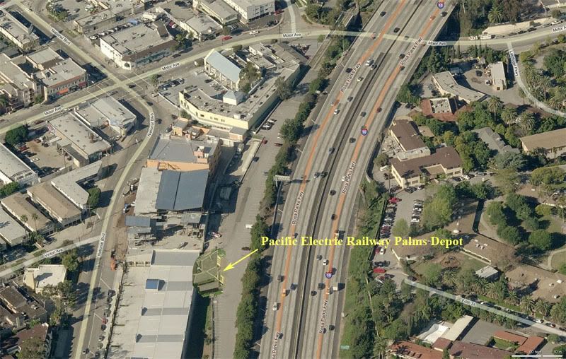 Here is a movie clip that has the Palms Depot in it. At 3:04 min:sec, you can see the roof of the Depot Grounds seen in the photo above from the rail right-of-way in the movie, looking toward the left (east) side of the station. Notice how high the station sits from Palms, as it's located on the rail right-of-way. Of course, the woods seen in the movie where the woman in her nightgown emerges from is now the Santa Monica Freeway. |
|
|
|
Post by Alexis Kasperavičius on Sept 30, 2011 8:08:20 GMT -8
Well, not quite photos - but close. Here are 1877 tax returns for the Los Angeles and Independence Railroad (precursor to Expo) laying out track length, detailed breakdowns of cost of equipment, operations, passengers & freight carried - and a trove of other tidbits I'm sure will be of interest to some: (Gotta love Google books search!) Returns of Los Angeles and Independence Railroad Company... |
|
|
|
Post by Gokhan on Sept 30, 2011 12:13:16 GMT -8
I'm sure will be of interest to some Certainly of great interest to me.  Here is an excerpt on the accidents that happened on the Los Angeles & Independence Railroad. The Santa Monica Wharf pier was just north of Santa Monica. No idea which section was the Cirurga Rancho.  |
|
|
|
Post by Alexis Kasperavičius on Sept 30, 2011 12:54:21 GMT -8
I'll bet it was "Cienega Rancho" - don't forget most everything was first taken by hand and it's likely this report was written up in San Francisco - transcribing from another's handwritten note. In some flavors of Spencerian script, a lowercase "e" looks a lot like "r" as it had a top loop - and an "n" could easily be seen as a "u" - depends on where one was schooled and how neat the handwriting was... I took a course once..  One other thing, this states that the track gauge is standard, not narrow as mentioned elsewhere. It also states (I think) that the line actually started operations in 1876. This is probably the best source for dates and specifics as everything else I've seen is third hand or here-say from questionable sources. |
|
|
|
Post by Gokhan on Dec 26, 2011 23:43:58 GMT -8
Nice screenshot of the Expo Line Pacific Electric Railway Palms Depot from the 1958 movie The Return of Dracula. It was located in the Expo Line right-of-way at Vinton Avenue behind the northwest corner of what is now Price Self-Storage in Palms. It's now in the Heritage Square Museum. This is looking toward southwest from the tracks: 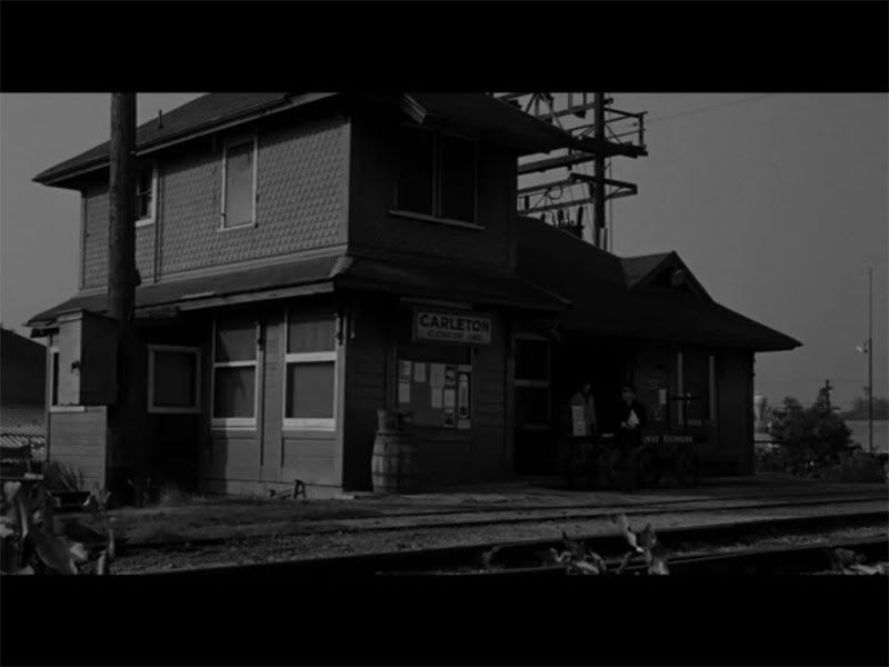 |
|
|
|
Post by Gokhan on Jan 14, 2012 10:37:46 GMT -8
Palms / Cheviot Hills historian Jonathan Weiss has some great high-resolution aerial photos in the history section of his Expo Greenway Web site. One of my favorite is this 1941 one. On the left side, you can see the Pico Drive-in movie theater, which was California's first drive-in theater, later replaced by Westside Pavilion mall. Expo railroad tracks are horizontal in the middle, running by Palms Park on the far right side and then arching and running across Overland and Westwood Boulevards. Note the nice creek that runs across the tracks between Overland and Westood, now replaced by the infamous Overland storm drain below ground. (See the flood-control map.) 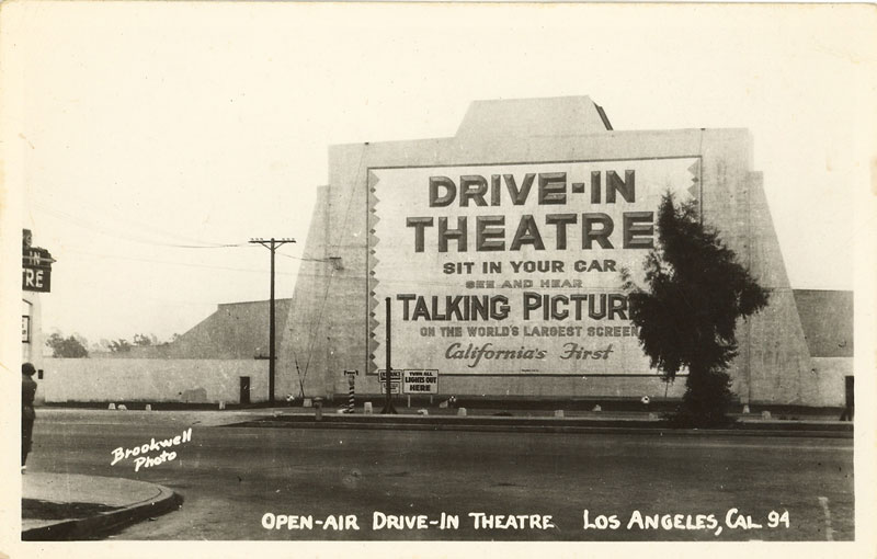 |
|
|
|
Post by darrell on Jan 15, 2012 22:47:21 GMT -8
Palms / Cheviot Hills historian Jonathan Weiss has some great high-resolution aerial photos in the history section of his Expo Greenway Web site. One of my favorite is this 1941 one. Wow, what a photo! |
|
|
|
Post by Gokhan on Jan 15, 2012 23:50:37 GMT -8
This 1927 one on the same Web site also shows a good section of the Expo Phase 2 right-of-way in Palms / Cheviot Hills. You can see two rail cars back-to-back in the right-of-way by Palms Depot, which was located a block east of Motor Avenue. Depot Grounds building, which was recently replaced by the Price Self-Storage, didn't exist back then.
|
|
|
|
Post by Gokhan on Apr 20, 2012 9:36:18 GMT -8
The new topological maps at historicaerials.com/ are great! This one is a 1952 map, showing the continuation of the Expo Line through Venice and Marina Del Rey to Inglewood (to connect with the Crenshaw Line) and the continuation of the Venice Line to Santa Monica on Neilson Way (then a double-tracked Pacific Electric right-of-way). 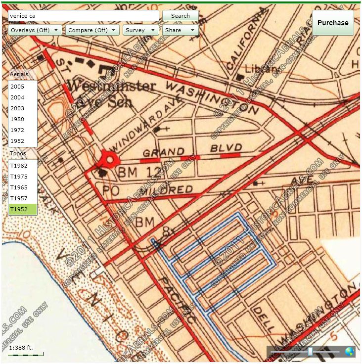 |
|
|
|
Post by bobdavis on Apr 20, 2012 21:55:07 GMT -8
Thinking about the old Air Line and the cars and locomotives that ran on it: At least three are preserved at Orange Empire. PE Business Car 1299 (can run as a "trailer", needs electrical work), Torrance-built locomotive 1624 (runs on special occasions) and wooden interurban 1001 (runs on special occasions).
|
|
|
|
Post by Alexis Kasperavičius on Apr 24, 2012 12:40:00 GMT -8
Found some more shots of the Los Angeles & Independence I had not seen before: Another shot of the downtown terminus (with a horse drawn street car next to it):  ...and the station in Santa Monica where it then continued to the wharf:  Current day pier close up (South of Wharf):  The very end of the line on the wharf:  Looking back towards Santa Monica from the cab:  Looking down the wharf from the hills:   The LA&I RR traveling up "PCH" before it was there:  Looking south on same tracks  And finally - Is this Air Line or Venice? Check the station sign:  ...all from catalog.library.ca.gov |
|
|
|
Post by rubbertoe on Apr 24, 2012 12:48:10 GMT -8
Alexis,
Great find! Gives a whole new meaning to "subway to the sea". Well, not quite, but you get the idea. I wonder if anyone ever jumped out the train window into the ocean on a dare. It looks like you can do it based on how close the track is to the edge of the pier.
RT
|
|
|
|
Post by Alexis Kasperavičius on Apr 24, 2012 13:10:09 GMT -8
And a few more: Where the line turned north up the coast:  Another shot looking south down the coast from farther back:  Another wharf shot (I assume after S&P took over)  Looking northeast (Train in upper left):  SM Depot after S&P takeover:  |
|
|
|
Post by Gokhan on Apr 24, 2012 18:29:29 GMT -8
Great find, Alex!
Note that "Warf" refers to the Santa Monica Pier, which was built in circa 1875, in most of the pictures and the "Lang Warf" in Pacific Palisades, north of the Santa Monica Canon (Santa Monica Canyon is where Patrick's Roadhouse is here today), which was built in 1893, in some others. It's very important not to confuse between the two. The Long Warf is the really long L-shaped structure and the Santa Monica Pier is the one in most pictures, including the one with the flyover tracks (Picture 4504).
|
|
|
|
Post by Alexis Kasperavičius on Apr 24, 2012 18:43:47 GMT -8
The Long Warf is the really long L-shaped structure and the Santa Monica Pier is the one in most pictures, including the one with the flyover tracks (Picture 4504). Hi Gokhan, I was also pleased to find these. One thing I have read though is that the "Wharf" was extended by S&P after acquisition of the LA&I and I thought they were the same. On closer inspection though, I think you're right - the one marked "Santa Monica Landing" is close to the present day pier and the Wharf is near what is now the road house. Here's one more "railroad" near what what we now call the Santa Monica Pier. It's the same building as the the last shot in my last post and gives us a good reference.  Note that you can see the flagged cupola (above) in this picture in most of the southbound shots (with the wharf behind the camera) indicating were two piers: one where there is a current pier (the landing) and one near the roadhouse (the wharf - which was extended and finally destroyed after the Long Beach port opened). |
|
|
|
Post by Gokhan on Apr 24, 2012 19:22:20 GMT -8
Yup, they are all Santa Monica Pier (its late-19th-Century version), located at what is now Colorado Ave, except for the very long L-shaped ones in the three pictures named the Mammoth Wharf (first time I heard this name) and SP Wharf and the one picture you said assuming after S&P takeover (with three tracks and a lot of equipment and facilities on it), which are the Long Wharf, located past the Santa Monica Canyon.
I wonder where the flyover from the pier went to.
Great stuff!
|
|
|
|
Post by Gokhan on Apr 24, 2012 19:28:29 GMT -8
 This one actually might be an amusement roller coaster. It's hard to believe that it would be for actual trains. |
|
Deleted
Deleted Member
Posts: 0
|
Post by Deleted on Dec 13, 2012 12:42:26 GMT -8
This is PERY Car 1299 eastbound on Exposition Blvd at 11th Ave/Degnan Blvd siding, east of Crenshaw Blvd. Note the Circus train on the siding. According to Alan they used to have the circus every year at Washington and Hill Streets. They would put a huge tent up on vacant land. Billy Graham had his first Tent meeting there in 1949, which the photographer attended at age 17. September 27, 1953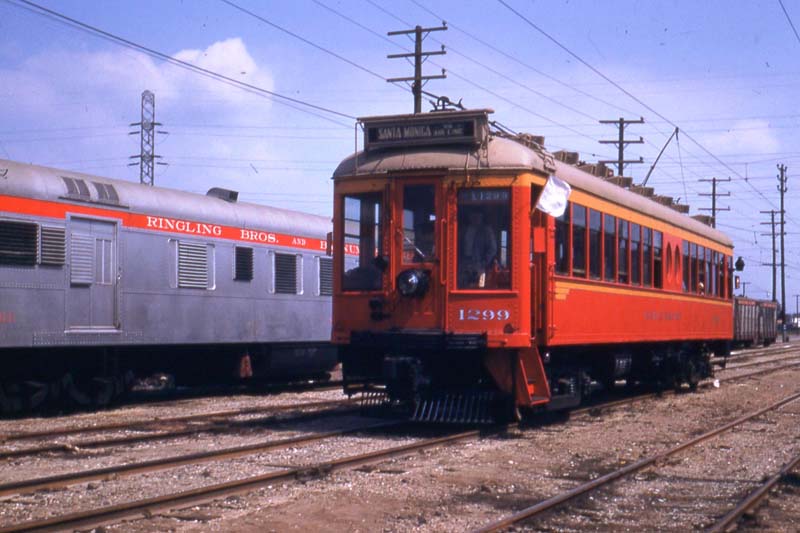 So....as a kid, one of my early recollections was the circus coming to town. However, it was much further west and south than Washington and Hill, which is just northeast of The Interchange, right? The first house we lived in was West Hyde Park Blvd, where it goes due north-south. Florence was A) across the intersection, and B) other side of the Eucalyptus trees. We were on Hyde Park and Augusta, just a stone's throw east of where the San Diego Freeway crosses Florence. Memory being what it is nowadays, it was proceeding southwest....so where would they have put a circus in 1950 or so down in that direction? I also remember the steam switcher crossing Crenshaw at the south side of Northrop....second house...13231 Doty (geez, I still recall that....PRospect 4-2878), and when they started testing jet aircraft, the "blue" light on the signal on Crenshaw would light, they'd roll the gates back, and overrun was across Crenshaw into what is now a parking lot east of Crenshaw. Just would like to know where that circus train would have set up on that line. The line down Florence was Santa Fe? Thanks. Dave (feeling quite old, thank you very much) |
|
|
|
Post by joemagruder on Dec 13, 2012 14:23:05 GMT -8
I recall going to the Ringling Brothers et al. circus with my father sometime in the late 1940s. It was in a tent at about Beverly and Fairfax - near the Pan Pacific auditorium. I think that in that era there were more than 1 circus that traveled by rail and that the locations may have been flexible.
|
|
Deleted
Deleted Member
Posts: 0
|
Post by Deleted on Dec 13, 2012 17:15:57 GMT -8
We start the tour from the east toward the west at Amoco Junction, that is where the Expo Line would intersect the Blue Line near Long Beach Ave and E 25 St, if Metro had used this segment of the right-of-way. Or the Long Beach Blue Line....if they had used existing ROW, swung west off Alameda/Long Beach Ave., swung down Adams, passing Compton Ave, Cooper, S. Central, S San Pedro, S Main, Broadway, Hill and Grand, followed Silver and Expo north along the Harbour Freeway towards LAUT. The Exposition ROW goes straight as an arrow east from Harbour until it his San Pedro and curves southerly. They have plans for that section of ROW, grade could even be separated? Dave (for that matter, run Gold south from where it curves onto E. 1st., you only go a couple of blocks until you hit rail again. For sure the rails cross E. 4th., and there is a spur at E. 3rd, altho can't tell if the rail has been paved over or now in between. Rail branches off at Traction and E. 2nd, to a private ROW on the west of Alameda. |
|
|
|
Post by darrell on Feb 21, 2013 22:57:26 GMT -8
(Re-posted from Phase 2 Construction thread - not old-old historical, but definitely before the line's construction)I got back to scanning old Kodachromes, in this case from October 1998, for some more "before" photos of phase 2 (and phase 1, which I'll put here since that thread's gone dormant). 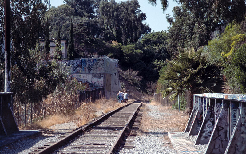 I'll start with this one looking west from the Motor bridge, looking very much like walking into the forest. 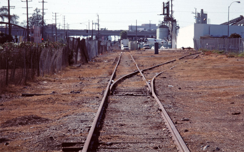 West from Military toward Sepulveda, the concrete plant, and the 405, when this track switch (I believe part of the original wye) was still there. 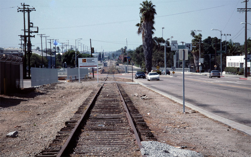 Long shot west toward the Ballona Creek bridge. 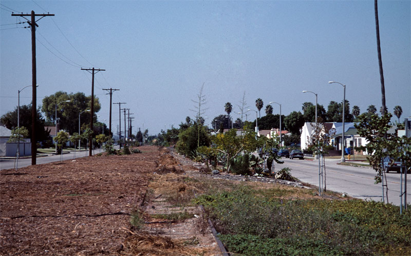 Early after the right-of-way was landscaped in the 1990s; the street on the right is Somerset. 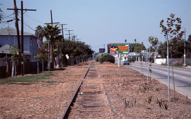 Looking west from 3rd Avenue, seeing more of the then-new landscaping. 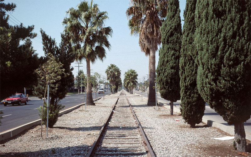 And the old median west of Vermont, looking west.
|
|
|
|
Post by Gokhan on Feb 21, 2013 23:05:05 GMT -8
(Re-posted from Phase 2 Construction thread - not old-old historical, but definitely before the line's construction)I got back to scanning old Kodachromes, in this case from October 1998, for some more "before" photos of phase 2 (and phase 1, which I'll put here since that thread's gone dormant). Thanks. Perhaps not old-old for us but toddlers back then are college students now.  Building light-rail is certainly taking a lifetime, literally. Or perhaps more than a lifetime between Alan Week's Kodachromes, your Kodachromes, my digital images (and yours and Alan's), and now Dwight's digital images. |
|
|
|
Post by Gokhan on Jan 4, 2014 18:21:03 GMT -8
This is posted on a back wall of Santa Monica's Ocean Park Omlette Parlor (2732 Main Street; this is by the restrooms): 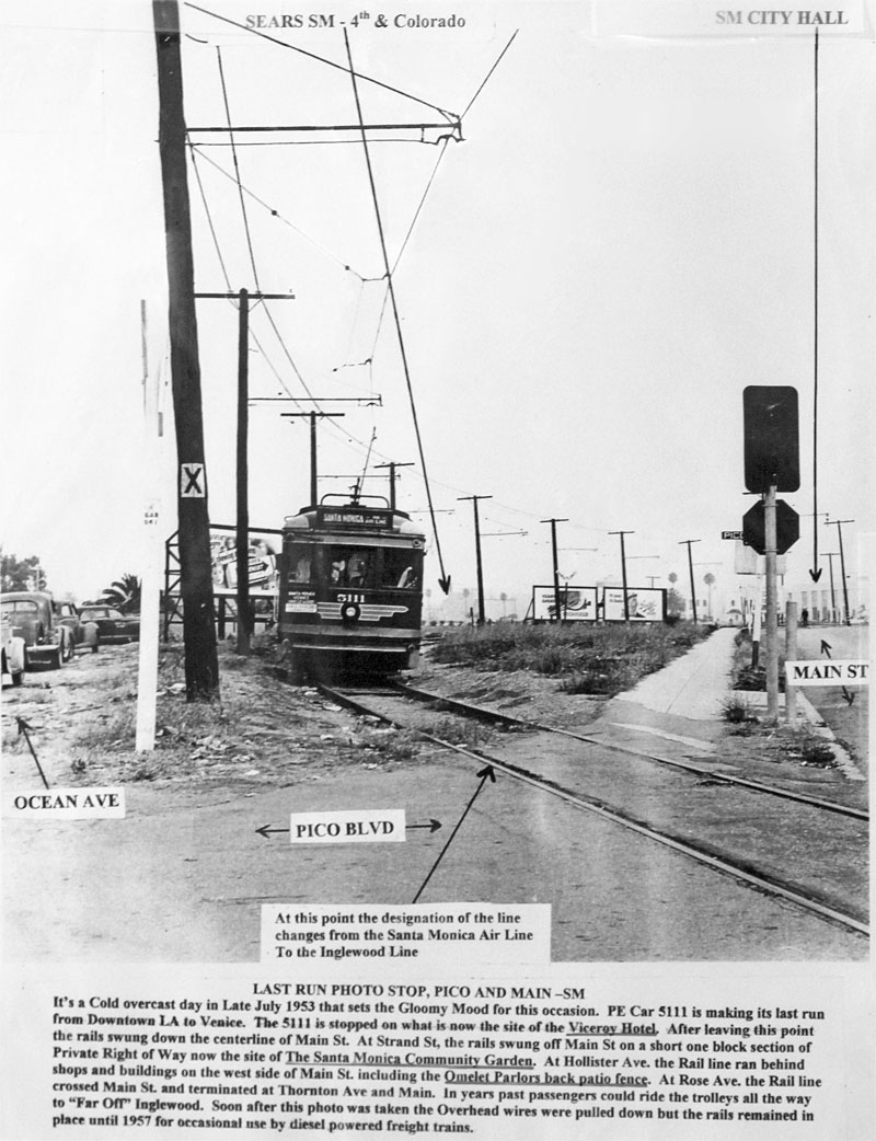 Thanks to greedy landlords, the Omelette Parlor didn't live to see Expo Line Phase 2: 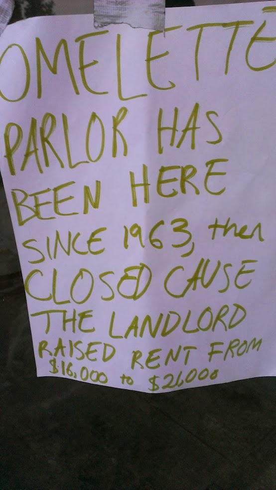 |
|
|
|
Post by Alexis Kasperavičius on Feb 28, 2014 0:59:05 GMT -8
Some new shots of the Los Angeles and Independence should be coming online very soon do to a new purchase. Here's a cool one of the LA&I in Santa Monica around 1878:  The Huntington acquires 4,600 rare, old photographs of Southern California"...the newly purchased photos primarily focus on the landscape, topography and buildings of Santa Monica and Los Angeles..." The Huntington acquires 4,600 rare, old photographs of Southern California"...the newly purchased photos primarily focus on the landscape, topography and buildings of Santa Monica and Los Angeles..."
"The Huntington still needs to catalog the large collection, but Watts said she expects some prints will be available in its digital library by summertime. "
(link)
|
|
|
|
Post by rubbertoe on Feb 28, 2014 6:14:41 GMT -8
Some new shots of the Los Angeles and Independence should be coming online very soon do to a new purchase. Here's a cool one of the LA&I in Santa Monica around 1878: The Huntington acquires 4,600 rare, old photographs of Southern California"...the newly purchased photos primarily focus on the landscape, topography and buildings of Santa Monica and Los Angeles..."
"The Huntington still needs to catalog the large collection, but Watts said she expects some prints will be available in its digital library by summertime. "
(link)
Amazing picture! It looks like there are 11 or 12 passenger cars being pulled by the steam locomotive. Given the low population of Santa Monica back then, I wonder if this was just a promotional train, maybe to show off the cheap real estate by the beach? Look forward to seeing these if they are ever shown at the Huntington or online. Please let us know if you hear anything further Alexis. RT |
|
|
|
Post by Gokhan on May 10, 2014 9:17:47 GMT -8
Nice! Yes, back then it was either train or walk -- so, it wasn't uncommon to have a dozen rail cars.
By the way, it's not Los Angeles & Independence Railroad but Southern Pacific. Southern Pacific bought it from LA&I RR less than two years after it was built in 1875.
|
|
|
|
Post by Gokhan on May 10, 2014 9:22:12 GMT -8
Windward Ave & Pacific Ave in Venice, California. Not sure what kind of line it is: 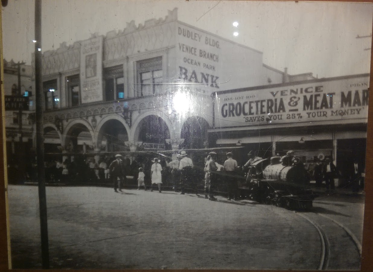  |
|
|
|
Post by darrell on May 10, 2014 9:54:26 GMT -8
Windward Ave & Pacific Ave in Venice, California. Not sure what kind of line it is:" Jeffrey Stanton's 1987 Venice of America 'Coney Island of the Pacific' says this (page 21): A miniature railroad with a Prairie 2-6-2 engine was installed in the spring [1906, the year after Venice opened in July, 1905] as a municipal transportation system for those who dreaded the thought of rowing a boat to market. Its two mile loop on 18 [inch, I presume] guage track crossed over graceful bridges that spanned residential district canals with romantic names like Venus, Lion, Altair and Aldebarren. Its main terminal and turnaround point was on Windward at Trolley Way [the location of your photos]. The public, particularly children, loved the ride and the price was right, a nickel. |
|
f ron
Full Member
  
Posts: 222
|
Post by f ron on May 10, 2014 9:56:53 GMT -8
|
|
|
|
Post by darrell on May 10, 2014 11:20:02 GMT -8
Thanks, f ron, this gave a lot more detail, including the photo of the train crossing a bridge and the map of its route. I lived in Venice in the late 1970s and lamented the loss of the original canals as I walked the streets that replaced them. So this train only ran from 1906 through 1924. But what a great idea, using a miniature steam train for local transit. Kind of like Disneyland. |
|