|
|
Post by James Fujita on Jun 23, 2011 23:57:20 GMT -8
I like our existing "Red Line, Blue Line, Green Line" colors, although I think place names would be fine as well.
We've started a fine tradition of colors for our existing lines, so I think it would be a mistake to change that now. People are creatures of habit (my mom still calls Rite-Aid "Thrifty").
However, place names would be okay for new rail lines, such as the Expo Line. We've broached that wall, so to speak. Crenshaw/ LAX would be okay for the new line.
But in any case, we need colors for the maps. One way or another, this line needs a color.
I've said it before, but I'll say it again: Letters and numbers are meaningless. And it's extremely New York-centric to call it the civilized standard, when Tokyo and London are both clearly more civilized than New York. ;D
|
|
|
|
Post by ieko on Jun 24, 2011 0:38:00 GMT -8
So...
Here's just from my personal experience.. Maybe this is because what I'm used to but I'll let you decide that.
I find ambiguity of a color to be useful because it doesn't distract me from my ultimate destination.
For example, I was recently in Vancouver and they have three separate lines -- the Canada Line, the Expo Line, and the Millennium Line. The entire time I was there, I was wondering what that even meant and if that meant I needed to know something about this line that wasn't obvious to me (an outsider). The other bit was before I came, I was trying to figure out how to get around and saw these names pop up, but it only led to confusion. It made me wonder, "what kind of service is this?" - "Canada Line?? Is that some sort of some sort of trans-Canada rail service?" Which progressed to.. "is that going to be seriously expensive to ride?" The other thing is, if we expand a line - does that mean we change the name too?
For letters/numbers, I think this should only be done when you've exhausted the supply of easily understanble colors. You should also make an attempt to assign the alphabet to one set of services and numbers to another. In our case, Metro only has numbers for bus lines so rail should get letters.
So if everything happens in measure R as it stands we'll have..
1 Blue
2 Red
3 Green
4 Gold
5 Purple
6 Orange
7 Silver
8 Crenshaw [needs color]
Eight lines to me doesn't scream that we need to figure out a new way to identify the system.
Just for a point of reference, when I visit a place that has the same style of identifying rail lines like Chicago, I don't run into the issues listed above.
|
|
|
|
Post by bzcat on Jun 24, 2011 11:11:56 GMT -8
I generally agree that if the line already has a color name, we just leave it alone. But since we have now adopted what I think is the best practice with location/destination/major thoroughfare method of naming new line (i.e. Expo Line that follows Exposition Blvd), we need to stick with that method. Going back to a color name for Crenshaw/LAX Line is a step backwards.
We are not going to "run out of color" per se, but we may have a problem when Metro starts running different service on the same track(s).
For example, we all know that while there will be a continuous "Blue Line" track from Azusa to Long Beach, but Metro is unlikely to run ALL the trains through the entire length of the future Blue line. So at some point, there will be "short line" or "regional line" on this track (e.g. Azusa-Pasadena, Arcadia-Metro Center, Union Station-Long Beach etc). Do you add more colors names to identify these service variations? This is where location/destination based names become ideal for communicating precise service destination and clarity (e.g. Foothill Line, Long Beach Line etc). They can all stay in the same color on the map but a useful map will need to show the service modes and different final destinations.
I would not nominate Vancouver or London example of using generic names (Jubilee, Millennium, Canada etc) as best practice. But Tokyo gets my vote as the best model... almost all the line names are descriptive with location/destination. If you take the Ginza line, you know you will end up in Ginza at some point.
|
|
|
|
Post by ieko on Jun 24, 2011 12:10:30 GMT -8
Short-lined trains will still keep the color of the line, Metro would just reflect this in the schedule and through the train signage.
I remember being in Japan and finding the names of the rail lines just as useless -- you have to think as if you're not from here. What good is it to you if the train is named "Expo Line?" It just confuses you and makes you wonder what "Expo" is.
I suspect "Expo Line" will be temporary until the regional connector is finished. Then we will see a restructuring of the system colors into the grid they'll form.
|
|
|
|
Post by James Fujita on Jun 24, 2011 14:05:40 GMT -8
I don't think the map would need to show ALL of the possible routes. Too much preciseness would lead to too much complexity.
For example, with the Blue Line as it currently exists, there are trains which do not go all the way into Long Beach, although I think this is primarily at the last run of the evening or beginning of a day. You are expected to know that one train is a "Del Amo" bound train by looking at the headboards, or by listening to the station announcements.
When trains go Long Beach-Azusa, I would think the map would show the full length as Blue, and in the event Metro decides some trains go from Azusa to Santa Monica, that might get a different color, perhaps Expo Line Aqua. There would need to be station announcements and Next Train monitors which say "Next Train: Azusa" or "Next Train: Little Tokyo" or whatever.
In long form: "Next train: Blue Line train to Azusa. In five minutes, Blue Line train to Pasadena"
In Tokyo, they have the idea of commuter trains and what we would call "Metro" or "light rail" or "subway" trains sharing the same tracks. You don't encounter express trains in downtown, but as you get out beyond the Yamanote loop and out towards the suburbs, some trains do go all the way out to Saitama, and do not. Some are express trains, some are locals.
They manage to express all of this with signs and monitors and a map that concentrates on the Metro subway and only shows a vague idea of the commuter train to the outer boonies. (You can get timetables and maps for the Tobu private electric railway or whatever, but that is not included on the Tokyo Metro map)
Los Angeles isn't likely to find itself with this problem, although I sometimes think that the Gold Line Foothill extension, if it ever reached beyond Claremont to Ontario and beyond in San Bernardino County, could become this.
EDIT: "What does this name mean" could be a problem for visitors, but only visitors not armed with Lonely Planet, AAA or travel apps. Expo references Exposition Park. The park is filled with science museums and an expo is where you would expect to find scientific exhibitions.
[ Why Anime Expo is an expo and not a con, I don't know. ]
I do wish that the Aqua Line name had caught on, but Expo isn't that bad.
|
|
|
|
Post by bluelineshawn on Jun 24, 2011 15:24:10 GMT -8
Well I'm pretty sure that Metro is looking to move to letters or numbers, but it doesn't have to be either or. They can decide to use both if they want.
|
|
|
|
Post by jdrcrasher on Jun 24, 2011 16:25:11 GMT -8
Los Angeles isn't likely to find itself with this problem, although I sometimes think that the Gold Line Foothill extension, if it ever reached beyond Claremont to Ontario and beyond in San Bernardino County, could become this. As far as I know, Ontario Airport is the long-term permanent terminus for the Gold (soon to be Blue) Line. |
|
|
|
Post by James Fujita on Jun 24, 2011 19:43:56 GMT -8
Metro already uses numbers; according to the timetable, the Gold Line is 804. It's also the Edward R. Roybal line.
Nobody uses the numbers. I doubt anybody uses the Roybal name.
(And I was speaking hypothetically on the Foothill extension. It's the closest thing we have to Tokyo's commuter/ subway combination.)
I will say that Tokyo recently added letters and numbers to signs, a pointless gesture IMHO. The numbers are interesting from a tech geek standpoint because each station has a letter/number combo, such as "G1" and you can tell how many stations apart "G1" is from "G6." But none of that information is necessary.
But they haven't eliminated the names or the colors and after years with names like "Hanzomon" and "Ginza," I doubt anybody would want them to.
It's just brainless numerics, like corporations identifying people by ID # rather than by name.
|
|
|
|
Post by metrocenter on Jun 28, 2011 7:38:36 GMT -8
At last week's Metro Board meeting, Supervisor Ridley-Thomas apparently introduced a new motion for the benefit of those near the Crenshaw Line. (I did not hear about it until after the fact, as it did not show up on the official agenda. So I don't know if whether or not it came up for a vote.) The motion asks for a number of sensible things, including safety and traffic mitigation plans for Park Mesa Heights, a local hiring plan, a "business loss mitigation fund", and streetscape improvements. |
|
|
|
Post by JerardWright on Jun 28, 2011 10:09:07 GMT -8
At last week's Metro Board meeting, Supervisor Ridley-Thomas apparently introduced a new motion for the benefit of those near the Crenshaw Line. (I did not hear about it until after the fact, as it did not show up on the official agenda. So I don't know if whether or not it came up for a vote.) The motion asks for a number of sensible things, including safety and traffic mitigation plans for Park Mesa Heights, a local hiring plan, a "business loss mitigation fund", and streetscape improvements. It didn't come to a vote at the meeting, it was being addressed for inclusion into the July Committee and Board meeting cycle. (Something the Park Mesa grade separation/Leimert Park motion never did) I for one will support it even with that second clause as the baseline design for the two streets (54th and Slauson) at LOS D and F respectfully even if this line was underground that would still be the case per the EIR in addition Slauson will have a station which would negate the negative impacts of the LRT operating on the traffic cycle. |
|
|
|
Post by rajacobs on Jun 28, 2011 11:01:16 GMT -8
The smaller Cleveland MTA system would not normally offer a comparison, but the eastside MTA was built out of the Shaker Rapid Transit and Cleveland Transit System and uses both colors and destinations.
The Shaker-Green and Van Aken-Warrensville eastbound destinations are the endpoints of track that is shared for half the distance from the downtown starting point. The Van Aken Bl. line is designated as the Blue Line and the Shaker Bl. line is designated as the Green Line the old CTS line (which also shares some of the track) to Windermere in the east as the Red Line.
When the City of Shaker Heights ran 2 lines independently, the eastbound trains were designated by their eastern termini. After MTA acquired them, they were renamed Blue and Green lines, but with the trains carrying the designation Green or Warrensville depending on which track (Van Aken Bl. or Shaker Bl.) they ended.
I thought the colors were a nice touch but unnecessary in Cleveland. LA is a different story. The Green Lilne, for example, will have trains that go to Redondo and trains that go to the airport (we hope!). In that case we'll need Green-Airport and Green-Redondo to differentiate. Further color usage (to differentiate trains with termini though they use the same track, as in Cleveland) would be confusing with the potential of different termini along a single line.
|
|
|
|
Post by James Fujita on Jun 29, 2011 14:45:40 GMT -8
I think we're overthinking the color issue.
The Green Line, when trains head for LAX and for Torrance's new transit center, will be similar to London's Piccadilly Line (named for Piccadilly Circus) which has Uxbridge and Heathrow Airport branches.
Both branches are represented by a dark blue color on the map, and people rely on signs and station announcements to know which is which.
|
|
|
|
Post by jdrcrasher on Jun 29, 2011 20:22:30 GMT -8
I don't think the Green Line will go to Redondo Beach once it's extended to Santa Monica. The Crenshaw Line, and eventually, a 405 Corridor would use the ROW instead.
|
|
|
|
Post by ieko on Jun 30, 2011 0:51:03 GMT -8
Metro's rail operations staff has expressed several times that the current idea is to have ...
Green Line - Norwalk to Aviation/Century
Crenshaw Line - Expo/Crenshaw to Torrance Transit Center
Why? Combined services south of Aviation Station would be inefficient and harder to manage. (i.e. not enough demand, and Crenshaw Line trains have street running portions making it hard to time trains properly to hit the Aviation wye).
|
|
K 22
Full Member

Posts: 117
|
Post by K 22 on Jun 30, 2011 6:54:23 GMT -8
I think we're overthinking the color issue. The Green Line, when trains head for LAX and for Torrance's new transit center, will be similar to London's Piccadilly Line (named for Piccadilly Circus) which has Uxbridge and Heathrow Airport branches. Both branches are represented by a dark blue color on the map, and people rely on signs and station announcements to know which is which. So if the colors get ditched and just go by names, you'd have: Hollywood Line Wilshire Line Expo/Eastside Line (post-Connector) Crenshaw/South Bay Line (  ) Glenn Anderson Line ( ) Pasadena/Long Beach Line ( ) Van Nuys/Westwood Line (for the 405 Line) Those names don't sound too terrible, in my opinion. |
|
|
|
Post by masonite on Jun 30, 2011 8:38:16 GMT -8
Metro's rail operations staff has expressed several times that the current idea is to have ... Green Line - Norwalk to Aviation/Century Crenshaw Line - Expo/Crenshaw to Torrance Transit Center Why? Combined services south of Aviation Station would be inefficient and harder to manage. (i.e. not enough demand, and Crenshaw Line trains have street running portions making it hard to time trains properly to hit the Aviation wye). Originally, they stated they were going to split the Green Line and send some of the trains to LAX and some to the South Bay. I never thought that was the right course, because of the issues you stated above (over-serving the South Bay portion of the line) and the timing problems interlining a grade separated route with one that is not entirely grade separated. Overall, this makes for a cleaner more efficient system in my opinion. |
|
|
|
Post by James Fujita on Jun 30, 2011 11:55:35 GMT -8
Sending the Green Line north to the airport and the Crenshaw Line south to Torrance would work. It would work better if Aviation Station were WEST of the wye instead of east of it, because as things stand now, Torrance to Norwalk would require Torrance -> wye -> airport transfer -> wye -> Norwalk, if you catch my drift. But, Nowalk to LAX and Torrance to Crenshaw would make more sense than South Bay to LAX and Crenshaw to Norwalk. And LAX still gets served from all directions this way. So if the colors get ditched and just go by names, you'd have: Hollywood Line Wilshire Line Expo/Eastside Line (post-Connector) Crenshaw/South Bay Line ( ) Glenn Anderson Line ( ) Pasadena/Long Beach Line ( ) Van Nuys/Westwood Line (for the 405 Line) Those names don't sound too terrible, in my opinion. Glenn Anderson Line sounds horrible to me. I hate politician-based names, such as "Edward R. Roybal Gold Line" or "Julian Dixon Station". They have no basis in the geography of the area, and even if you've lived in Los Angeles for a long time, you wouldn't necessarily recognize the names. Tourists would recognize "Hollywood" and "Wilshire" just as they ought to recognize that "Ginza" is Tokyo's most historically famous shopping district. [ although Akihabara may have overtaken Ginza, thanks to millions of otaku ;D ]. They should even recognize "Pasadena" as home to the Rose Bowl. And it's ridiculous to talk about "ditching" colors. Maps have colors, signs have colors. Tokyo even color-codes its trains, so that a Ginza Line train has orange stripes while a Yamanote Line train is a distinctive shade of green. Even if you changed the name to "Hollywood" the color on signs and maps should always be a healthy red. |
|
|
|
Post by metrocenter on Jun 30, 2011 12:25:26 GMT -8
Agreed. As much as I prefer Metro Rail lines to be given non-color names, the colors have to remain for the maps. It's one of many ways for riders to distinguish the lines.
|
|
|
|
Post by bzcat on Jul 1, 2011 10:50:12 GMT -8
Glenn Anderson line is a terrible name  In a perfect world, this is what Metro should have used from the beginning: Color on Map - Name Red - Hollywood line Purple - Wilshire line Green - Norwalk-LAX line Blue - Long Beach line (based on current operations) Gold - Pasadena line (based on current operations) Teal - Expo-Eastside line Pink - Crenshaw-LAX line |
|
|
|
Post by ieko on Jul 1, 2011 14:13:39 GMT -8
Those names don't give the whole picture though and there is no consistant meaning -- when you do these things you must be consistant.
So for example, why is the Red Line the Hollywood Line when it terminates in North Hollywood and Downtown L.A.?
You could name a line after a corridor like you did there with the Purple Line, the only issue here is that it's the only line that stays on a well known corridor besides the current Green Line..but...
Our system is new and still being built, if we went wit this scheme we'd have to rename our lines often -- which is a huge problem because every renaming would be a serious marketing struggle, people would just be too used to current names.
Plain colors keep things simple and allow users to not get bogged down on things that don't matter.
|
|
|
|
Post by masonite on Jul 1, 2011 17:27:01 GMT -8
Those names don't give the whole picture though and there is no consistant meaning -- when you do these things you must be consistant. So for example, why is the Red Line the Hollywood Line when it terminates in North Hollywood and Downtown L.A.? You could name a line after a corridor like you did there with the Purple Line, the only issue here is that it's the only line that stays on a well known corridor besides the current Green Line..but... Our system is new and still being built, if we went wit this scheme we'd have to rename our lines often -- which is a huge problem because every renaming would be a serious marketing struggle, people would just be too used to current names. Plain colors keep things simple and allow users to not get bogged down on things that don't matter. Not to belabor this topic that probably gets too much discussion here as I think the colors work fine for now, but the names would provide some context. Hollywood and Long Beach are the major streets which the Red and Blue Lines travel on just like Expo. I'd call the Green Line, the Century- LAX Line. Think of it like this, if you just came to LA, and saw the Hollywood Line it would be a pretty good bet you'd look at that line's station list for North Hollywood. That would be pretty intuitive. Right now the Red Line name wouldn't lead you to do that as it wouldn't tell you anything. |
|
|
|
Post by ieko on Jul 1, 2011 19:14:43 GMT -8
But what if you wanted to go to Downtown L.A.? Would you be left to expect the "Downtown L.A. Line?" Naming makes you assume things you normally wouldn't, that's why it does more harm than good.
Century - LAX would be confusing because the Green Line does not go on Century Blvd, or go to Century City. but would end at Century/Aviation...
|
|
|
|
Post by masonite on Jul 1, 2011 19:49:00 GMT -8
But what if you wanted to go to Downtown L.A.? Would you be left to expect the "Downtown L.A. Line?" Naming makes you assume things you normally wouldn't, that's why it does more harm than good. Century - LAX would be confusing because the Green Line does not go on Century Blvd, or go to Century City. but would end at Century/Aviation... Just because someone has a destination doesn't mean they expect to have a line named for it. Most any traveler across the world knows the highest confluence of lines would be the center of the city. I doubt anyone would figure that since there is no "Downtown LA Line" there must not be a route to Downtown LA. A naming system is at best a rough clue as to the line not an end all or a substitute for a map. In fact the map would still have the same colors on it that we have today. The need to call a line something more specific is why our lines often have real names like Pasadena Line or Crenshaw or Expo Line until they go into service and get a color, although Expo is keeping its name for now. The Green Line does go down the Century Freeway, but I do agree with you that there may be some confusion with Century City so that particular name may not work. Anyway, we could go on and on as people have strong preferences for naming conventions whether it is a New York, London, or Washington DC style naming. |
|
|
|
Post by metrocenter on Jul 22, 2011 7:52:54 GMT -8
On Wednesday, Metro staff gave an oral presentation of its community improvement plan for the Crenshaw/LAX Corridor project to the Metro Planning and Programming Committee. (Meeting agenda here.) Jerard Wright was able to get a copy of the presentation. (Thanks Jerard!) One focus of the presentation was Metro staff plans for managing traffic at Crenshaw/Slauson. Keep in mind, Mark Ridley-Thomas has introduced a motion which would mandate a reduction of traffic congestion at that intersection from level-of-service (LOS) F to LOS C or better, by 2030. From Metro staff's report: Potential Enhancements for Traffic at Crenshaw/Slauson
- Addition of:
- Dual Left Turn Lanes From Slauson
- Eastbound Through Lane on Slauson
- Right Turn Only Lane on Westbound Slauson
- Temporary Right Turn Lane (after school hours) on
- Southbound Crenshaw
- Improves Level of Service (LOS) to “E” in 2030
- Subject to negotiation with LADOT, since these would be betterments
- LOS “C” is not achievable without significant impacts to adjacent property owners
So per Metro staff, LOS C is not a practical target. The only way to achieve LOS C is to turn Slauson into a broad highway of speeding cars. And this would devastate local businesses and residents. The next Metro Board meeting is August 4. It'll be interesting to hear what happens with MRT's motion. |
|
|
|
Post by LAofAnaheim on Jul 22, 2011 9:01:23 GMT -8
How is widening the capacity of the street going to help businesses in Crenshaw? Isn't it ironic that the areas with smaller streets have more economic progress? Look around L.A. and see where people congregate (hint: it's not where the streets are the widest...)
|
|
|
|
Post by Transit Coalition on Aug 6, 2011 11:38:41 GMT -8
LA Wave NewspaperInglewood officials bicker about Crenshaw rail lineBy OLU ALEMORU, Staff Writer Story Created: Aug 3, 2011 at 6:55 PM PDT (Story Updated: Aug 3, 2011 at 7:52 PM PDT ) INGLEWOOD — In a somewhat acrimonious debate, the City Council Tuesday night shot down by a 3-2 vote an initiative proposed by Councilman Mike Stevens to explore funding for an underground crossing at the Florence and Centinela intersection of the Crenshaw-LAX Light Rail Line. Meanwhile, Mayor James Butts and Councilmen Eloy Morales and Ralph Franklin, backed a Butts-amended initiative to seek federal Transportation Investment Generating Economic Recovery (TIGER) grants to resurface Century Boulevard. The three councilmen all objected to the wording in Stevens’ initiative that “funds on a contingent basis Design Option 3 (Florence/Centinela intersection) with $13.25 million from the city of Inglewood Redevelopment Agency providing this if the project is not funded by MTA by the completion of the project design process.” According to Stevens, the agency would eventually seek reimbursement for those funds from the Metropolitan Transportation Authority. In a background brief to Stevens’ proposal, it was noted that MTA staff has indicated that funding limitations are one of the reasons they are recommending an at-grade crossing level at the Florence/Centinela intersection. Stevens argues that the at-grade crossing poses unique safety hazards, not fully evaluated by MTA officials in the final environmental report. The shape and features of the intersection, the proximity of two schools, a large public park, a large church, a blind corner, awkward roadway configuration, close proximity to residential properties and the lack of north-south arterials in North Inglewood due to Prairie Avenue dead-ending at Ed Vincent Park and Centinela dead-ending at St. John’s Church, all necessitate a grade separation, the document states. Furthermore, it maintains that the high frequency of funeral processions in the immediate vicinity due to the close proximity of St. John’s Catholic Church and Inglewood Park Cemetery to the crossing would push funeral procession routes to already overburdened streets like La Brea Avenue and Crenshaw Boulevard, creating more traffic congestion from a project intended to address transportation challenges. “This initiative primarily sweetens the pot,” Stevens said. “I’m asking for the city manager to look into alternative funding for this project so we can move it below grade.” Replying to a question from Morales, City Administrator Artie Fields said there was currently $11 million in un-obligated redevelopment funds available. “My biggest concern is the content of a council initiative that seeks to draw down $13.52 million in redevelopment funds,” Franklin said. “There are many redevelopment projects and residents have told us time and time again they want something done about Century Boulevard.” Councilwoman Judy Dunlap strongly disagreed. “I don’t know how three members can be so confused with a simple motion,” she said. “The TIGER grant is a good option, but that’s in my colleague’s original motion. We’re assuming our city manager, who is an expert in the field, will look at all possible funding sources.” However, Morales backed Franklin and Butts. “There’s a significant difference in the two motions,” he said. “The original initiative is to use all resources to fund the project. Those funds have to exist first, but [in the meantime] we have to prioritize the wishes of the residents.” ======= City begins demolition of blighted South L.A. shopping center[/size] (Photo by Olivia Miller/via Flickr) By WIRE SERVICES Story Created: Aug 5, 2011 PDT (Story Updated: Aug 5, 2011 at 2:43 AM PDT ) The city's General Services Department began demolition Thursday on a South Los Angeles shopping center the city has sought to tear down and redevelop since the Bradley administration. Officials hope the demolition of Marlton Square, formerly known as Santa Barbara Plaza, will finally lead to the 20-acre site being redeveloped after decades of starts and stops. The shopping center is near the intersection of W. Martin Luther King Jr. and Crenshaw boulevards. "This community has watched for nearly two decades as Marlton fell into disrepair and became an eyesore, attracting a variety of problems like illegal dumping, arson and vandalism," said Councilman Bernard Parks, who was on hand for the ceremonial start of the demolition process. "Today we can finally turn the page on the problems of the past and begin a new chapter as we clear the way for future development." Marlton Square has experienced an on-again, off-again development process that dates back to former Mayor Tom Bradley, who expressed interest in redeveloping the site in 1984. Former Lakers star turned real estate entrepreneur Magic Johnson had put forward a plan for the site in 1996, but was ultimately outbid by private equity firm Capital Vision Equities in 2002. Capital Vision's lender went bankrupt in 2006, and the firm defaulted on the project, leaving nearly 50 properties at Marlton Square in limbo in bankruptcy court. The city's Community Redevelopment Agency has since acquired about 20 percent of the properties, while bankruptcy proceedings have led to another owner, Commercial Mortgage Mangers, holding the rest. "Clearing these properties is a small but important step forward ... to revitalize Marlton Square, which we consider South L.A.'s biggest economic development opportunity," agency Chief Executive Officer Christine Essel said. The demolition is expected to be complete in early December. Parks aide Dennis Gleason said there are a number of developers in the wings interested in building on the site. "This development is part of the rebirth for the entire Crenshaw corridor," said an aide to Los Angeles County Supervisor Mark Ridley-Thomas, whose district includes Marlton Square. "What's possible there now is further enhanced by the imminent availability of transit service," said the supervisor's senior deputy for economic development, Dan Rosenfeld. He credited the agency for shepherding the project through an extraordinarily complex set of technical and legal requirements. "I don't think we have ever seen a real estate knot that was more tightly tied," Rosenfeld said.
|
|
|
|
Post by thanks4goingmetro on Aug 6, 2011 22:11:55 GMT -8
Marlton Square's location is prime, it's in the best spot in Crenshaw next to the remodeled mall and brand new Rave theater and public promenade, it's just down the hill from luxury homes, and it will be served by an underground Crenshaw Line station at Crenshaw/MLK Blvd. With the blight now partly demolished, let's hope for some green space and the rest to come down (and the senior housing to be completed) in the meantime til it's fully repurposed by some entity.
The Florence/Centinela situation seems a tad bit alarmist and overblown, underground, really? I can't vouch for how busy this intersection is, but the density is so low in the area surrounding it, and I find this suspect, for the simple fact that a bridge could be built over the intersection (only $5M at the Sepulveda Expo line rate) cheap enough to grade separate the railroad AND put down new luxury blacktop for the autos. I'll investigate this in person tomorrow.
|
|
|
|
Post by thanks4goingmetro on Aug 10, 2011 16:25:27 GMT -8
Harbor Subdivision Railroad crossing at Florence/Centinela 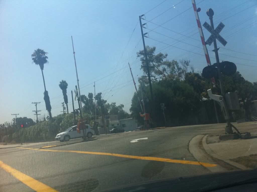 There is a considerable hill that the railroad and Florence rest on, mid-day traffic isn't too bad, but considering worse traffic, frequent trains, and the hill; grade separation is understandable diligence so a problem does not arise. Harbor Subdivision Railroad adjacent to Florence 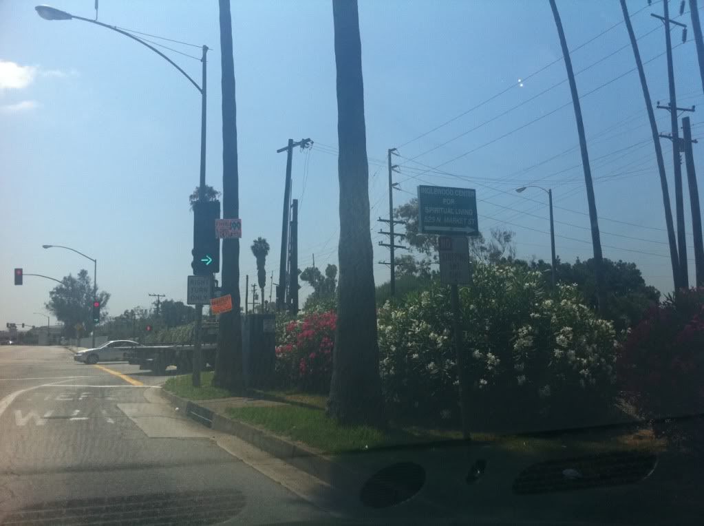 The railroad presently enjoys a beautifully landscaped surrounding with flowers and tall palms Harbor Subdivision Railroad crossing at Redondo/Florence 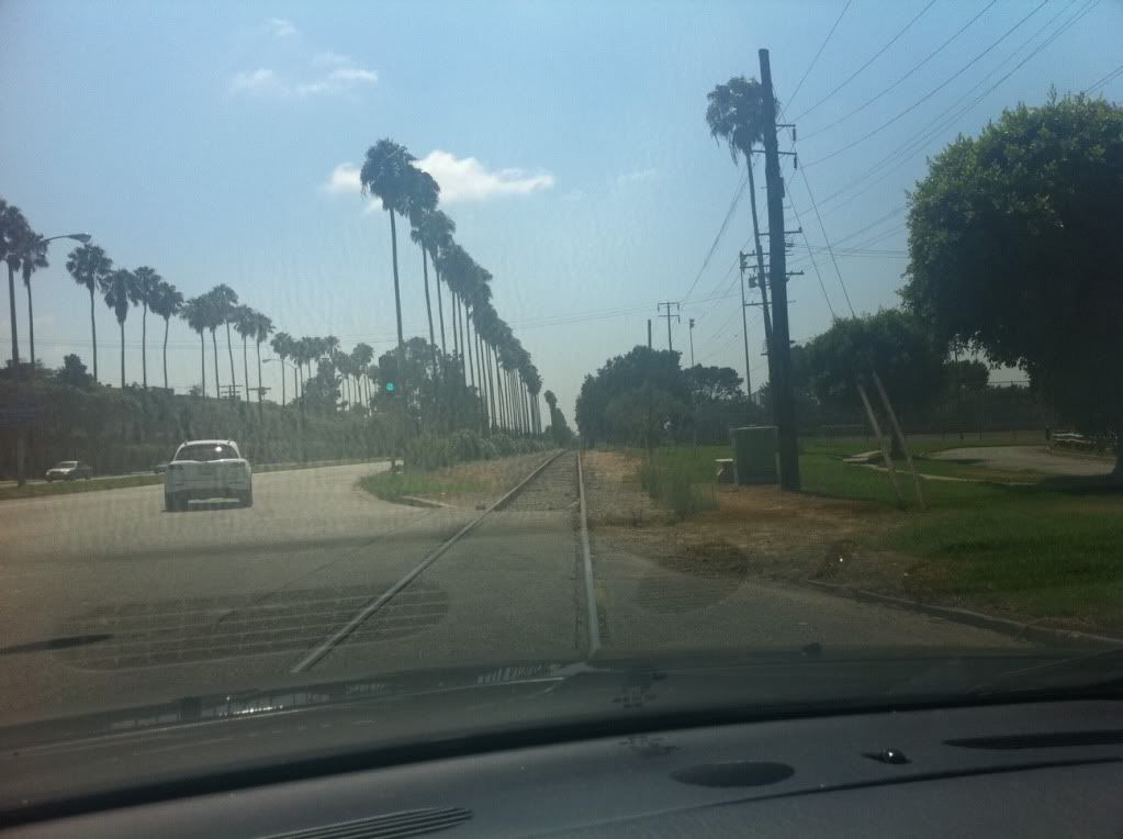 A look down the corridor facing west |
|
|
|
Post by metrocenter on Aug 15, 2011 8:26:12 GMT -8
I actually don't think a separation is necessary at Centinela: the crossing is fairly small and quiet, with not a lot of traffic. Much smaller than Crenshaw/Slauson, for instance.
But I am surprised that City of Inglewood Metro staff is opposing the separation, only because I thought it was a done deal.
For those who don't know, the proposed grade separation was a cut-and-cover trench. This was included in the DEIR as a design option (Design Option 3) and was estimated to add $13 million to the project budget.
|
|
|
|
Post by Philip on Aug 31, 2011 18:12:16 GMT -8
|
|


 )
)

