|
|
Post by bzcat on Oct 22, 2010 17:13:58 GMT -8
You have probably seen my posts where I refer to my fantasy Google Map of all the existing, planned, and proposed rail and BRT lines. Well, I've been tinkering with it continuously over the last week or so and have incorporated a lot of the ideas that were tossed around on this forum (e.g. the Vermont Ave line not being able to connect at Wilshire/Vermont, Red Line spur to Burbank airport, Pink line alignment via Fairfax and San Vicente etc). Anyway, I though I would create a separate topic for discussion. I would like to hear what you think and any suggestions you have about the proposed lines. Existing lines: Red Purple (to Koreatown) Gold (separate Expo + East LA segments) Blue (separate Long Beach + Pasadena segments) Silver Orange E-W Green (Norwalk to Redondo) Planned lines partially funded (mostly Measure R): Downtown Connector (unite the 2 separate segments of Gold + Blue) Purple (to VA Hospital) Orange N-S Blue (Foothill segment) West Santa Ana Branch (OC to Green Line segment) Pink (Crenshaw + South Bay segments) 405 Corridor (SFV-UCLA segment) Wilshire BRT (not illustrated on map) Gold (Whittier segment) Planned line - unfunded: Purple (Santa Monica segment) Pink (West Hollywood segment) Glendale/Burbank light rail with no proposed alignment (as identified in Metro's long range plan) West Santa Ana Branch (Green Line to Union Station segment as identified in Metro's long range plan) Proposed (unofficial): Green (Norwalk Metrolink + Lincoln segments) Pink (Carson segment) Vermont Ave Corridor Venice Blvd Corridor Red (extension to BUR from North Hollywood) 405 (UCLA-LAX-Downtown LA segments) maps.google.com/maps/ms?ie=UTF8&hl=en&msa=0&msid=109982261189696647553.000492747cf29fbd56df1&ll=34.011689,-118.24791&spn=0.366549,0.727158&z=11 |
|
|
|
Post by masonite on Oct 22, 2010 22:11:19 GMT -8
You have probably seen my posts where I refer to my fantasy Google Map of all the existing, planned, and proposed rail and BRT lines. Well, I've been tinkering with it continuously over the last week or so and have incorporated a lot of the ideas that were tossed around on this forum (e.g. the Vermont Ave line not being able to connect at Wilshire/Vermont, Red Line spur to Burbank airport, Pink line alignment via Fairfax and San Vicente etc). Anyway, I though I would create a separate topic for discussion. I would like to hear what you think and any suggestions you have about the proposed lines. Existing lines: Red Purple (to Koreatown) Gold (separate Expo + East LA segments) Blue (separate Long Beach + Pasadena segments) Silver Orange E-W Green (Norwalk to Redondo) Planned lines partially funded (mostly Measure R): Downtown Connector (unite the 2 separate segments of Gold + Blue) Purple (to VA Hospital) Orange N-S Blue (Foothill segment) West Santa Ana Branch (OC to Green Line segment) Pink (Crenshaw + South Bay segments) 405 Corridor (SFV-UCLA segment) Wilshire BRT (not illustrated on map) Gold (Whittier segment) Planned line - unfunded: Purple (Santa Monica segment) Pink (West Hollywood segment) Glendale/Burbank light rail with no proposed alignment (as identified in Metro's long range plan) West Santa Ana Branch (Green Line to Union Station segment as identified in Metro's long range plan) Proposed (unofficial): Green (Norwalk Metrolink + Lincoln segments) Pink (Carson segment) Vermont Ave Corridor Venice Blvd Corridor Red (extension to BUR from North Hollywood) 405 (UCLA-LAX-Downtown LA segments) maps.google.com/maps/ms?ie=UTF8&hl=en&msa=0&msid=109982261189696647553.000492747cf29fbd56df1&ll=34.050384,-118.187485&spn=0.366382,0.727158&z=11 I've always found the Vermont corridor worthy of a line, especially with its super high bus ridership and unused median south of Gage. It doesn't appear heavy rail might be the best choice, because of the connection at Wilshire. I wonder if light rail could somehow connect to the Green Line and run as a spur here. That way the Green Line and/or Crenshaw Line maintenance yard could be utilized as well. However, that may be fantasy as I really don't see an easy way to connect here since the Green Line is in the middle of the freeway. Venice Blvd., I could see as a streetcar connecting to Expo at Robertson as others have suggested. It could also maybe then go up Electric Ave., behind Abbot Kinney where PE trains used to run (at least I believe they did here). Burbank Airport Red Line extension at 2.5 miles to me seems like a great project as you would not only connect to an airport, but to a Metrolink line allowing people coming in on this line to connect to jobs in Hollywood, Universal City and so forth, without going all the way to Union Station and transferring or involving a shuttle. Overall, this airport is a more important connection than Ontario since most of the people using this airport live or are going to destinations in a much tighter radius than Ontario. I also think the Norwalk Green Line to Metrolink HSR station at 2.5 miles is going to be an important missing link if we don't fill it. Of course, the 3 mile gap from Crenshaw and Expo to Fairfax/Wilshire is going to be seen as a major gap that needs to be completed. And then there is another 3 mile gap from Fairfax up to Hollywood/Highland. Also, taking the Purple Line the last 3.5 miles to Downtown SM is still an important missing link as well. The Expo Line may be overwhelmed with the Crenshaw Line opening and this could help provide some relief. Also, this section has already shown high ridership in environmental studies and is in total gridlock in the afternoons. Finally, there will be the 2 mile plus gap from the so called 405 Line at Wilshire Westwood (assuming it ends here) to the Expo Line, which I think everyone would agree needs to be filled. Unfortunately, I don't see much support for the Burbank and Green Line connections and we are going to need another Measure R just to complete all these 2-3 mile gaps. Kind of depressing, because our system with these gaps is really going to fall short of what it should be. |
|
|
|
Post by LAofAnaheim on Oct 22, 2010 22:58:23 GMT -8
I've always found the Vermont corridor worthy of a line, especially with its super high bus ridership and unused median south of Gage. It doesn't appear heavy rail might be the best choice, because of the connection at Wilshire. I wonder if light rail could somehow connect to the Green Line and run as a spur here. That way the Green Line and/or Crenshaw Line maintenance yard could be utilized as well. However, that may be fantasy as I really don't see an easy way to connect here since the Green Line is in the middle of the freeway. The Blue Line connects to the Green Line...and it's in a freeway median. I don't think that's an issue. Metro will find a way to have a connecting station. |
|
|
|
Post by masonite on Oct 22, 2010 23:15:55 GMT -8
I've always found the Vermont corridor worthy of a line, especially with its super high bus ridership and unused median south of Gage. It doesn't appear heavy rail might be the best choice, because of the connection at Wilshire. I wonder if light rail could somehow connect to the Green Line and run as a spur here. That way the Green Line and/or Crenshaw Line maintenance yard could be utilized as well. However, that may be fantasy as I really don't see an easy way to connect here since the Green Line is in the middle of the freeway. The Blue Line connects to the Green Line...and it's in a freeway median. I don't think that's an issue. Metro will find a way to have a connecting station. They share a station but not tracks. Unless you can get Vermont trains on the Green Line then a maintenance facility would have to be built just for the Vermont Line. Also, it would be nice if Vermont trains could go straight onto the Green Line without another transfer. |
|
|
|
Post by bluelineshawn on Oct 23, 2010 8:38:54 GMT -8
No, the green and blue lines have a connecting non-revenue track. Not the best design, but it's there and I presume that it's used to get green line trains to the blue line yard for major maintenance.
masonite, I'm torn on your argument. I pretty much agree with everything that you said, although with the 2nd highest bus ridership in the county Vermont is definitely worthy of a rail line. And I agree that light rail would work best providing that a light rail line could be built with sufficient capacity to provide the level of service that would be required. It would need a minimum of 4-car trains running 12 tph at rush hour. And it's very possible that 5-car trains would be required because many current blue line riders would be better served by a Vermont line and would switch if one existed. A light rail line might be at capacity soon after it is built.
I think the issue then becomes whether trying to provide service for that level of ridership would best be done by heavy rail. For example if you're building a grade separated line to heavy rail standards and heavy rail is cheaper to operate than light rail and the vehicles are cheaper at one point does building another yard make more sense in the long run?
IINM heavy rail would require fewer substations, vehicles would cost a little more than half, and operating and maintenance costs would be reduced.
|
|
|
|
Post by masonite on Oct 23, 2010 9:46:59 GMT -8
No, the green and blue lines have a connecting non-revenue track. Not the best design, but it's there and I presume that it's used to get green line trains to the blue line yard for major maintenance. masonite, I'm torn on your argument. I pretty much agree with everything that you said, although with the 2nd highest bus ridership in the county Vermont is definitely worthy of a rail line. And I agree that light rail would work best providing that a light rail line could be built with sufficient capacity to provide the level of service that would be required. It would need a minimum of 4-car trains running 12 tph at rush hour. And it's very possible that 5-car trains would be required because many current blue line riders would be better served by a Vermont line and would switch if one existed. A light rail line might be at capacity soon after it is built. I think the issue then becomes whether trying to provide service for that level of ridership would best be done by heavy rail. For example if you're building a grade separated line to heavy rail standards and heavy rail is cheaper to operate than light rail and the vehicles are cheaper at one point does building another yard make more sense in the long run? IINM heavy rail would require fewer substations, vehicles would cost a little more than half, and operating and maintenance costs would be reduced. My mistake. I did not realize the Blue and Green had that non-revenue connection. It makes sense from a maintenance perspective. That makes me think that a connection could be done between a Vermont Line and Green Line. I certainly agree with your assertion that this will be a heavily used line that is going to attract more than 2 or even 3 car trains. Remember Western is the third busiest bus corridor and that is just a mile to the West. If the Blue Line gets to 100,000 riders, which I think is starting to get close to rush hour capacity, then this discussion will be more urgent (although I think it should be a little more urgent now). Overall, I think it is important that this line be connected to the rest of the system and not be an orphan line in which transfers are necessary at both ends. Theoretically, the Green Line could run 5 car trains if platforms were extended, although I'm not sure what additional power generation/sub-stations might be necessary to upgrade. Also, for the section below Gage that would be above grade, it would be important to consider the attributes between heavy and light rail in this section. |
|
jass
New Member

Posts: 11
|
Post by jass on Oct 23, 2010 15:16:21 GMT -8
Whats amazing is that even with all those fantasy lines, there are still large gaps in the system.
|
|
|
|
Post by jeisenbe on Oct 24, 2010 0:10:15 GMT -8
"Venice Blvd Corridor": Do you envision this as BRT or LRT? Your map shows a number of 90 degree turns on this line, which really should be avoided for engineering reasons (90 degree turns are slow, accidents are more frequent, and track maintenance is tricky) and legibility reasons (frequent turns make it hard for riders to remember the route). I would suggest a Venice light rail line or BRT should either head straight to downtown LA, to provide east-west rapid transit in the big gap between Wilshire and Expo. Otherwise, if you want it to go to E Hollywood, turn left at Fairfax, and right at Hollywood, basically following the course of the current 780 Metro Rapid bus route: www.metro.net/riding_metro/bus_overview/images/780.pdf |
|
|
|
Post by bzcat on Oct 24, 2010 18:57:04 GMT -8
"Venice Blvd Corridor": Do you envision this as BRT or LRT? Your map shows a number of 90 degree turns on this line, which really should be avoided for engineering reasons (90 degree turns are slow, accidents are more frequent, and track maintenance is tricky) and legibility reasons (frequent turns make it hard for riders to remember the route). I would suggest a Venice light rail line or BRT should either head straight to downtown LA, to provide east-west rapid transit in the big gap between Wilshire and Expo. Otherwise, if you want it to go to E Hollywood, turn left at Fairfax, and right at Hollywood, basically following the course of the current 780 Metro Rapid bus route: www.metro.net/riding_metro/bus_overview/images/780.pdfVenice Blvd past Robertson is pretty low density so LRT all the way to Downtown is probably over kill. I did model much of the alignment on the 780 bus... but I made the line turn up on La Cienega instead of Fairfax because Fairfax south of Pico is really narrow (difficult for street running LRT alignment) and is also mainly low density residential housing. I do agree that in general, this line as I have designed has too many turns... looking for more input on how to route it so it get to Hollywood and on to Pasadena without the frequent 90 degree turns in Mid City. Edit: I decided the turn up La Cienega doesn't really do much so I put the line through Fairfax like you suggested... although this will imply that the line will need to go underground at Venice/Fairfax right after the Kaiser Hospital station. I also re-configured the line to stay on Colorado Blvd instead of going south on Eagle Rock Blvd - this does two things: provide a more direct link between Pasadena/SGV with Glendale; and eliminated a couple of sharp turnsAs to the LRT vs. BRT issue, ideally, all the major streets in LA that is wide enough should have a bus lane like Paris or London... Venice Blvd is certainly one of those wide streets. |
|
|
|
Post by bzcat on Oct 24, 2010 19:18:57 GMT -8
Overall, I think it is important that this line be connected to the rest of the system and not be an orphan line in which transfers are necessary at both ends. Theoretically, the Green Line could run 5 car trains if platforms were extended, although I'm not sure what additional power generation/sub-stations might be necessary to upgrade. Also, for the section below Gage that would be above grade, it would be important to consider the attributes between heavy and light rail in this section. There is a couple of different options for connecting Vermont line to the rest of the light rail system: 1. Via Green line - probably require demolishing part of I-105 and perhaps also the Vermont station on the Green Line. 2. Via Pink line in Carson - this is the option I have illustrated on my map. The South Bay Harbor Subdivision study only calls for the "Green" line to be extended to Torrance but I don't see why we can't go another 2 miles past Sepulveda to meet up with Vermont line. The right of way already exists so it's just a matter of laying down some non-revenue track on the Pink Line (or Green line under the current color scheme). 3. Via Expo line at USC - this is probably the least attractive option because it will involve tearing up tracks we just laid down on Expo. Also, I think Vermont line will need to run underground here so it may not even be an option. 4. Via LAX-Downtown express @ Slauson Ave - This is probably the cheapest option... you can build the connecting tracks here for both lines from scratch and do it properly. However, the Crenshaw Blvd-Downtown LA segment of Harbor Subdivision is currently not being studied for anything so the line is not even on Metro's horizon. |
|
|
|
Post by transitfan on Oct 25, 2010 6:39:29 GMT -8
No, the green and blue lines have a connecting non-revenue track. Not the best design, but it's there and I presume that it's used to get green line trains to the blue line yard for major maintenance. That is correct. And actually, from the time the Green Line opened in August 1995 until sometime in 2001 (when the Hawthorne Yard and Shops (Div. 22) opened for revenue service), Green Line trains were based at the Blue Line yard (division 11) and had to do that dance twice a day (I regret that I never got to actually see it!). This is when the Green Line ran single car trains and used the 15 Nippon-Sharyo P685 (865?) cars that are now assigned to the Blue Line (154-168). |
|
|
|
Post by jdrcrasher on Oct 25, 2010 14:23:05 GMT -8
I'm sorry, but if the Vermont Corridor is built, it HAS to be Heavy Rail Transit. The amount of efficiency trumps the cost of fixing the Wilshire/Vermont station. It just makes absolutely no sense to extend the Green Line here when it's already being extended to two places. Also, I think the Green Line should eventually go further east past the Norwalk Metrolink/HSR station. I would suggest a Venice light rail line or BRT should either head straight to downtown LA, to provide east-west rapid transit in the big gap between Wilshire and Expo. Actually I like this idea, too. Venice Blvd past Robertson is pretty low density so LRT all the way to Downtown is probably over kill. Density isn't always everthing. Just because there a lot of people compacted into a certain area doesn't mean that they'll use transit. Bus ridership must also be taken into account when building lines. |
|
|
|
Post by jdrcrasher on Oct 25, 2010 14:49:20 GMT -8
The Blue Line connects to the Green Line...and it's in a freeway median. I don't think that's an issue. Metro will find a way to have a connecting station. Unless you want to widen the freeway for a connection ramp, then no, Metro won't be able to find a way. Again, it's much better in the long run to fix the wilshire/vermont station to allow the Red Line to be a north-south line. |
|
|
|
Post by masonite on Oct 25, 2010 16:04:21 GMT -8
I'm sorry, but if the Vermont Corridor is built, it HAS to be Heavy Rail Transit. The amount of efficiency trumps the cost of fixing the Wilshire/Vermont station. It just makes absolutely no sense to extend the Green Line here when it's already being extended to two places. I don't necessarily disagree, but was throwing this out there since it may be an easier solution than rebuilding the Vermont subway station (then again it may not - who knows until it is really studied). It is true that you could not have the Green Line branch to both the airport (Century/Aviation) and the South Bay. It would have to just go to LAX and Crenshaw would serve the South Bay, which is how I think it should be done anyway. Shawn brought up some interesting points in that you might not want to have light rail with 4-5 car trains as at this stage it may be more efficient to have heavy rail at this level (which I would probably agree). I just think that 10 years from now if oil prices spike that the Blue and Expo lines will be overwhelmed with no additional capacity possible. Vermont is a great transit corridor from Wilshire down to the Green Line. It would be a rousing success and it could be above grade south of Gage. The big negative is rebuilding that Vermont/Wilshire station as that would be all but impossible. Also, you would really have to have all Red Line trains go to South LA instead of Downtown, but I'd imagine very high frequency here for both the Purple and Red Lines, so that really takes most of the pain out of the transfer. At peak times, no one would probably need to wait more than 2-2.5 minutes. |
|
|
|
Post by bzcat on Oct 26, 2010 11:30:55 GMT -8
I'm sorry, but if the Vermont Corridor is built, it HAS to be Heavy Rail Transit. The amount of efficiency trumps the cost of fixing the Wilshire/Vermont station. It just makes absolutely no sense to extend the Green Line here when it's already being extended to two places. Also, I think the Green Line should eventually go further east past the Norwalk Metrolink/HSR station. I would suggest a Venice light rail line or BRT should either head straight to downtown LA, to provide east-west rapid transit in the big gap between Wilshire and Expo. Actually I like this idea, too. Venice Blvd past Robertson is pretty low density so LRT all the way to Downtown is probably over kill. Density isn't always everthing. Just because there a lot of people compacted into a certain area doesn't mean that they'll use transit. Bus ridership must also be taken into account when building lines. Well, the map itself is mode-neutral. You can make the Vermont line HRT in this map and it still won't change anything (i.e. you will have to shut down the Purple line to construct a new station etc). The map only shows where we should build rail lines not whether it should be LRT or HRT  Green line extension past Norwalk Metrolink station? To where? La Habra? Brea? I think the argument becomes whether there is enough local ridership to support Brea-Norwalk segment because no one will want to ride the light rail for 2 hours to get from Brea to LAX. The Foothill extension on the Gold line has the same problem... but I can see much higher local ridership between Citrus College and Pasadena than a Green line extension on Imperial Highway. The Venice question is more interesting. I know 733 is a pretty popular bus line but would that still be the case after Expo line opens? If you are starting from Downtown, it might be easier to take Expo to Culver City. If you are coming from Venice to Downtown LA, it might be easier to take the 733 the "wrong way" to Santa Monica and catch the Expo or Purple line (once those lines are done). My point here is that a 3rd east-west rail line may be premature... we don't really know what ridership pattern will be like once Expo opens. However, we do know that there is no existing freeway or rail line that cuts across West LA/Mid City diagonally to Hollywood - and we DO know that tons of commutes are in this exact pattern (e.g. West LA to Hollywood or Glendale area and vice versa) - that's my justification for having the Venice line go north to Hollywood and eventually to Pasadena. |
|
|
|
Post by jdrcrasher on Oct 26, 2010 15:23:27 GMT -8
Green line extension past Norwalk Metrolink station? To where? La Habra? Brea? I think the argument becomes whether there is enough local ridership to support Brea-Norwalk segment because no one will want to ride the light rail for 2 hours to get from Brea to LAX. If it was elevated, I highly doubt such a commute would take two hours. In the future I think there'll be some justification for an extension to Brea. Besides, it can also be extended up Leffingwell and Colima to Whittier. As you indicated, the Foothill extension is a much different story. The FT187 line is almost always packed at rush hour. I should know.....I take it to Citrus College. I see a TON of CC-bound students on the bus (and even some heading to APU, believe it or not). Probably. Expo is kind of far away from Venice (in fact it's on the other side of the freeway on most of Phase 1) and when it does get close to Venice , it completely intersects with it. BTW, if the Venice Line is ever extended to downtown, I think it should get there via Venice, Hoover, and Washington to connect with the Expo/Blue Lines. I think this is one reason for the Crenshaw Line north extension. |
|
|
|
Post by bzcat on Oct 27, 2010 10:17:55 GMT -8
Probably. Expo is kind of far away from Venice (in fact it's on the other side of the freeway on most of Phase 1) and when it does get close to Venice , it completely intersects with it. BTW, if the Venice Line is ever extended to downtown, I think it should get there via Venice, Hoover, and Washington to connect with the Expo/Blue Lines. In my design, I provided a Venice-Expo transfer at Culver Junction. This basically solves your problem with people going from Venice all the way to Downtown LA. But let say if we want to take the Venice line all the way to Downtown, I think the alignment should follow Venice to Rimpau to provide a transfer to Crenshaw/Pink line at Rimpau. From Rimpau, the Venice line will then go on Pico Blvd into Downtown and terminates at Expo/Blue line at Staples Center/Pico Station. And if we want to get into the real "wishful thinking" stage, the Venice line should continue on Pico thru Central Ave (maybe in a trench tunnel?) and then hop on Olympic and go across the river to Soto St where it should go north into East LA and onto Huntington and Main St Alhambra. |
|
|
|
Post by bzcat on Oct 27, 2010 11:06:57 GMT -8
jdrcrasher - I broke up the "Venice" line into 2 different lines after giving your comments some thoughts. The Pasadena to Westside leg is now "Cross Town" line and it terminates in Century City. The Venice line goes to Downtown LA as we discussed. Would be nice to have this line continue into SGV as well, but probably not in my lifetime. Revised Map |
|
|
|
Post by jdrcrasher on Oct 27, 2010 16:47:27 GMT -8
For some reason the link isn't working. I mean it goes to google maps, but doesn't show what you're describing.
|
|
|
|
Post by bzcat on Oct 27, 2010 17:35:16 GMT -8
|
|
|
|
Post by masonite on Aug 9, 2011 15:48:36 GMT -8
I have been posting on this board since the days when all there pretty much was to talk about was the dream of new lines. Getting back to that frame of mind, here are some thoughts on what might be expected for a Measure R#2, which might not come for another 25-30 years.
I am going under the framework that to get another tax measure like Measure R passed, it will need to be regionally balanced (which in my opinion often results in lower quality lines being built instead of more expensive lines in a smaller area), so I am not necessarily saying this is what I think should be in the Measure, but something that is more likely to come out of one.
These lines are all relatively close in cost depending on the extension.
Red Line to Burbank Airport (SFV)
Valley light rail Line from Orange Line to Sylmar (SFV)
Green Line to Norwalk (SE - Gateway)
Crenshaw Line to Purple Line (Westside)
Foothill Extension to Claremont (SGV)
Crenshaw (current Green) Line extension further into Torrance (South Bay)
Red Purple Line Extension into Arts District and slightly into Eastside along Whittier (Eastside)
Further extension of the Santa Ana Row on top of what is done in current Measure R (SE cities)
Harbor Sub - Metrolink or limited stop service from LAX to Union Station (South LA)
Metrolink improvements (SFV, Antelope Valley, SGV)
Purple Line Extension from VA to Bundy (Westside)
Of course, this leaves off some key projects that I would love to see like a Crenshaw Line all the way to Hollywood, or an extension of the Valley Line to LAX, or a Vermont Line between Wilshire and the Green Line. However, all those projects are bound to be very expensive and will require extensive bore tunneling. Also, all of those projects are West of Downtown in the City and would get a lot of complaints from suburban residents who almost derailed Measure R over the otherwise very popular Westside extension. People will throw a fit if they think that the Westside is getting another subway at their expense, which means you can probably take the Purple Line Extension to Bundy off here as well even if that is only about a mile.
|
|
|
|
Post by rubbertoe on Aug 9, 2011 16:51:49 GMT -8
Masonite,
I think that you could see the Measure R2 well before 25 years elapse. In about 4 years we will have:
1. Foothill Extension done
2. Expo Phase 1 done
3. Expo Phase 2 possibly done
4. Crenshaw nearly complete
5. Downtown Connector started
6. LA Streetcar possibly under construction
Given all the new people and regions that will be riding and benefiting from all of the above, I would think that support for transit expansion in general will be very high. Of course, the current economic situation and any/all Federal funding are variables that will be hard to predict going forward, but I see LA County as being very supportive of transit going forward.
Having said that, I could see a "Mini R2" coming along in maybe 4-5 years. Once the above projects are either done or nearly done, we will have a much better idea of ridership and political support going forward. At that time, they could do a study to identify which projects would provide the most "bang for the buck" given the current system, and what people might be willing to tax themselves to get done. Maybe a smaller version of your list would be my guess.
Measure R is 0.5% for 30 years and supposed to generate $40 billion. If that ratio holds, then every year a 0.1% tax would yield about $266 million. A 0.25% tax would yield $665 million. I think a "Mini R2" for say 10 years at 0.25% would be much more likely to pass, especially if you sell it as a "putting the icing on the cake" kind of argument, and limit what you are trying to get done. That would provide another $6.65 billion.
RT
|
|
|
|
Post by thanks4goingmetro on Aug 9, 2011 19:01:28 GMT -8
No, the green and blue lines have a connecting non-revenue track. Not the best design, but it's there and I presume that it's used to get green line trains to the blue line yard for major maintenance. Thanks, I've been so curious about where this electrified connecting track does  Such a good idea over loading trains on trucks I guess 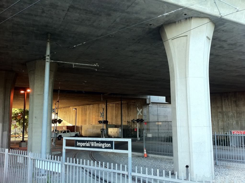 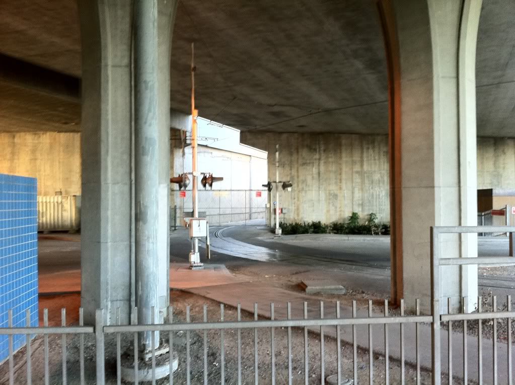 photos must be sized 780 pixels or less in width. Fix. |
|
|
|
Post by transitfan on Aug 10, 2011 7:15:52 GMT -8
No, the green and blue lines have a connecting non-revenue track. Not the best design, but it's there and I presume that it's used to get green line trains to the blue line yard for major maintenance. Thanks, I've been so curious about where this electrified connecting track does Such a good idea over loading trains on trucks I guess photos must be sized 780 pixels or less in width. Fix. Yep, and from the time that the Green Line opened in August, 1995 until sometime in 2001, that connector was used daily to get the Green Line cars to the Blue Line yard where they were based at that time (the Green Line yard (Hawthorne Yard & Shops) was completed by then, but for some reason, MTA didn't start using it until the Siemens P2000 cars went into service). Before that, the Green Line used Nippon-Sharyo cars 154-168, after the P2000s went into service, 154-168 were transferred to Blue Line service, so that it could start running 3-car trains. |
|
|
|
Post by Alexis Kasperavičius on Aug 11, 2012 13:09:16 GMT -8
...and here it is set to music. Courtesy of Move LA:
|
|
|
|
Post by jeisenbe on Oct 24, 2017 18:18:04 GMT -8
BZCAT, I took your map and added potential station locations. It's been a few years since you've worked on this. What do you think? drive.google.com/open?id=1wwMsQHh8D-0p3czOnunB0TKB6b8&usp=sharingI'd have to disagree ith a Lakewood/Rosemead line (unless it's mid-range BRT with exclusive lanes) and I'm still not sure of the downtown routing of the Venice/Valley line. I extended the Blue Line on the map, since the second Foothill extension is a sure thing, and added a layer to show Metrolink. BZCAT, I can give you permission to edit this, or you can just download the underlying KML files if you're interested. It looks nice with the new "dot" station options in Google Maps: 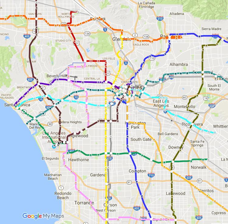 |
|
|
|
Post by bzcat on Nov 3, 2017 10:45:08 GMT -8
Interesting. The graphic does look better. BTW, I've changed my mind on some of the routing on this map and there is a 2nd "new" version here: MapThe big difference is I now have WSAB going beyond Union Station and turning west on Sunset/Santa Monica to Century City; and I got rid of the LAX to Union Station line because I don't see it as politically viable anymore. And you are right the Rosemead line is probably at best a BRT. |
|
|
|
Post by jeisenbe on Nov 5, 2017 4:09:02 GMT -8
I suspect that the LAX line failed because the folks pushing for it really wanted an express to the airport. It could be useful as a local route, but it needs a way to get to Downtown, not just to Union Station. Or it could serve as another circumferential line, like the Green line but closer in, once we have a few more radial lines getting directly to downtown.
I like your other changes. I also had that idea of connecting the WSAB line to the proposed Sunset/Santa Monica line, since that seems to be one of the projects most likely to be included in the next long-range plan, and the WSAB line is currently planned to akwardly dead-end at Union Station.
|
|
|
|
Post by jahanes on Jan 22, 2019 11:36:02 GMT -8
I recently completed a fantasy map of what the metro could look like in 2100. This is based on Metro's current plans, as well as a variety of LA fantasy maps I've edited over the years on google drive. The rough routing of the lines can be viewed here. Some new (AFAIK) ideas I introduce are the construction of a second line over Cahuenga pass linking the Crenshaw and Ventura blvd lines, abandoning the Washington Blvd tracks so the Vermont line can tie into the regional connector, and an inner circumferential line utilizing Western, Hyperion, and Eagle Rock blvd. Also, the MTA has been replaced with the Pacific Electric Transportation District and Metro Rail becomes the Pacific Electric Metro. I also envision the expansion of Metro Center under this scheme, since it could easily result in it becoming the busiest passenger rail station in North America. I sketch out a rough concept in the google map. Feel free to ask questions ans let me know what you think.  |
|
|
|
Post by numble on Mar 11, 2021 20:17:34 GMT -8
LA Metro is now developing a list of strategic unfunded capital projects. The deadline for submissions is June 30, 2021:
|
|


 Such a good idea over loading trains on trucks I guess
