|
|
Post by darrell on Jul 18, 2011 9:13:59 GMT -8
Driving to work from Santa Monica to USC in the morning I've noticed that there is some sort of surface grading or construction work happening on the south side of Olympic between 26th St. and Cloverfield, adjacent to the self-storage facility. Does this have anything to do with Expo Phase 2, or is it a commercial project? That is part of the Expo right-of-way, and will be a ramp from the grade crossing across 26th to the bridge over Cloverfield. |
|
|
|
Post by darrell on Jul 18, 2011 9:23:28 GMT -8
" Santa Monicans Weigh In On Bergamot Station's Future" By Jason Islas Lookout Staff July 18, 2011 – Santa Monica residents turned out in droves Wednesday to have their say about the future of the Bergamot Station Art Center. City planners invited the community to the workshop to share ideas about changes to the center when the Expo Light Rail and related developments transform the area around the galleries. "The more we can hear from people, the better," said Community & Strategic Planning Manager Francie Stefan. Stefan added she was thrilled to hear the passionate commitment to Bergamot Station coming from the audience of some 100 residents gathered in the spacious Pier 59 Studios West Building. "How do we create an environment that is both supportive of the arts and of a mixed-use, transit oriented neighborhood?" planners asked residents. More specifically, audience members were asked for their ideas on how to open the space to "subsidizing" ventures – businesses that bring in profits to support establishments that require subsidies, like art galleries and the center's art museum. After an introduction by city staff, residents broke into clusters to share their thoughts. City officials divided the conversations into two categories: projects that need subsidies and projects that would subsidize them. At every table, residents were adamant that Bergamot Station not lose its character as an "artistic epicenter." Since it will be the first stop in Santa Monica, Bergamot Station needs to be representative of the city, some said. More communal artistic spaces, in the form of artist lofts and group workshops where artists can collaborate were on some wish-lists. Bruria Finkle, a local artist, curator and board member of Downtown Santa Monica, Inc. said she would like the City to expand Santa Monica's art museum to 25,000 square feet with the influx of money coming its way as the area gets developed. "The enterprises coming in are multimillion dollar enterprises," said Finkle. "And the community should enjoy it." Former Planning Commissioner Gwynne Pugh said he would like to see a small, inexpensive and "funky" hotel in Bergamot Station to encourage nightlife on the site. Restaurants and pubs were suggested by many as a way of making the area economically viable. They could have performance spaces in them as a way of tying the new businesses to the art scene. Wednesday's workshop was the second of three workshops hosted by city planners to elicit community involvement in development plans in the area around the future Expo Light Rail Station near the eastern border of Santa Monica. The first workshop was held in February and dealt with Bergamot Transit Village (" Santa Monica's Love/Hate Relationship with Bergamot Plan," February 22). The third workshop will cover the Mixed/Use Creative District north of Bergamot Station and Bergamot Transit Village, and will be held this fall. Bergamot Station was formerly a train stop and light industrial center along a Southern Pacific Railroad line that ran from Downtown Los Angeles to the coast. The City purchased the land in the late 1980's and many of the original buildings have been refurbished and used as art galleries. Bergamot Station will once again be used as a train stop after the Expo light rail project is completed in 2015. For more information about community workshops and the future of Bergamot Station, visit www.bergamotplan.net . |
|
|
|
Post by matthewb on Jul 18, 2011 10:14:10 GMT -8
Bergamot Station is going to be a great stop. If anything like the vision for the area shown in the public presentations is implemented, it will be one of the best models for transit oriented development throughout LA. I understand that proximity to the ocean and high paying jobs is important to the financial viability of these plans, but the county would be a lot better off if it had more clusters of 4-6 story buildings with ground level retail and a walkable street grid next to transit. With a completed purple line, and reasonable connections from Westwood subway stops to the Expo line, the best of LA lifestyle will be achievable by transit. The entire westside will be reachable through urban villages concentrated around metro stops like pearls on a necklace.
|
|
|
|
Post by rubbertoe on Jul 23, 2011 15:27:03 GMT -8
Expolinefan, Welcome to the forum. We always like to see new members, especially ones that take lots of pictures  How did you get those aerial shots of La Cienega and La Brea? RT |
|
|
|
Post by Gokhan on Jul 23, 2011 16:51:42 GMT -8
Thanks for the Phase 2 update, expolinefan -- great pictures!
For those who don't know, potholing is done to locate utilities, especially unknown or poorly documented ones. Colorado Blvd is full of utilities and a lot of them are unknown.
Phase 2 has started well. One possible source of delay I am worried about for Phase 2 is the long-term leases in the Expo Phase 2 right-of-way. Some leases go for a year or more from now and Metro and Expo so far hasn't done a good job of terminating them.
Welcome again to the forum!
|
|
|
|
Post by Gokhan on Jul 29, 2011 8:55:24 GMT -8
Moving the discussion to the correct thread: Update from the man himself, Expo CEO Rick Thorpe: One interesting thing he mentioned is that the box under the Santa Monica Freeway may not be wide enough. One option is to shut down the Westbound lanes for 3 MONTHS while they work on it. He wasn't kidding. Yes, the trains are 11.0-ft-wide dynamically and the tunnel is only 25.0-ft-wide. Leaving 1 ft clearance on each side would only leave 1 ft walkway in the center, which is not enough. You need a 3-ft-wide walkway. Since the entire 350-ft-long tunnel crosses the entire freeway (diagonally from southeast to northwest), closing only half the freeway would only allow construction of the half the length of the tunnel. Rather than closing the westbound lanes for three months and then the eastbound lanes for three months, there is a less disruptive way: You can first close the inner lanes in both directions for three months and then the outer lanes in both directions for three months (or the other way around). This way traffic can still flow slowly in both directions during construction. Note that the tunnel is a reinforced-concrete box structure under the freeway -- much like a large storm drain. |
|
|
|
Post by bzcat on Jul 29, 2011 15:54:31 GMT -8
Agree with Gokhan... I don't think they will close down 1 direction of 10 freeway for 3 months... It will surely be constructed in sections e.g. start from the outside lane on each side and work their way towards the middle. This way, you close 1 lane at a time for 2 or 3 days... entirely feasible without huge disruption like Carmaggedon.
I assume the old tunnel will be no good and they will need to demolish and construct all new concrete box under the freeway?
|
|
|
|
Post by Gokhan on Jul 29, 2011 16:02:35 GMT -8
Listening to Rick in the TTC video, it sounds like Phase 2 may not open until 2017. Here is the overlay of Palms Overhead box structure under the freeway: 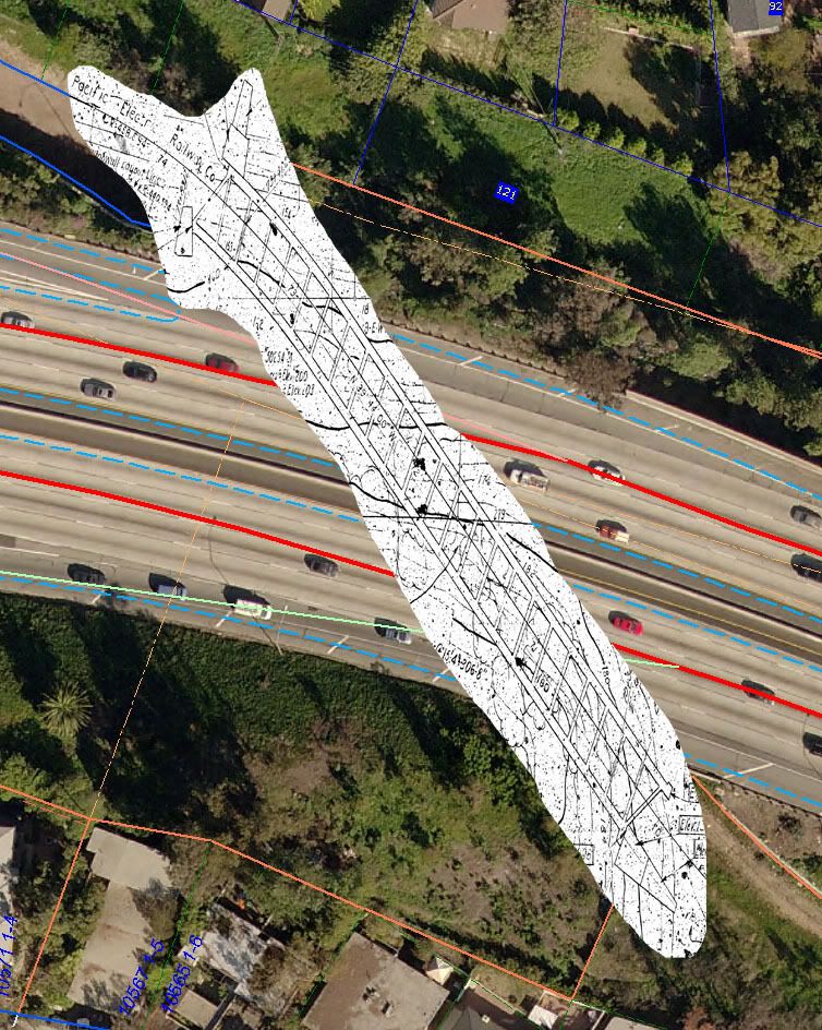 After listening to Rick, it sounds like they would have to only reconstruct the curved section, in which the dynamic width of the trains increases. It looks like the curve is near the northwest end of the tunnel, and they would have to only close the Overland Avenue exit to smooth out the curve, which would reduce the dynamic width of the trains and possibly allowing two-track operation with enough (3 ft) walkway in the middle. Single-track operation in the tunnel is definitely a no–no. It would cost even more to build an automatic train-protection system to prevent collisions in and around the tunnel and it would also increase the travel time significantly. The Kenter Canyon storm drain under Colorado is a major issue as well. The other major issue is the 4th/Colorado Station track entrance. He also mentioned that, if nothing is done, DWP won't be able to relocate the power lines until 2018. |
|
|
|
Post by jeisenbe on Jul 29, 2011 22:53:02 GMT -8
He also mentioned that, if nothing is done, DWP won't be able to relocate the power lines until 2018. What does that mean? Is DWP saying they don't have the cash to do it until 2018? Isn't Expo going to pay for the utilities relocation? |
|
|
|
Post by Gokhan on Jul 30, 2011 9:17:09 GMT -8
He also mentioned that, if nothing is done, DWP won't be able to relocate the power lines until 2018. What does that mean? Is DWP saying they don't have the cash to do it until 2018? Isn't Expo going to pay for the utilities relocation? It's not a money issue but a territory issue. The way DWP works is that it's a seven-year-long process for the plans to be drawn, redrawn, redrawn, things coordinated, and finally realized. Expo is looking for alternative ways and Mayor's office has hired someone to coordinate things with DWP. Certainly 2018 is not a realistic option and Expo needs to speed it up by at least three or four years so that the line can open before 2016. What's going to happen meanwhile is that the bridges will be built except for the spans crossing the power lines and those spans will be put in when the power lines are relocated. |
|
|
|
Post by Gokhan on Jul 30, 2011 9:20:00 GMT -8
Other options for the Palms Overhead I-10 box structure:
* Keep the 25-ft-wide tunnel as it is and assume a 10-ft dynamic width for the trains (probably realistic given the mild curve) and leave 1-ft clearance on each side and a 3-ft walkway in the middle.
* Have partial closures of the freeway and work your way along the entire length of the tunnel gradually.
|
|
|
|
Post by darrell on Jul 30, 2011 16:25:01 GMT -8
This appears to be a the patched aftermath of one of a number of "pot hole" excavations along Colorado in Santa Monica, east of 14th Street. (A lot of my drive-by photos get rotated.) 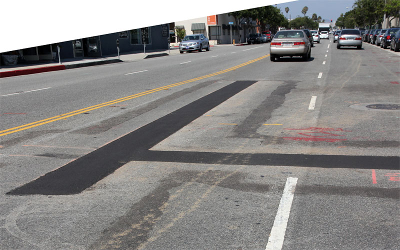 |
|
|
|
Post by darrell on Jul 30, 2011 16:45:43 GMT -8
And here are more "before" photos, from east of the Colorado section in Santa Monica. 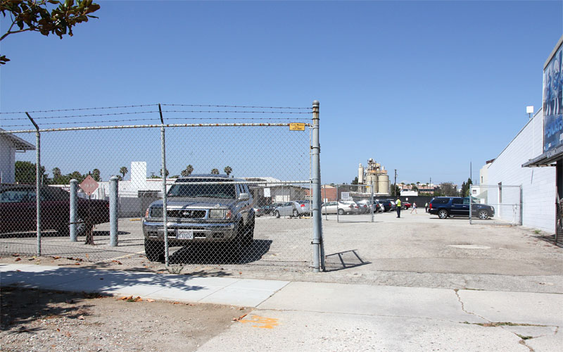 East from 17th the old right-of-way ends and tracks will curve up to Colorado where the Hastings Plastics building on the left will be demolished. 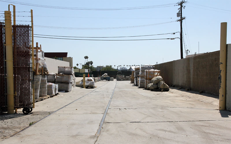 Looking west from 19th, behind the concrete plant in the previous photo. 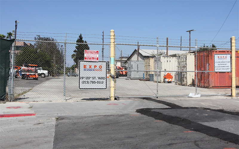 Looking east from 19th, where Skanska Rados has put up signs for a construction yard. 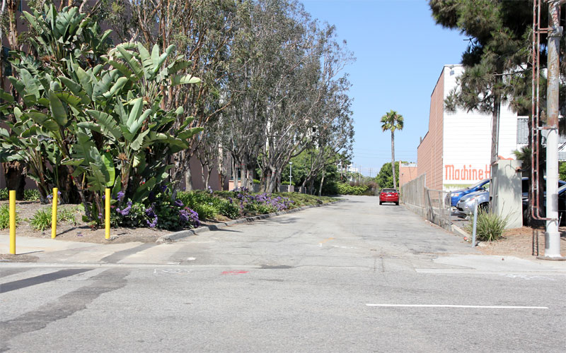 Looking east from 20th. Note the old crossing pole on the right. 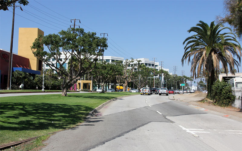 Where the tracks crossed Olympic west of Cloverfield, to become a bridge over Olympic and Cloverfield. 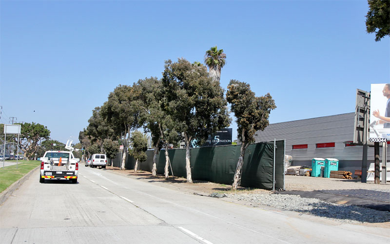 On the south side of Olympic east of Cloverfield, where an MSE ramp will come down to a grade crossing at 26th. 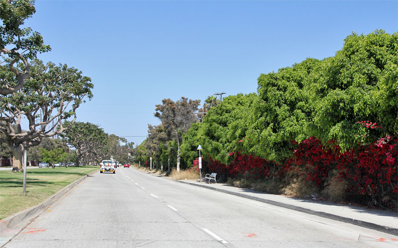 The thick bougainvillea and ficus hedges on the south side of Olympic will become the Bergamot Station west of 26th. |
|
|
|
Post by thanks4goingmetro on Jul 30, 2011 19:32:58 GMT -8
Though it may be too soon and specific to ask, my questions about the reuse of the historic I-10 freeway underpass box on Expo Phase 2 are:
#1 will the narrow tunnel width restrict operating speeds?
#2 will the tunnel require ventilation which also can restrict capacity?
I find it ideal if there is enough vent capacity and elbow room to have Expo trains blast through this relatively straight section at a generous speed.
|
|
|
|
Post by rajacobs on Aug 1, 2011 9:59:50 GMT -8
Not so long ago, dozens of K-rails were neatly stacked in a criss-cross fashion on the southeast side of the ROW north of Venice. Peering east down the ROW from the parking lot above Albertson's, I was perplexed to see those K-rails now moved to the southwest side of the ROW north of Venice. They are aligned--in the path of--the MSE that will be built to receive the Venice bridge.
It must have been quite an effort to move them! Additionally that are little dump-truck load -sized piles of refuse (broken concrete with "stuff" in the piles along the ROW, where the K-rails used to be and they're along the whole length of the Albertson's building.
I was anticipating that one day I'd show up and see giant drills showing up and then CIDH holes being drilled. Now it looks like a further clean-up will be required before that can begin. ...One additional note, the port-a-potties are gone.
|
|
|
|
Post by Gokhan on Aug 1, 2011 11:20:35 GMT -8
Though it may be too soon and specific to ask, my questions about the reuse of the historic I-10 freeway underpass box on Expo Phase 2 are: #1 will the narrow tunnel width restrict operating speeds? #2 will the tunnel require ventilation which also can restrict capacity? I find it ideal if there is enough vent capacity and elbow room to have Expo trains blast through this relatively straight section at a generous speed. Also see my posts above for more discussion. Neither the tunnel nor the Motor Ave bridge is historic -- they're part of the freeway built in 1963. The tracks used to cross Motor Avenue further north on an old bridge before the freeway was built. The first thing that needs to be decided is whether 25.0 ft width would be enough for two tracks with sufficient clearance. CPUC and Metro would both have to OK it, as the clearances could be too little. A ventilation system would be required. Vertical clearance is 23.0 ft and it should be plenty for the ventilation system. Speed limit is 25 MPH in both tunnel approaches due to the curves on either side of the tunnel. Speed limit is 45 MPH in the trench due to the milder curve there. PERR in the plans below stands for Pacific Electric Railroad. 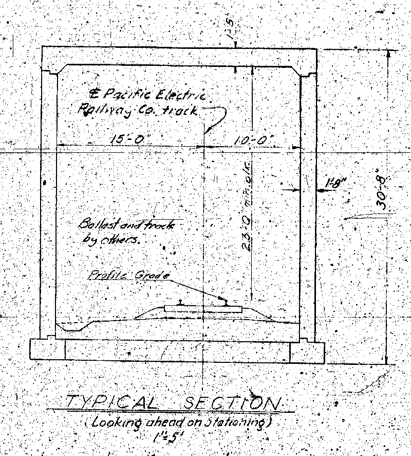 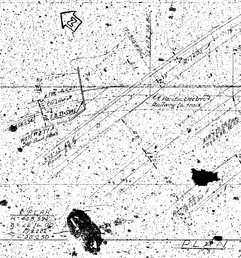 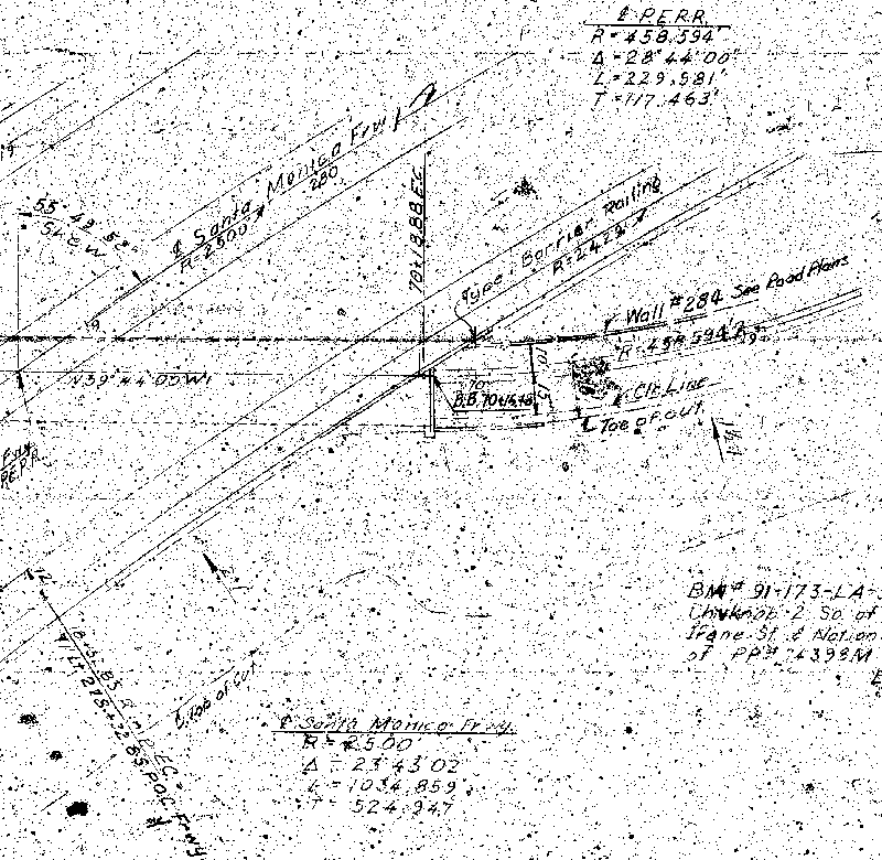 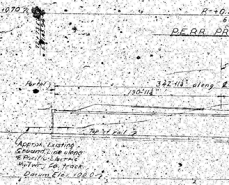 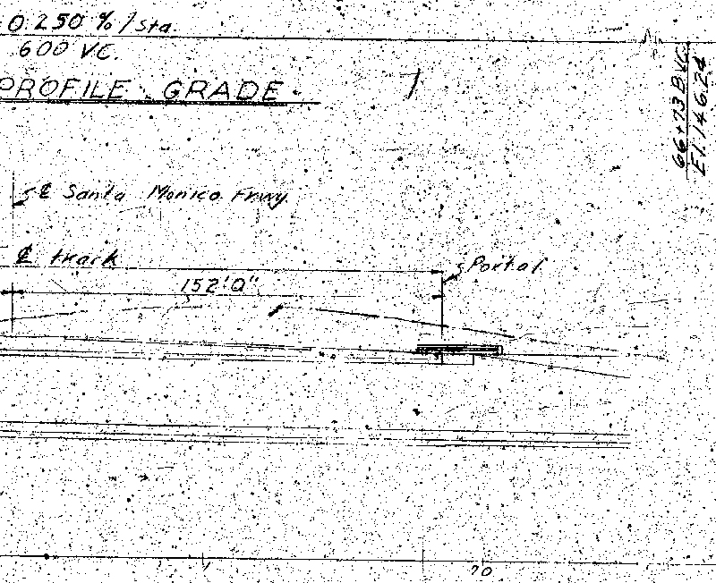 |
|
|
|
Post by Alexis Kasperavičius on Aug 1, 2011 12:19:15 GMT -8
Speed limit is 25 MPH in both tunnel approaches due to the curves on either side of the tunnel. Speed limit is 45 MPH in the trench due to the milder curve there. This train as planned is going to be incredibly slow - only 45 mph in a protected ROW and 25 MPH in a tunnel? Wow. Once people start bitching about the speed, how would one go about getting it to something more reasonable like 85 MPH? |
|
|
|
Post by LAofAnaheim on Aug 1, 2011 13:03:17 GMT -8
Speed limit is 25 MPH in both tunnel approaches due to the curves on either side of the tunnel. Speed limit is 45 MPH in the trench due to the milder curve there. This train as planned is going to be incredibly slow - only 45 mph in a protected ROW and 25 MPH in a tunnel? Wow. Once people start bitching about the speed, how would one go about getting it to something more reasonable like 85 MPH? Where in the world is light rail "reasonable" at 85 mph? I thought our Green Line at 65 miles was the fastest light rail in the nation. And how can you even do that speed with stations 1 - 2 miles apart? Makes no sense............. |
|
|
|
Post by jamesinclair on Aug 1, 2011 13:28:12 GMT -8
Where in the world is light rail "reasonable" at 85 mph? I thought our Green Line at 65 miles was the fastest light rail in the nation. And how can you even do that speed with stations 1 - 2 miles apart? Makes no sense...... 85 mpg is probably not feasible, but over 45mph certainly is. Heavy rail lines frequently hit 65mph, and light rail, 55mph. Also, it blows my mind that we allow untrained 16 year olds with food, drinks and cell phone to drive at 70mph+ whenever they want.... But a highly trained metro operator? 45mph for you! |
|
|
|
Post by LAofAnaheim on Aug 1, 2011 13:48:10 GMT -8
85 mpg is probably not feasible, but over 45mph certainly is. Heavy rail lines frequently hit 65mph, and light rail, 55mph. Also, it blows my mind that we allow untrained 16 year olds with food, drinks and cell phone to drive at 70mph+ whenever they want.... But a highly trained metro operator? 45mph for you! Heavy rail does NOT hit frequently hit 65 mph www.funtrivia.com/askft/Question84273.htmlI think you are blowing *smoke* out your window to give a blanket statement that heavy rail frequently hit 65 mph and light rail at 55 mph. The only segment in LA that could hit 65 mph is the Hollywood/Highland to Universal City segment. And there's not many other places in the nation that have that significant of a distance between 2 subway stations and can hit such a high speed. This is an outlier and not a standard. Also, only the Green Line hits frequent speeds above 50 mph, wheras the other light rail lines only have segments of that. So it's not "frequent". I think you're more upset about society..which we can do nothing about. That 16 year old is not employed by a government agency getting a paycheck and moving thousands of people. |
|
|
|
Post by bzcat on Aug 1, 2011 14:58:21 GMT -8
I was just going to say 45 mph seems plenty fast for an urban train... not many urban rail system (subway, heavy rail or otherwise) go past that speed on a regular basis. NYC subway trains have designed maximum speed of 55 mph but it almost never reach that speed. Our above ground light rail that goes 45 mph in certain section is plenty fast by comparison.
Edit: Another data point - Yamanote line in Tokyo has maximum operating speed of 90km/h during off peak hours. That's about 55 mph maximum speed - same as NYC subway. The line is 35 km long and takes almost exactly 65 minutes to ride back to original station (it runs in a circle). If you assume 10 second dwell time at each of the 29 stations, that's 10 sec x 30 stops or exactly 5 minutes of stationary time. So that implies a 60 minutes of run time an average speed of 35km/h or roughly 20 mph.
|
|
|
|
Post by Gokhan on Aug 1, 2011 15:00:29 GMT -8
|
|
|
|
Post by bluelineshawn on Aug 1, 2011 16:37:57 GMT -8
No one has exactly said otherwise but it's almost implied that our light rail only goes 45 mph on the street running portions but I'm pretty sure that the blue line goes 50-55 down long beach ave. between Washington and wardlow.
|
|
|
|
Post by LAofAnaheim on Aug 1, 2011 16:53:45 GMT -8
No one has exactly said otherwise but it's almost implied that our light rail only goes 45 mph on the street running portions but I'm pretty sure that the blue line goes 50-55 down long beach ave. between Washington and wardlow. Average speed of the Blue Line is 24 mph Source: www.lightrailnow.org/myths/m_lrt012.htmCompared to 38 mph average on the Green Line.... The Blue Line does not hit 45 mph on its street running segments. I've taken it many times, the train does not go any faster than the posted speed limit; and generally that's between 35 - 40 mph. But with all the station stops..it's about 30 - 35 mph on the Blue Line. |
|
|
|
Post by Gokhan on Aug 1, 2011 17:39:34 GMT -8
In street-running sections, CPUC limits the speed limit to the speed limit of the traffic (no fences) or the speed limit of the traffic plus 10 MPH (with 6-ft-high fences). That's why the Eastside extension 1st St speed limit is 30 MPH and the Blue Line Washington speed limit is 35 MPH. Colorado speed limit will be 30 MPH for the same reason.
In sections where both fences and crossing gates are provided, CPUC doesn't impose a speed limit.
|
|
|
|
Post by wad on Aug 2, 2011 3:29:18 GMT -8
Green Line Go's Faster than 38mph Between Stations More Like 65mph It's average speed factors to 38 mph. That's accounting from zero to acceleration to top velocity to deceleration and back to zero for a stop. That's how you get the 38 mph figure. |
|
|
|
Post by Gokhan on Aug 2, 2011 7:54:59 GMT -8
The definition of the average speed is simply the total distance by the total travel time. Average speed should not be confused with instantaneous speed (such as the cruising speed) measured at a single instance of time. Average speed is usually far less than the cruising speed (70, 65, and 55 MPH for the Red/Purple, Green, and Blue Lines, respectively) because of the station dwells, acceleration/deceleration, curves, and other slowdowns. You can use this formula to approximately calculate the travel times. |
|
|
|
Post by jdrcrasher on Aug 2, 2011 12:34:36 GMT -8
Nevermind. lol
|
|
|
|
Post by Gokhan on Aug 2, 2011 15:31:54 GMT -8
Are these the OCS poles already? Wow, Phase 2 has got a jump start! |
|
|
|
Post by Gokhan on Aug 2, 2011 16:36:24 GMT -8
Last Tuesday they were doing utility exploration (digging and siphoning) by the cement plant in the evening and at night. They cleared the right-of-way and put nice signs. Although I was on the street and never in the right-of-way, and there was nothing in the totally empty right-of-way except for a couple of siphoning trucks, I noticed that the construction supervisor was following me while pretending to talk on the cell phone and mind his own business. When I walked in the other direction, he kept following me and just when I was about to leave, he couldn't help not asking why I was taking pictures. I could have told him that I was one of the reasons he's got a job but I didn't. LOL View of the right-of-way west of Sepulveda, including the cement plant that could be the replaced by Target: 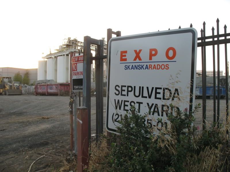 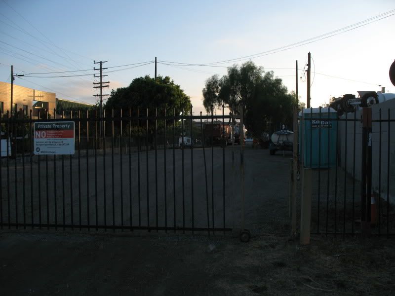 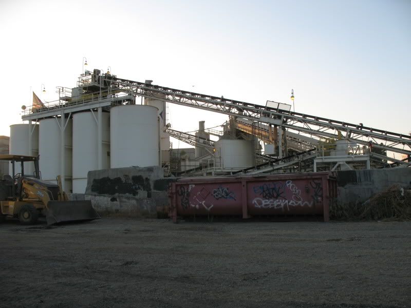 Unfortunately they used the wrong color for Expo. Orange?  |
|