|
|
Post by carter on Sept 17, 2011 11:59:28 GMT -8
that Building on the South East Conner just looks like it will loose some sidewalk if this image from the city of Santa Monica is correct. It's probably more than just the sidewalk and at least some partial acquisition. The drawing is only conceptual. No matter what they do there, the Sears Auto location is plain awful for the Santa Monica Station. Minor design changes won't do any significant improvements on it. Whoever came up with the idea of of the Sears Auto terminus should be put in prison. It's really an outrage. Santa Monica is doing so much micromanaging on the design but they completely messed up the terminal station. There were so many better places to put the station, such as south of Colorado on Main St or south of Colorado on Ocean Ave, adjacent to the new park, either on its east side or its west side just off the street. Doing it that way would require a bridge over the 10 Freeway and an at grade crossing of 4th Ave. The former would be expensive and logistically challenging and the latter would mean trains coming in and out of a terminal station slowly every few minutes in front of the major road into downtown Santa Monica from the 10. Those are some serious tradeoffs to put a station where you described, and I'm not even really clear on what the benefit is. |
|
|
|
Post by Gokhan on Sept 17, 2011 12:47:34 GMT -8
Doing it that way would require a bridge over the 10 Freeway and an at grade crossing of 4th Ave. The former would be expensive and logistically challenging and the latter would mean trains coming in and out of a terminal station slowly every few minutes in front of the major road into downtown Santa Monica from the 10. Those are some serious tradeoffs to put a station where you described, and I'm not even really clear on what the benefit is. The bridge wouldn't be expensive at all -- probably only about $10 million. It's not the freeway there -- it's PCH, and the bridge is at-grade -- there are no approach ramps. It would be a very simple, cheap structure. You would be also saving $200 million from the land cost of the Sears Auto lot. There is a light at 4th St and the trains would follow the light like other crossings on Colorado -- no blockage of the freeway at all. The obvious and huge advantage of the new location would be that it would be very close to the beach and major attractions and in a good location where people could easily view and access it -- simply a much better terminus than the distant and obscure location now. The other important advantage would be that the line could continue toward Venice on Main St in the future. |
|
|
|
Post by darrell on Sept 17, 2011 14:35:38 GMT -8
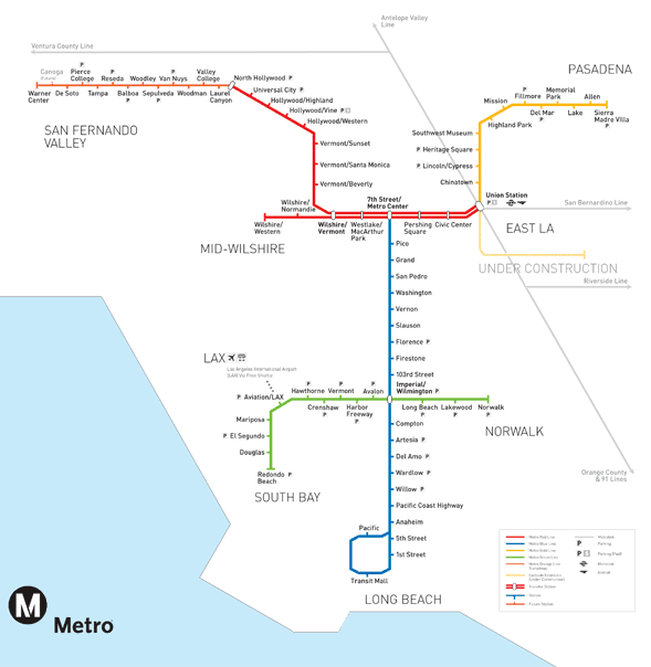
 From the note about Grand Stairs on the north side of the station platform I wonder what the elevation of the end of the tracks is relative to 4th Street there? My hope for the original terminus station plan was that some time in the future it would be extended south along the Lincoln Corridor. Tracks could cross the 4th Street offramp at grade, bridge across the freeway, and curve via the Chevron station site onto Lincoln (map below). That seems harder with this configuration, but perhaps a curve south on the west side of 4th? Per your station location, Gokhan, don't forget a main purpose of this station location is for people to walk to downtown Santa Monica jobs and transfer to the major bus corridor on 4th Street. 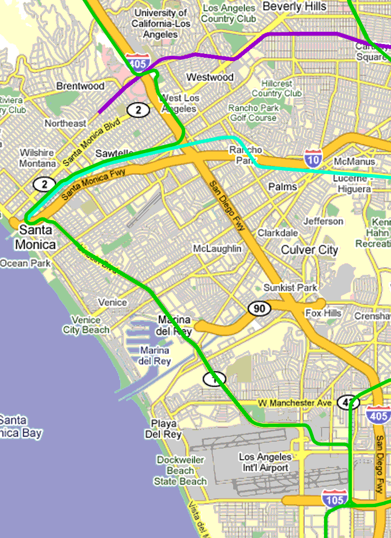 |
|
|
|
Post by JerardWright on Sept 17, 2011 16:00:53 GMT -8
From the note about Grand Stairs on the north side of the station platform I wonder what the elevation of the end of the tracks is relative to 4th Street there? I like this redesign as it improves three things as it relates to Colorado Street, it makes the station more compact with a better use of space and two it enlarges the footprint of the rest of the lot for bus layovers for those connecting buses with Expo and it provides as fast entry and egress of the station. Personally I think Santa Monica should just go whole hog and convert the entire corridor into a pedestrian/transit mall from 14th to Ocean. However the street blocks are not long enough for the platforms when they include needed ADA ramps and circulation to enter and exit the platforms. However with either configuration at least two questions came to mind with Lincoln Corridor? 1) What is the best alignment for this corridor between Santa Monica and Venice? 2) What is so important about through-routing these services together when the Lincoln Corridor in this arrangement would miss the Wilshire Subway @ 4th/Wilshire (per the drawings in the DEIR)? |
|
|
|
Post by joshuanickel on Sept 17, 2011 20:34:03 GMT -8
SANTA MONICA CITY STATION IDEA Image Overlay made with Goggle Earth As close as I could get to correct Layout  I like Santa Monica design better fast into and out of the station and less noise with less of a curve at station The city really pushed for this design because it allows plenty of room for the TOD that the city wants for that space. One thing to note about this new plan that is not clear on the map is that there will be no eastbound traffic between 4th and 5th street. They had to move the station out to create the new curve. The city is planning an "esplanade" (Bike lanes, wider sidewalks) between 4th and the pier. One of the options currently on the table include making this section westbound traffic only. To avoid the eastbound traffic from impacting 4th street since they would have to go left or right due to the new station design. To get on the freeway from the pier you would have to use the new Olympic extension being built next to the park. |
|
|
|
Post by Gokhan on Sept 18, 2011 2:36:06 GMT -8
Per your station location, Gokhan, don't forget a main purpose of this station location is for people to walk to downtown Santa Monica jobs and transfer to the major bus corridor on 4th Street. The Main St location would be only a minute or two extra walk to the bus stop at 4th -- no big deal. It's kind of awkward to make a U turn and follow Lincoln Blvd. Also, the 405 line shouldn't detour through Santa Monica either. I would really like the line continue on Main St to Venice Beach as in the past. Remember Venice is a huge tourist attraction and South Santa Monica is popular too. Also, there are no attractions on Lincoln Boulevard till Marina Del Rey -- a waste of route. |
|
|
|
Post by wad on Sept 18, 2011 4:00:20 GMT -8
Why no bus transit center on the station site?
|
|
|
|
Post by bzcat on Sept 19, 2011 14:44:16 GMT -8
Why no bus transit center on the station site? Most buses runs in a circle already in Downtown Santa Monica except #3 which runs N-S on 4th St. You can walk to all the major bus stops in the Downtown circle from the Expo station in about 30 seconds. If you reroute all the buses to terminate at the train station, it will simply add more running time without achieving any enhancement to the transit experience. Plus the footprint of the station is too small to accommodate all the BBB lines. |
|
|
|
Post by bzcat on Sept 19, 2011 15:01:35 GMT -8
1) What is the best alignment for this corridor between Santa Monica and Venice? 2) What is so important about through-routing these services together when the Lincoln Corridor in this arrangement would miss the Wilshire Subway @ 4th/Wilshire (per the drawings in the DEIR)? It depends on what mode we are talking about. If it is light rail, I believe the best alignment is starting at Wilshire/4th St Purple line station with a tunnel going south on 4th St (so the transfer station for both Purple and Expo lines will be underground) and cut across Santa Monica High School to reach Pico/Lincoln diagonally. The line will then follow Lincoln more or less at surface or elevated in portions to LAX. Connection to both Purple and Expo lines are addressed in this alignment. If it is street car, the best alignment is starting Wilshire and 2nd St going south and jump over the I-10/PCH (in conjunction with the new freeway cap park?) to Main St. Follow Main St all the way to Venice Circle. And if desired, extend east on Venice Blvd to Lincoln Blvd to connect with the Lincoln light rail I described above. |
|
|
|
Post by rajacobs on Sept 19, 2011 15:13:48 GMT -8
The second alignment that you mention, BZCAT, offers access to the beach and boardwalk that seems desparately needed given the number of cars parked at the side of the Santa Monica Pier on any given weekend.
When mentioned was made earlier about the "grand staircase" and I realized that the modified design seems to leave the rails rather high, it seemed to me that Santa Monica is setting the stage for an elevated continuation of the rail that would send it in the direction of Main Street or Ocean, which addresses my concern that transit access to the beach is addressed.
|
|
|
|
Post by rajacobs on Sept 19, 2011 15:18:47 GMT -8
On a separate topic, I just received an update on the Gold Line Foothill Extension that is nothing short of professional and exciting. This is how it reads: "Construction Update: I-210 Bridge
One deep foundation down and two to go!
The last two weeks have seen heightened activity on the south side of the I-210 Freeway at the future site of the Gold Line Bridge. Crews successfully completed the first of three deep foundations - first drilling the 110-foot deep, 11-foot diameter hole; then installing a 130-foot long, 11-foot diameter reinforcing steel cage; and finally, pouring 400 cubic yards of concrete (requiring 45 truck loads).
Each deep foundation takes approximately two weeks to complete. With completion of the first foundation last week, the crew is now turning their attention to the two located in the center median of the eastbound I-210 Freeway. Over the next four weeks, these two deep foundations will go through the same process outlined above.
Periodic partial and full lane closures of the eastbound I-210 Freeway between Baldwin and Santa Anita Avenues will continue throughout the 12-month construction period. Full closures occur from Midnight to 5:00 a.m. to minimize impacts on this regionally significant freeway. If you haven't already, take a minute to sign up to receive up-to-the minute text alerts and/or emails before closures occur at foothillextension.org. What clear and motivational writing. ...Makes me just about salivate on the reported progress (despite knowing about the political and legal minefield that the legal team from NFSR is weaving). I'd love to see this kind of reporting coming out of the Expo team regarding the Phase II work. |
|
|
|
Post by LAofAnaheim on Sept 19, 2011 16:19:42 GMT -8
GOLD-LINE has it's Act together much better than EXPO-LINE Could they have better Management ?? Are you sure about that? It's been 1 year since "groundbreaking" and all they can talk about is the iconic bridge structure. We're still unsure if Phase 2 construction can even happen due to the Monrovia lawsuit (which may have merit, unlike the NSFR lawsuit) and another potential lawsuit with Board members serving city councils AND the Gold Line Authority. |
|
|
|
Post by LAofAnaheim on Sept 19, 2011 16:22:01 GMT -8
On a separate topic, I just received an update on the Gold Line Foothill Extension that is nothing short of professional and exciting. This is how it reads: "Construction Update: I-210 Bridge
One deep foundation down and two to go!
The last two weeks have seen heightened activity on the south side of the I-210 Freeway at the future site of the Gold Line Bridge. Crews successfully completed the first of three deep foundations - first drilling the 110-foot deep, 11-foot diameter hole; then installing a 130-foot long, 11-foot diameter reinforcing steel cage; and finally, pouring 400 cubic yards of concrete (requiring 45 truck loads).
Each deep foundation takes approximately two weeks to complete. With completion of the first foundation last week, the crew is now turning their attention to the two located in the center median of the eastbound I-210 Freeway. Over the next four weeks, these two deep foundations will go through the same process outlined above.
Periodic partial and full lane closures of the eastbound I-210 Freeway between Baldwin and Santa Anita Avenues will continue throughout the 12-month construction period. Full closures occur from Midnight to 5:00 a.m. to minimize impacts on this regionally significant freeway. If you haven't already, take a minute to sign up to receive up-to-the minute text alerts and/or emails before closures occur at foothillextension.org. What clear and motivational writing. ...Makes me just about salivate on the reported progress (despite knowing about the political and legal minefield that the legal team from NFSR is weaving). I'd love to see this kind of reporting coming out of the Expo team regarding the Phase II work. Expo Line has a much more up-to-date Twitter page and Facebook page that has multiple updates daily. Foothill Gold Line still relies on e-mails; hence haven't embraced the social networking as well as Expo. Foothill Gold Line should learn from Expo and utilize social networking to give people real-time information. Also, I am able to communicate directly with the people who run the Twitter/Facebook page, unlike the e-mails to Habib. |
|
|
|
Post by darrell on Sept 19, 2011 18:39:33 GMT -8
On a separate topic, I just received an update on the Gold Line Foothill Extension that is nothing short of professional and exciting. This is how it reads: "Construction Update: I-210 Bridge
One deep foundation down and two to go!
The last two weeks have seen heightened activity on the south side of the I-210 Freeway at the future site of the Gold Line Bridge. Crews successfully completed the first of three deep foundations - first drilling the 110-foot deep, 11-foot diameter hole; then installing a 130-foot long, 11-foot diameter reinforcing steel cage; and finally, pouring 400 cubic yards of concrete (requiring 45 truck loads). ... We know what that looks like from Expo in Culver City (10/16/09 and 10/8/09): 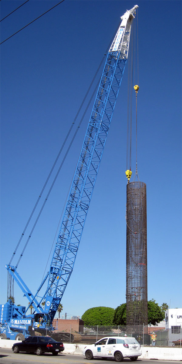 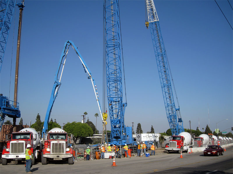 |
|
|
|
Post by Gokhan on Sept 19, 2011 20:46:29 GMT -8
We know what that looks like from Expo in Culver City (10/16/09 and 10/8/09): Except some of the Expo CIDH foundations were larger in diameter and they had something like two dozen of them in Culver City alone. So, this is like a mini project in comparison. |
|
|
|
Post by Gokhan on Sept 19, 2011 20:47:16 GMT -8
First Two Buildings Demolished for EXPO Phase-2 Technically it was the Sears Auto in Santa Monica. But, then, these are on the MTA right-of-way. Thanks for the update. |
|
|
|
Post by rajacobs on Sept 19, 2011 21:36:42 GMT -8
Expo Line has a much more up-to-date Twitter page and Facebook page that has multiple updates daily. Foothill Gold Line still relies on e-mails; hence haven't embraced the social networking as well as Expo. Foothill Gold Line should learn from Expo and utilize social networking to give people real-time information. Also, I am able to communicate directly with the people who run the Twitter/Facebook page, unlike the e-mails to Habib. , Good points on the Twitter feed and Facebook! These are areas that the Foothill Extension team could learn from Expo. Nonetheless, I still find email valuable and in the case of Foothill Extension, comparing apples to apples, their emails as a marketing tool are first rate--simply more interesting than the Expo Phase 1 updates, like a television show you want to go back to for the next installment! |
|
|
|
Post by rubbertoe on Sept 20, 2011 6:19:46 GMT -8
We know what that looks like from Expo in Culver City (10/16/09 and 10/8/09): Except some of the Expo CIDH foundations were larger in diameter and they had something like two dozen of them in Culver City alone. So, this is like a mini project in comparison. There is one other major difference too. I was wondering where they built the 100+ foot long rebar cage, since I didn't see it anywhere on the ROW South of the IBS. I drove around there looking for it. When I looked at the Pasadena Star News pictures of the night work, I saw the rebar cage being delivered on a truck. This seemed strange, since trucks don't normally haul around 100+ foot loads. In one of the articles either in the newspaper or from the construction authority, I read that the 110 foot rebar was actually delivered in two separate sections. So, there wasn't anything as impressive as the Expo rebar placement where the entire column was dropped in at once. They had more room on the Expo ROW, and they built more of those large columns too, which may be why they built them all in place versus bringing them in from elsewhere. RT |
|
|
|
Post by Gokhan on Sept 25, 2011 10:21:52 GMT -8
Darrell, expolinefan, and others: Phase 2 stuff goes here!  |
|
|
|
Post by darrell on Sept 25, 2011 13:50:47 GMT -8
Thanks, expolinefan, for the aerials and close-ups of the right-of-way clearing! That also makes these more timely, catching up with photos I took back on 8/4/11, where things have already changed since then. (Moved from the wrong thread) First, potholling between 7th and Lincoln being filled in.  Then a series of "before" photos from Centinela to Sepulveda. Driving along here has been pretty forgettable, but soon it will permanently change.  Looking northeast from Centinela, where there will be an MSE wall from Centinela to Bundy. 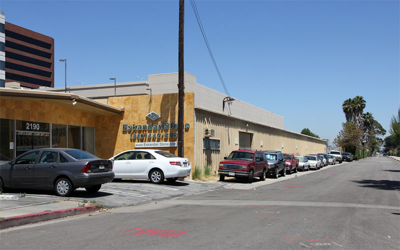 The stone retailer on the northeast corner of Bundy and Exposition, with quite a row of trees beyond. The former FedEx is behind me on the northwest corner.  One block east of Bundy, at Westgate.  The next block east, at Granville. 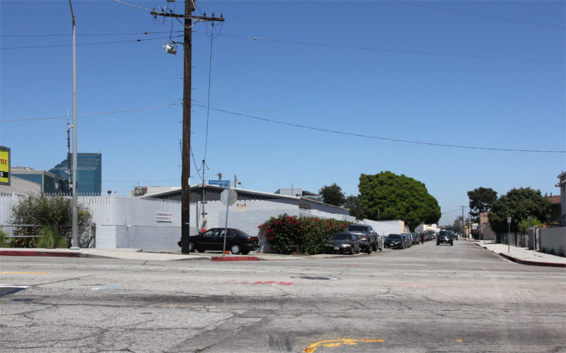 Northeast corner of Barrington and Exposition, where there will be a grade crossing. 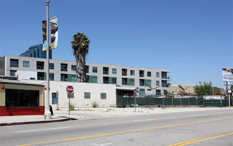 Where Exposition runs into Pico at Gateway, looking north. The bridge across Pico, Sawtelle, and Sepulveda will begin here.  Looking east where Exposition branches on the right from Pico.  The right-of-way itself, with a landmark tree I fear for. 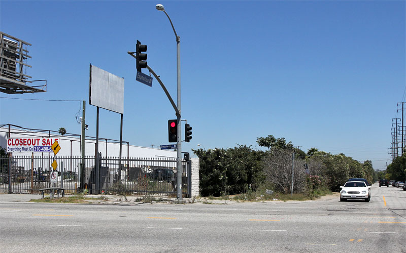 Finally, the northeast corner of Sepulveda and Exposition. Note the "Closeout Sale" sign at the stone yard. |
|
K 22
Full Member

Posts: 117
|
Post by K 22 on Sept 26, 2011 9:49:21 GMT -8
The Sepulveda and Bundy stations are both above grade, right?
|
|
|
|
Post by Gokhan on Sept 26, 2011 11:28:46 GMT -8
The Sepulveda and Bundy stations are both above grade, right? Yes, with a center platform on a bridge directly over the street, like the La Brea and La Cienega stations. |
|
|
|
Post by darrell on Sept 26, 2011 11:30:27 GMT -8
The Sepulveda and Bundy stations are both above grade, right? Yup. Here are Expo's elevation drawings from last spring. 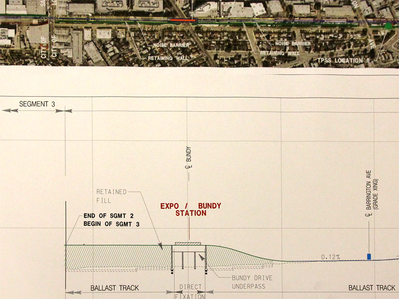 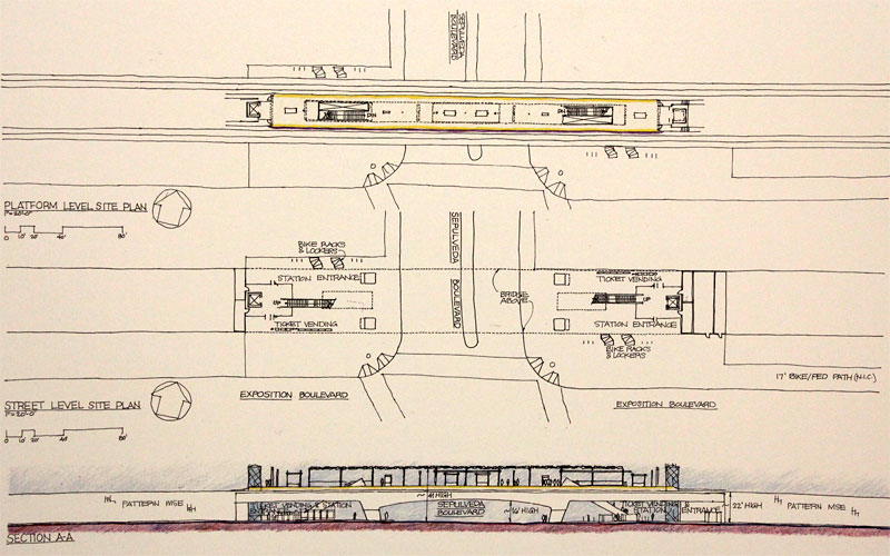 |
|
|
|
Post by roadtrainer on Oct 5, 2011 11:22:29 GMT -8
Gokham:  Did they finally clean up the hills of dirt by Expo/Bagley? And did the old piles of dirt bury the old rails?  |
|
|
|
Post by rajacobs on Oct 5, 2011 12:06:27 GMT -8
Roadtrainer, we walk by there nearly every night, either on or else next to the ROW. A path wide enough for a car or two has been created between piles of dirt and rock between National and Bagley. Much of it looks almost graded in that stretch.
What makes me doubt that it's "graded" is that there is no place for a bike path between the embankment and Expo. Furthermore, the hillets on either side of this "path" are full of rocks and up to 2ft. diameter boulders, also broken concrete piled to the freeway-side ...none of which probably would compact very well.
As for east of Bagley and on out to Venice, all mounds of dirt have been removed. The area has been stagnant for some time but for storage of stacked "K-rail" concrete barriers, 2 port-a-potties, and oil pipes wrapped in plastic that evidently were dug out of the ROW somewhere, and 1 front-end loader backhoe and a forklift. There's virtually nothing else left on the ROW in this section.
As for the rails, we've seen no evidence of the former rails east of National from the western-most entrance gate to the ROW and eastward to Venice, with the exception of asphalt-covered rail that stretches across Bagley. However rails remain between the National bridge and the western-most entrance to the ROW.
|
|
|
|
Post by Gokhan on Oct 5, 2011 13:03:59 GMT -8
rajacobs, you're probably new to the area, but roadtrainer probably remembers how the tracks looked liked only a few years ago. Until about four years ago, the tracks between behind Albertsons and National/Palms were fully intact -- you could see the rail and ties. There were also no fences. Then, a used-car dealer leased the right-of-way and covered the tracks with gravel and put fences. The used-car dealer was there only for about a year. Then, the Expo Authority used it for Phase 1 construction-material storage, including the dirt and gravel piles.
The fences there are now gone but the right-of-way is not completely cleared. Grading hasn't started yet. I expect it to start in about two to three months.
Regrading the bike path, there is space for it. It will be north of the tracks east of Bagley and south of the tracks west of Bagley, in the Expo right-of-way, off the street (17-ft-wide Class 1 bike and pedestrian path).
|
|
|
|
Post by rajacobs on Oct 5, 2011 13:25:07 GMT -8
Actually, I've been here gosh, over twenty years! I remember the used car dealer covering the tracks and putting up fences and the construction material storage.
The ROW is no longer being used for storage except for the material I noted, although it is largely cleared--try walking it! As for grading, there was grading done to the dirt mounds following removal of the pipeline, though I too think this grading has little to do with the grading required for the rails.
As for the bikepath--yes, north of the tracks to the east of Bagley and south the the tracks to the west. West of Bagley to National--this is where the grading has been done in the aftermath of pipeline extraction, but not for the rails or the bikepath.
|
|
|
|
Post by Gokhan on Oct 5, 2011 14:00:44 GMT -8
Grading means precise leveling of the right-of-way according to exact specifications in the final design. The grading for the track bed and multiuse path will be at different heights. The grading for the track bed will be below the existing tracks, which need to be removed first, as there will be ballast under the tracks above the earth. You will see how it looks when it's done: First a very smooth and clean graded earth, lower than existing ground. Then the ballast-retaining walls cast. Then, the subbalast (fine gravel) and the black weed cloth. Then the ballast. Then the ties and rail.
There will be no bike path in the right-of-way west of Palms/National. It will be a Class II bike path there (marked bike lanes on National Blvd and Motor Ave).
|
|
|
|
Post by Gokhan on Oct 6, 2011 15:09:00 GMT -8
Expo board meeting audio recorded today: Expo board meeting 2011/10/06There was a very nice presentation on the Expo maintenance facility, starting at 36:35 of the audio. They have two new concepts now (see the drawings here) and the second one was selected as the final concept. The facility will be completed and ready for operations in October 2014. |
|
|
|
Post by Gokhan on Oct 7, 2011 15:31:24 GMT -8
Here is some more Expo Line photography for you to enjoy, taken on Wednesday. Northvale Road trench in rain viewed from the Palms Park pedestrian bridge. This is looking southeast: 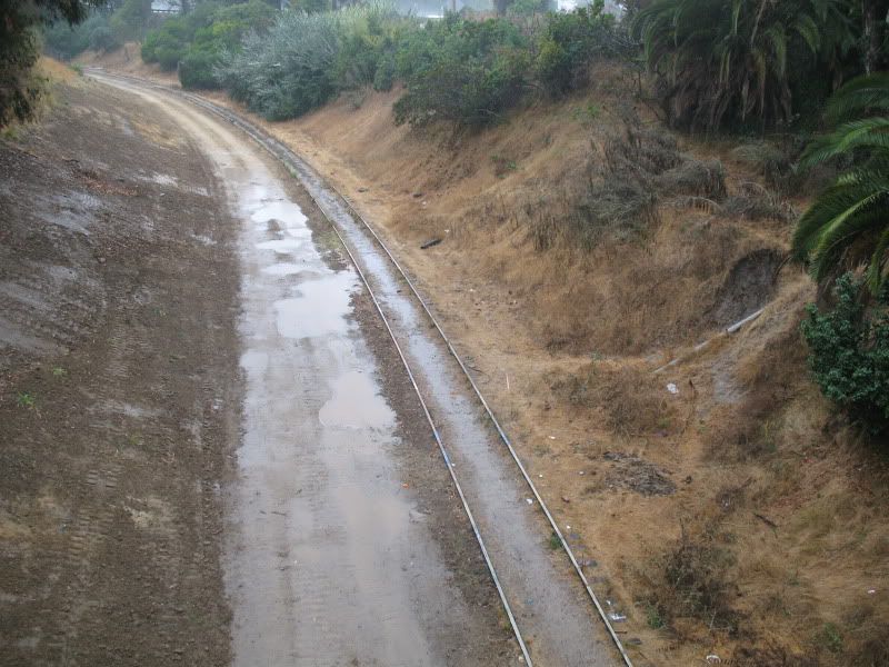 Looking northwest: 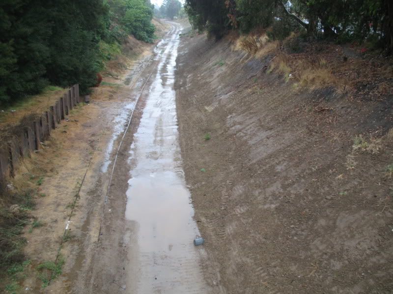 Wet Palms Park kitties: 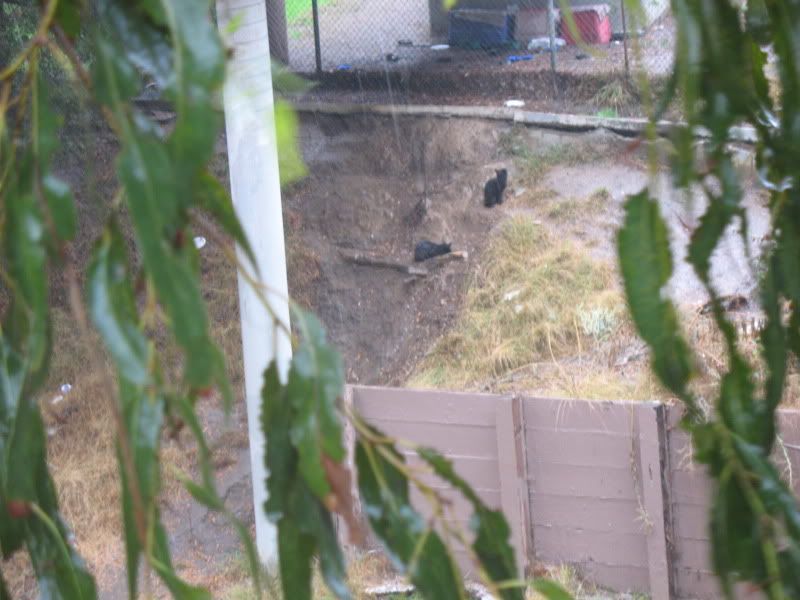 |
|


 Did they finally clean up the hills of dirt by Expo/Bagley? And did the old piles of dirt bury the old rails?