|
|
Post by roadtrainer on Oct 11, 2011 21:47:22 GMT -8
;D Hey Expoline Fan! How about some photos of the remaining properties that are slated for destruction?  |
|
|
|
Post by roadtrainer on Oct 12, 2011 21:00:51 GMT -8
Expoline Fan made this Page Showing the Before and After of Location of buildings to come down for Phase-2 Expoline Fan  Thanks for the great work on those buildings to come down, your a real reporter just like those who work for The newspapers! Sincerely the Road trainer |
|
|
|
Post by rajacobs on Oct 13, 2011 10:56:54 GMT -8
For a few weeks, the ROW between Venice and Bagley was tacitly open. Ok, there was the barely closed gate at Venice, but otherwise, it was a nice walk from Bagley to Venice along an otherwise wide-open ROW.
Last night we found the Venice gate secured and a 6-7 foot high wood-slatted chainlink fence newly-installed from Bagley southeast along Exposition to Exposition Dr (next to the Alberson's). Additionally all machinery is now removed from the ROW there and the old, wrapped oil pipes extracted from the ROW, still lying in a couple of piles over the past week, also had been removed.
Perhaps the area is finally on the verge of becoming a construction site.
|
|
|
|
Post by Gokhan on Oct 13, 2011 14:27:50 GMT -8
Alex, when these buildings are all gone and the right-of-way is cleared, perhaps it's time for you to make a sequel to your highly popular cult-classic Expo Line Right-of-Way movie?  |
|
|
|
Post by Alexis Kasperavičius on Oct 13, 2011 16:36:20 GMT -8
Gokhan, I would but I really am living in Montreal.
Dwight (Expoline Fan) has graciously agreed to shoot what I am missing. I have a lot of footage through buildings that are no longer there and closed off impound lots with guys opening gates as the "train" comes through. Good stuff, but missing some crucial pieces.
Once I get organized I will put it together. Probably very soon. There are just a lot more pieces to this one!
A
|
|
|
|
Post by benh57 on Oct 13, 2011 22:53:14 GMT -8
Dear Crazy Person who threatened to sue me today when I introduced myself. When looking at the Streetsblog story that you claimed I had used your copyrighted picture, I discovered I had used my own picture. It's a pretty crappy thing to threaten to sue someone within moments of meeting them, especially when they extend their hand in friendship, but it marks you as a complete ass when you threaten to sue them for something they didn't do. I'm guessing you got Curbed and Streetsblog mixed up, as a Curbed story also on the Phase II lawsuit has a note at the top that the image was removed at the photographer's request. Who was this? "Expoline Fan"? One would hope he will apologize.. |
|
|
|
Post by rajacobs on Oct 18, 2011 10:13:23 GMT -8
On the Gold Line Extension IBS construction topic... (Gokhan, you can e-mail your request for that separately ) RT You actually gave me a good idea. Perhaps someone can set up a video feed at an Expo Line location and we can always see the Expo action from our computers.  A long time ago I imagined building and installing a mount for a camera somewhere just west of the Palms/National station pointed at the southern terminus of Phase II, sufficiently high to capture the work over time and take a single frame daily from initiation of construction to completion. A Phase II Cam is a great idea. Wonder if Albertson's, Lycee, or one of the storage operations would support it, otherwise, someone living in a building adjacent to the tracks? |
|
|
|
Post by Gokhan on Oct 18, 2011 11:43:17 GMT -8
All Expo Line Phase 2 at-grade and grade-separated crossings -- under Resolution SX-100 -- are set to be approved at the November 10, 2011, meeting of the California Public Utilities Commission (CPUC).The deadline to submit comments is this Friday, October 21, 2011. Please do the following two things. (1) E-mail all CPUC commissioners and state in your own words why the grade crossings will be safe and emphasize the importance of building Expo Phase 2 as soon as possible. Note that all at-grade crossings were designed in collaboration with CPUC with all the state-of-the-art features. E-mail addresses (copy and paste): michelle.cooke@cpuc.ca.gov;jfp@cpuc.ca.gov;mp1@cpuc.ca.gov;tas@cpuc.ca.gov;mike.florio@cpuc.ca.gov;Catherine.sandoval@cpuc.ca.gov;mark.ferron@cpuc.ca.gov;gcollins@exporail.net (2) Click this link to sign a petition. ------------------------------------------- PS: Here is the link to the resolution, including detailed engineering drawings of the light-rail crossings: CPUC Resolution SX-100 for the Expo Line Phase 2 light-rail crossings
|
|
|
|
Post by darrell on Oct 18, 2011 23:24:02 GMT -8
As the long-time core supporters of the Expo Line, every one of us should write to the CPUC – BY THIS FRIDAY, October 21 – to recommend CPUC approval without delay of Resolution SX-100 for all of the Expo Line Phase 2 crossings. Use the email list Gokhan just posted.
Here's Light Rail for Cheviot's email for more information:
--------------------------------------
Supporters of the Expo Line:
Light Rail for Cheviot has learned that on November 10, 2011, the California Public Utilities Commission (CPUC) will consider approval of the crossings for Phase 2 of the Expo Light Rail Line. The CPUC is the state agency that reviews safety concerns at any point where a rail line crosses a street or walkway. The CPUC approval is a crucial step in getting the Expo Line to Santa Monica, and it is important that the commissioners hear from supporters of the project.
The Expo Phase 2 project underwent an almost three-year-long environmental review process with extensive public participation and significant community input. The Exposition Construction Authority received and responded to more than 9,000 comments from area stakeholders during the environmental process, including comments on the grade crossings, safety and traffic. The Expo Phase 2 grade crossings have been environmentally cleared and have been deemed safe through extensive review and study by the City of Los Angeles, the City of Santa Monica, Metro and CPUC staff.
To keep the project on track, please write comments to the CPUC requesting APPROVAL of the Expo Line crossings on November 10, and please submit them by FRIDAY, OCTOBER 21.
You can send individual letters, which would have the most impact. or you can email your comments to the CPUC by clicking on the link below. BE SURE to include your name and address and to refer to CPUC Resolution SX-100 in your subject line.
For personal letters, you should mail hard copies to Michelle Cooke, Interim Director, with a CC via email to Ms. Cooke, Jose Pereyra, the CPUC Commissioners and Expo.
Address personal letters to:
Ms. Michelle Cooke
California Public Utilities Commission
Consumer Protection and Safety Division
505 Van Ness Avenue
San Francisco, CA 94102
With a CC via email to the following:
Michelle Cooke, Interim Director
Jose Pereyra, Utilities Engineer
President Michael R. Peevey
Commissioner Timothy Alan Simon
Commissioner Michel Peter Florio
Commissioner Catherine J.K. Sandoval
Commissioner Mark J. Ferron
Exposition Construction Authority
POINTS TO CONSIDER:
The Phase 2 environmental process, which included significant community input, took place from February 2007-December 2009.
During that time, the Authority held 17 community meetings, 38 stakeholder meetings, participated in 11 community events and gave almost 40 presentations.
The Authority received and responded to over 9,000 comments during the environmental process.
The Authority provided opportunities for the public to speak at the Board meetings where the DEIR and the FEIR were approved. Several hundred people attended these meetings and over 200 people spoke at these meetings.
Comments on the DEIR and FEIR included extensive discussion on the crossings, safety, and traffic.
The Expo Board of Directors voted to approve the project with the crossings as environmentally cleared in the FEIR.
The Authority has met with the City of Los Angeles, City of Santa Monica, Metro and PUC staff which have all agreed that the crossings as environmentally cleared in the FEIR are safe as proposed.
The Authority, in conjunction with the other entities, evaluated the safety of each crossing through the development of a hazard analysis process started in the summer of 2009 and completed in the summer of 2011.
Except for the addition of the Sepulveda Boulevard grade separation which was funded by the City of Los Angeles, there have been no changes to the proposed grade crossings since the FEIR was approved in 2010.
Thank you all for your continued support of the Expo Line.
Karen Leonard and Sarah Hays - co-chairs Light Rail for Cheviot
|
|
|
|
Post by metrocenter on Oct 19, 2011 7:59:34 GMT -8
Done, and done. I didn't make all the points laid out by Darrell, but I think I got my point across. Dear Commissioners,
I am writing to urge you to approve CPUC Resolution SX-100. This resolution will allow creation of 27 rail-transit crossings in Los Angeles County (16 of them at-grade), for the Expo Phase 2 project.
I am not affiliated with the project, just an informed member of the public who has attended many of the EIR meetings and read much of the documentation. I am convinced that the proposed at-grade rail crossings are safe, due to the many safety features incorporated into the project. These features include signs, lights and in some cases gate arms.
Rail traffic is inherently safer than automobile traffic, because (a) it is operated by professionals, and (b) it is confined to a fixed guideway. Pedestrians, auto drivers and bicyclists will be very aware of these crossings, and will not encounter any danger so long as they do not willfully ignore and circumvent these safety features.
Thank You,
Name
City, State
(xxx) Phone |
|
|
|
Post by bzcat on Oct 19, 2011 9:54:40 GMT -8
Email sent!
|
|
|
|
Post by carter on Oct 19, 2011 13:56:35 GMT -8
Phase 2 Community meeting notice from Expo Authority: Join us for a design update on Expo Phase 2!
The Exposition Construction Authority invites you to a design update community meeting for Phase 2 of the Expo Line project. Stakeholders will receive information on design progress and will have the opportunity to view progress renderings.
The format will include a short presentation followed by an Open House session to facilitate dialogue and community input. The information presented at these meetings will be identical, so interested individuals, organizations and public agencies are welcome to attend on either of the following days:
Monday, November 14, 2011
6:30 p.m.
Vista Del Mar Child and Family Services Gymnasium
3200 Motor Avenue
Los Angeles, CA 90034
Parking available on campus
Tuesday, November 15, 2011
6:30 p.m.
Santa Monica Civic Auditorium East Wing Meeting Room
1855 Main Street
Santa Monica, CA 90401
Special Event free parking
Planned Agenda for Community Meetings
6:30 - 7:00 pm: Formal Presentation
7:00 - 8:00 pm: Open House Session
ADA Language Accommodation: If you require an interpreter, including sign language services, or other accommodations at these community meetings, please contact Expo at least five business days prior to the meeting date at 213-243-5534.
|
|
|
|
Post by carter on Oct 20, 2011 13:31:19 GMT -8
|
|
|
|
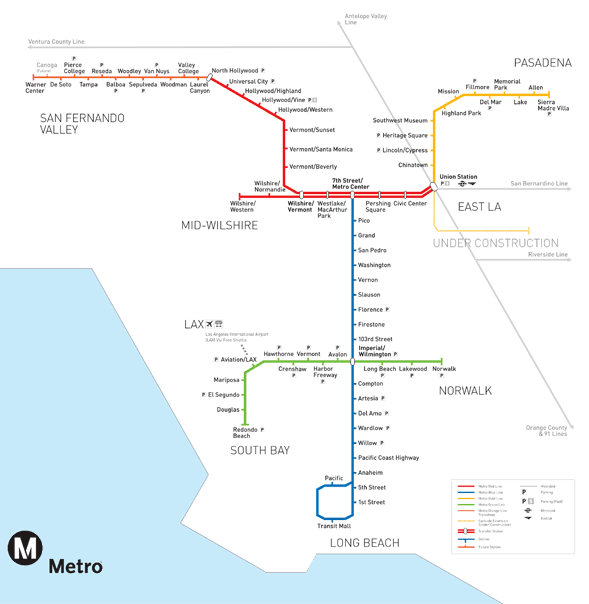
Post by matthewb on Oct 20, 2011 14:32:26 GMT -8
If you zoom in, there's an interesting future Metro map on the left hand side of the render. It looks like it has at least all the Measure R projects, plus a few more (at least a northern extension of the crenshaw line). |
|
|
|
Post by carter on Oct 20, 2011 16:01:12 GMT -8
If you zoom in, there's an interesting future Metro map on the left hand side of the render. It looks like it has at least all the Measure R projects, plus a few more (at least a northern extension of the crenshaw line). Good call! I hadn't noticed that. |
|
|
|
Post by roadtrainer on Oct 25, 2011 19:12:27 GMT -8
Dear Crazy Person who threatened to sue me today when I introduced myself. I think it's about time that you pull this message off the board! Thank you very much! The Roadtrainer! |
|
|
|
Post by carter on Oct 31, 2011 8:21:18 GMT -8
I just rode by the Expo ROW at Westwood on the Big Blue Bus and noticed some bright orange fencing. It seemed to be separating the trees on the edges of the ROW from the where the train will run in the middle.
This is just a guess but it would seem like they're trying to separate the trees they want to save from the part of the ROW they're going to start clearing.
|
|
|
|
Post by Gokhan on Nov 1, 2011 11:50:07 GMT -8
Skanska people were having a meeting near Bagley Avenue today.
|
|
|
|
Post by jamesinclair on Nov 2, 2011 19:32:48 GMT -8
So why were so many people allowed to build (mostly parking lots) in ROW they didnt own?
|
|
|
|
Post by LAofAnaheim on Nov 2, 2011 19:55:15 GMT -8
So why were so many people allowed to build (mostly parking lots) in ROW they didnt own? May as well lease out the space and make money. Metro has a significantly large Real Estate business, besides working on highways and providing public transit. Some of the ROW's they use are leased spaces with the knowledge they could be evicted one day. Look at the Orange line Chatsworth extension...most of these businesses cleared out in the year or two before full construction started. It's a smart business move. |
|
|
|
Post by jamesinclair on Nov 2, 2011 22:05:54 GMT -8
Oh I see, so it was all legal, and not squatting. Makes sense. Yes, it was a smart move to rent out that space. In this image posted above, www.tv-eic.tv/17th%20Streets.jpgWhy are the two building on the far right in red needed to be demolished? Why is the track veering from the clear ROW? |
|
|
|
Post by Gokhan on Nov 2, 2011 22:56:51 GMT -8
Why are the two building on the far right in red needed to be demolished? Why is the track veering from the clear ROW? The Metro-owned right-of-way ends at 17th St, with most of the Pacific Electric right-of-way west of 14th St sold to private entities in the 1960s and built on, and the section between 17th and 14th was sold shortly before the MTA both the section east of 17th in 1990. Before 1960s, the Expo Line right-of-way continued all the way to Venice, Marina Del Rey, and Inglewood, to connect with the Crenshaw Line (BNSF) right-of-way at Florence and "Cable" Place (just west of La Brea). |
|
|
|
Post by jamesinclair on Nov 3, 2011 12:09:45 GMT -8
Hm, it still appears that less demolition would have been needed had the line followed the ROW and turned up towards the street where the station parking is planned. The street would have also not needed to be re-alligned.
|
|
|
|
Post by joshuanickel on Nov 3, 2011 13:00:52 GMT -8
Hm, it still appears that less demolition would have been needed had the line followed the ROW and turned up towards the street where the station parking is planned. The street would have also not needed to be re-alligned. Coming on to the street at the intersection eliminates the need for crossing gates. The traffic signal will control the movement of the train. If they decided to use the parking area for the station, you would need crossing gates or a traffic signal to get the train in to the median. The current set up eliminates the need for another traffic signal just one block away. Where the station parking is located is not owned by metro. They purchased the property. Metro decided the best use for it would be parking but the city has other ideas for it. The city plans include a bike center, bike parking, and a kiss and ride. The city also sees a bus plaza. This will be the major stop for both UCLA and SMC. |
|
|
|
Post by bzcat on Nov 4, 2011 10:40:36 GMT -8
I drove by Westwood Blvd this morning and I saw a bunch of construction workers in orange hats (Skanska crew I assume) taking photos in front a house that has a NFSR yard sing. They were laughing and pointing as they posed for photos. Lol... these guys are great ;D
|
|
K 22
Full Member

Posts: 117
|
Post by K 22 on Nov 4, 2011 10:42:54 GMT -8
I drove by Westwood Blvd this morning and I saw a bunch of construction workers in orange hats (Skanska crew I assume) taking photos in front a house that has a NFSR yard sing. They were laughing and pointing as they posed for photos. Lol... these guys are great ;D I seriously cannot wait to see this station. I'm anticipating Westwood station more than any others on this line. |
|
|
|
Post by carter on Nov 4, 2011 13:28:32 GMT -8
Too bad for the trees  |
|
|
|
Post by bobdavis on Nov 4, 2011 14:00:38 GMT -8
Out in my area (San Gabriel Valley), we have the Huntington Drive median through San Marino, which has a rather impressive assortment of trees that have grown up in the 50-plus years since the Pacific Electric line to Glendora was abandoned. I can imagine the furore that would have erupted had Metro decided to follow the former PE route rather than use the Santa Fe right-of-way for the Gold Line. My wife thinks the trees are great because some of them turn beautiful colors late in the year, and they remind her of New England in the fall; I tell her that if Metro did decide to run another light rail line out our way, I'd be there with a rented chain saw, ready to sacrifice the first one for the greater glory of electric railroading.
|
|
|
|
Post by darrell on Nov 4, 2011 19:36:11 GMT -8
You can get precise distances from the Final EIR's plan and profile drawings.
On the transition from right-of-way to Colorado, I understand they tried hard to put the station south of Colorado on the former Fisher Lumber site and turn onto the street at 14th, but it didn't fit without property takes on the southwest corner of 14th and Colorado.
|
|
|
|
Post by Gokhan on Nov 4, 2011 20:53:01 GMT -8
You can get precise distances from the Final EIR's plan and profile drawings. On the transition from right-of-way to Colorado, I understand they tried hard to put the station south of Colorado on the former Fisher Lumber site and turn onto the street at 14th, but it didn't fit without property takes on the southwest corner of 14th and Colorado. I think these were the main factors behind choosing 17th St as the station location: (1) Access to Santa Monica College (2) To extend Memorial Park to Colorado Ave in the future (3) Santa Monica's desire to have this as a streetcar stop in the middle of the median (4) Santa Monica's desire to have the streetcar section as long as possible In my opinion, the line would run faster and the access would be easier if they had the station between 16th and 14th Streets in the former Pacific Electric right-of-way running through the former Fisher Lumber, but this didn't happen. Santa Monica probably also didn't want to sacrifice this land, which they purchased from Fisher Lumber a few years ago when they decided to sell their business. |
|


 Thanks for the great work on those buildings to come down, your a real reporter just like those who work for The newspapers!